canton of Aix-en-Othe (canton d'Aix-en-Othe)

- canton of France
- Country:

- Coordinates: 48° 13' 24" N, 3° 44' 20" E


- GPS tracks (wikiloc): [Link]
- Area: 644.92 sq km
- Population: 18130
- Wikipedia en: wiki(en)
- Wikipedia: wiki(fr)
- Wikidata storage: Wikidata: Q1724053
- INSEE canton code: [1001]
Includes regions:


Saint-Benoist-sur-Vanne
- commune in Aube, France
- Country:
- Postal Code: 10160
- Coordinates: 48° 14' 9" N, 3° 40' 13" E
- GPS tracks (wikiloc): [Link]
- Area: 16.68 sq km
- Population: 235


Villemoiron-en-Othe
- commune in Aube, France
- Country:
- Postal Code: 10160
- Coordinates: 48° 12' 1" N, 3° 46' 43" E
- GPS tracks (wikiloc): [Link]
- Area: 12.49 sq km
- Population: 205


Vulaines
- commune in Aube, France
- Country:
- Postal Code: 10160
- Coordinates: 48° 14' 0" N, 3° 37' 15" E
- GPS tracks (wikiloc): [Link]
- Area: 8.72 sq km
- Population: 222

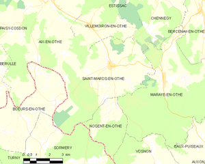
Saint-Mards-en-Othe
- commune in Aube, France
- Country:
- Postal Code: 10160
- Coordinates: 48° 10' 22" N, 3° 47' 57" E
- GPS tracks (wikiloc): [Link]
- Area: 31.4 sq km
- Population: 648

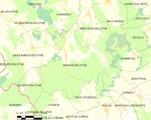
Maraye-en-Othe
- commune in Aube, France
- Country:
- Postal Code: 10160
- Coordinates: 48° 9' 50" N, 3° 51' 9" E
- GPS tracks (wikiloc): [Link]
- Area: 42.32 sq km
- Population: 473


Nogent-en-Othe
- commune in Aube, France
- Country:
- Postal Code: 10160
- Coordinates: 48° 8' 42" N, 3° 48' 22" E
- GPS tracks (wikiloc): [Link]
- Area: 9.06 sq km
- Population: 44


Paisy-Cosdon
- commune in Aube, France
- Country:
- Postal Code: 10160
- Coordinates: 48° 14' 4" N, 3° 42' 45" E
- GPS tracks (wikiloc): [Link]
- Area: 17.84 sq km
- Population: 338


Rigny-le-Ferron
- commune in Aube, France
- Country:
- Postal Code: 10160
- Coordinates: 48° 12' 31" N, 3° 37' 54" E
- GPS tracks (wikiloc): [Link]
- Area: 19.05 sq km
- Population: 362


Bérulle
- commune in Aube, France
- Country:
- Postal Code: 10160
- Coordinates: 48° 10' 39" N, 3° 39' 50" E
- GPS tracks (wikiloc): [Link]
- Area: 16.5 sq km
- Population: 247


Aix-en-Othe
- former commune in Aube, France
- Country:
- Postal Code: 10160
- Coordinates: 48° 13' 24" N, 3° 44' 4" E
- GPS tracks (wikiloc): [Link]
- Area: 34.76 sq km
- Population: 2443
- Web site: [Link]