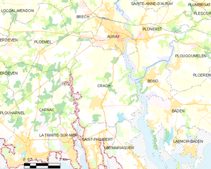
canton of Auray (canton d'Auray)

- canton of France
- Country:

- Capital: Auray
- Coordinates: 47° 39' 5" N, 2° 57' 26" E


- GPS tracks (wikiloc): [Link]
- Population: 32292
- Wikipedia en: wiki(en)
- Wikipedia: wiki(fr)
- Wikidata storage: Wikidata: Q1399525
- INSEE canton code: [5601]
Includes regions:


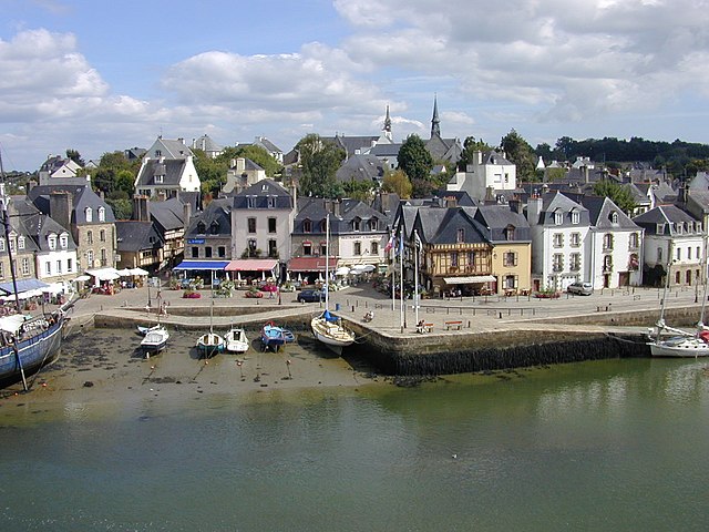
Saint-Philibert
- commune in Morbihan, France
- Country:
- Postal Code: 56470
- Coordinates: 47° 35' 12" N, 3° 0' 0" E
- GPS tracks (wikiloc): [Link]
- Area: 7.05 sq km
- Population: 1529
- Web site: [Link]
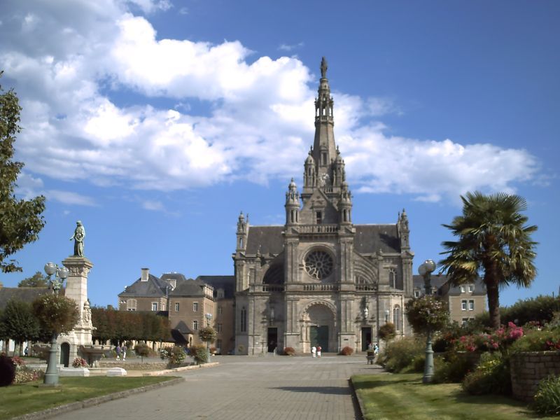

Sainte-Anne-d'Auray
- commune in Morbihan, France
- Country:
- Postal Code: 56400
- Coordinates: 47° 42' 13" N, 2° 57' 14" E
- GPS tracks (wikiloc): [Link]
- AboveSeaLevel: 34 м m
- Area: 4.97 sq km
- Population: 2633
- Web site: [Link]


Plougoumelen
- commune in Morbihan, France
- Country:
- Postal Code: 56400
- Coordinates: 47° 39' 9" N, 2° 55' 1" E
- GPS tracks (wikiloc): [Link]
- Area: 21.3 sq km
- Population: 2471
- Web site: [Link]


Le Bono
- commune in Morbihan, France
- Country:
- Postal Code: 56400
- Coordinates: 47° 38' 25" N, 2° 57' 3" E
- GPS tracks (wikiloc): [Link]
- AboveSeaLevel: 32 м m
- Area: 5.96 sq km
- Population: 2229
- Web site: [Link]


Pluneret
- commune in Morbihan, France
- Country:
- Postal Code: 56400
- Coordinates: 47° 40' 32" N, 2° 57' 27" E
- GPS tracks (wikiloc): [Link]
- Area: 26.2 sq km
- Population: 5473
- Web site: [Link]


Plumergat
- commune in Morbihan, France
- Country:
- Postal Code: 56400
- Coordinates: 47° 44' 31" N, 2° 55' 2" E
- GPS tracks (wikiloc): [Link]
- Area: 41.94 sq km
- Population: 4028
- Web site: [Link]

Auray
- commune in Morbihan, France
- Country:
- Postal Code: 56400
- Coordinates: 47° 40' 4" N, 2° 58' 57" E
- GPS tracks (wikiloc): [Link]
- AboveSeaLevel: 37 м m
- Area: 6.91 sq km
- Population: 13746
- Web site: [Link]

Crac'h
- commune in Morbihan, France
- Country:
- Postal Code: 56950
- Coordinates: 47° 37' 2" N, 3° 0' 5" E
- GPS tracks (wikiloc): [Link]
- Area: 30.54 sq km
- Population: 3318
- Web site: [Link]


Locmariaquer
- commune in Morbihan, France
- Country:
- Postal Code: 56740
- Coordinates: 47° 34' 9" N, 2° 56' 43" E
- GPS tracks (wikiloc): [Link]
- Area: 10.99 sq km
- Population: 1565
- Web site: [Link]