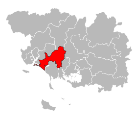
arrondissement of Lorient (arrondissement de Lorient)

- arrondissement of France
- Country:

- Capital: Lorient
- Coordinates: 47° 50' 0" N, 3° 15' 0" E


- GPS tracks (wikiloc): [Link]
- Area: 1489 sq km
- Population: 311008
- Wikipedia en: wiki(en)
- Wikipedia: wiki(fr)
- Wikidata storage: Wikidata: Q701562
- Wikipedia Commons Category: [Link]
- Freebase ID: [/m/095fqs]
- GeoNames ID: Alt: [2997576]
- INSEE arrondissement code: [561]
- GNS Unique Feature ID: -1447832
Includes regions:


canton of Plœmeur
- canton of France
- Country:
- Capital: Ploemeur
- Coordinates: 47° 43' 20" N, 3° 24' 17" E
- GPS tracks (wikiloc): [Link]
- Population: 34637


canton of Lanester
- canton of France
- Country:
- Capital: Lanester
- Coordinates: 47° 45' 57" N, 3° 20' 28" E
- GPS tracks (wikiloc): [Link]
- Population: 28786
canton of Pluvigner
- canton of Brittany
- Country:
- Capital: Pluvigner
- Coordinates: 47° 46' 13" N, 3° 2' 28" E
- GPS tracks (wikiloc): [Link]
- Population: 36300

canton of Pont-Scorff
- canton of France (until March 2015)
- Country:
- Capital: Pont-Scorff
- Coordinates: 47° 48' 52" N, 3° 24' 41" E
- GPS tracks (wikiloc): [Link]

canton of Quiberon
- canton of France
- Country:
- Capital: Quiberon
- Coordinates: 47° 30' 1" N, 3° 2' 37" E
- GPS tracks (wikiloc): [Link]
- Population: 36179
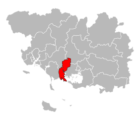
canton of Auray
- canton of France
- Country:
- Capital: Auray
- Coordinates: 47° 39' 5" N, 2° 57' 26" E
- GPS tracks (wikiloc): [Link]
- Population: 32292

canton of Port-Louis
- canton of France (until March 2015)
- Country:
- Capital: Port-Louis
- Coordinates: 47° 43' 22" N, 3° 16' 26" E
- GPS tracks (wikiloc): [Link]


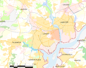
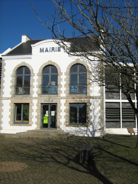
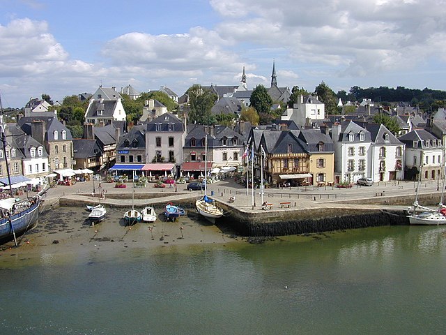
Lorient
- commune in Morbihan, France
- Country:
- Postal Code: 56100
- Coordinates: 47° 44' 45" N, 3° 21' 59" E
- GPS tracks (wikiloc): [Link]
- Area: 17.48 sq km
- Population: 57567
- Web site: [Link]


canton of Hennebont
- canton of France
- Country:
- Capital: Hennebont
- Coordinates: 47° 49' 5" N, 3° 13' 26" E
- GPS tracks (wikiloc): [Link]
- Population: 41872