canton of Beaugency (canton de Beaugency)
- canton of France
- Country:

- Capital: Beaugency
- Coordinates: 47° 47' 37" N, 1° 37' 49" E


- GPS tracks (wikiloc): [Link]
- Population: 25845
- Wikipedia en: wiki(en)
- Wikipedia: wiki(fr)
- Wikidata storage: Wikidata: Q1724418
- INSEE canton code: [4501]
Includes regions:


Baule
- commune in Loiret, France
- Country:

- Postal Code: 45130
- Coordinates: 47° 48' 39" N, 1° 40' 15" E


- GPS tracks (wikiloc): [Link]
- Area: 12.11 sq km
- Population: 2072
- Web site: [Link]


Villorceau
- commune in Loiret, France
- Country:

- Postal Code: 45190
- Coordinates: 47° 48' 1" N, 1° 35' 52" E


- GPS tracks (wikiloc): [Link]
- Area: 9.5 sq km
- Population: 1142
- Web site: [Link]


Tavers
- commune in Loiret, France
- Country:

- Postal Code: 45190
- Coordinates: 47° 45' 30" N, 1° 36' 47" E


- GPS tracks (wikiloc): [Link]
- Area: 22.62 sq km
- Population: 1343


Lailly-en-Val
- commune in Loiret, France
- Country:

- Postal Code: 45740
- Coordinates: 47° 46' 11" N, 1° 41' 11" E


- GPS tracks (wikiloc): [Link]
- Area: 45.61 sq km
- Population: 3043
- Web site: [Link]


Beaugency
- commune in Loiret, France
- Country:

- Postal Code: 45190
- Coordinates: 47° 46' 42" N, 1° 37' 54" E


- GPS tracks (wikiloc): [Link]
- Area: 16.45 sq km
- Population: 7475
- Web site: [Link]


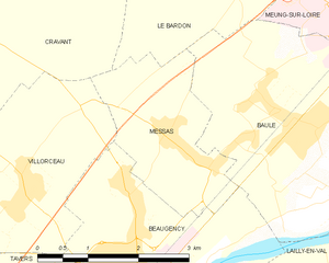
Messas
- commune in Loiret, France
- Country:

- Postal Code: 45190
- Coordinates: 47° 48' 28" N, 1° 38' 5" E


- GPS tracks (wikiloc): [Link]
- Area: 5.21 sq km
- Population: 878


Cravant
- commune in Loiret, France
- Country:

- Postal Code: 45190
- Coordinates: 47° 49' 43" N, 1° 34' 23" E


- GPS tracks (wikiloc): [Link]
- Area: 33.91 sq km
- Population: 961
- Web site: [Link]
