canton of Beaune-la-Rolande (canton de Beaune-la-Rolande)
- canton of France
- Country:

- Capital: Beaune-la-Rolande
- Coordinates: 48° 4' 1" N, 2° 25' 59" E


- GPS tracks (wikiloc): [Link]
- Wikipedia en: wiki(en)
- Wikipedia: wiki(fr)
- Wikidata storage: Wikidata: Q1724428
- Freebase ID: [/m/047_rd]
- Library of Congress authority ID: Alt: [n79031001]
- INSEE canton code: [4503]
Includes regions:


Bordeaux-en-Gâtinais
- commune in Loiret, France
- Country:
- Postal Code: 45340
- Coordinates: 48° 5' 56" N, 2° 31' 37" E
- GPS tracks (wikiloc): [Link]
- Area: 9.46 sq km
- Population: 116

Chambon-la-Forêt
- commune in Loiret, France
- Country:
- Postal Code: 45340
- Coordinates: 48° 3' 23" N, 2° 17' 43" E
- GPS tracks (wikiloc): [Link]
- Area: 17.16 sq km
- Population: 938


Batilly-en-Gâtinais
- commune in Loiret, France
- Country:
- Postal Code: 45340
- Coordinates: 48° 4' 25" N, 2° 22' 52" E
- GPS tracks (wikiloc): [Link]
- Area: 10.32 sq km
- Population: 446


Barville-en-Gâtinais
- commune in Loiret, France
- Country:
- Postal Code: 45340
- Coordinates: 48° 6' 43" N, 2° 24' 9" E
- GPS tracks (wikiloc): [Link]
- Area: 10.29 sq km
- Population: 328
Saint-Loup-des-Vignes
- commune in Loiret, France
- Country:
- Postal Code: 45340
- Coordinates: 48° 2' 28" N, 2° 25' 16" E
- GPS tracks (wikiloc): [Link]
- Area: 8.86 sq km
- Population: 406


Juranville
- commune in Loiret, France
- Country:
- Postal Code: 45340
- Coordinates: 48° 3' 39" N, 2° 29' 2" E
- GPS tracks (wikiloc): [Link]
- Area: 15.23 sq km
- Population: 455


Montbarrois
- commune in Loiret, France
- Country:
- Postal Code: 45340
- Coordinates: 48° 2' 43" N, 2° 23' 52" E
- GPS tracks (wikiloc): [Link]
- Area: 6.01 sq km
- Population: 305
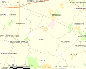
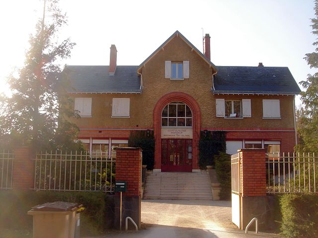
Lorcy
- commune in Loiret, France
- Country:
- Postal Code: 45490
- Coordinates: 48° 3' 20" N, 2° 32' 2" E
- GPS tracks (wikiloc): [Link]
- Area: 16.75 sq km
- Population: 559

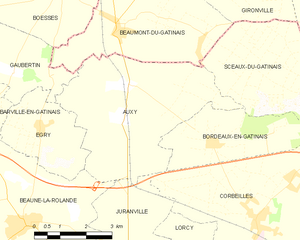
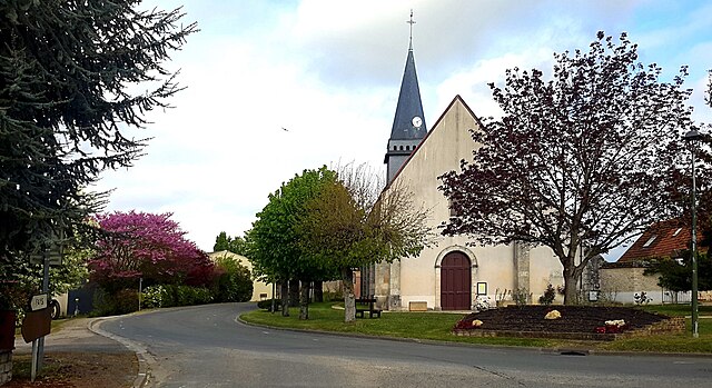
Auxy
- commune in Loiret, France
- Country:
- Postal Code: 45340
- Coordinates: 48° 7' 8" N, 2° 28' 28" E
- GPS tracks (wikiloc): [Link]
- Area: 20.28 sq km
- Population: 967


Montliard
- commune in Loiret, France
- Country:
- Postal Code: 45340
- Coordinates: 48° 1' 11" N, 2° 23' 50" E
- GPS tracks (wikiloc): [Link]
- Area: 8.99 sq km
- Population: 223
Gaubertin
- commune in Loiret, France
- Country:
- Postal Code: 45340
- Coordinates: 48° 7' 18" N, 2° 25' 21" E
- GPS tracks (wikiloc): [Link]
- Area: 7.29 sq km
- Population: 269
Égry
- commune in Loiret, France
- Country:
- Postal Code: 45340
- Coordinates: 48° 6' 11" N, 2° 26' 11" E
- GPS tracks (wikiloc): [Link]
- Area: 7.39 sq km
- Population: 376
Nancray-sur-Rimarde
- commune in Loiret, France
- Country:
- Postal Code: 45340
- Coordinates: 48° 4' 8" N, 2° 20' 1" E
- GPS tracks (wikiloc): [Link]
- Area: 11.58 sq km
- Population: 606


Beaune-la-Rolande
- commune in Loiret, France
- Country:
- Postal Code: 45340
- Coordinates: 48° 4' 11" N, 2° 25' 45" E
- GPS tracks (wikiloc): [Link]
- Area: 20.55 sq km
- Population: 1995
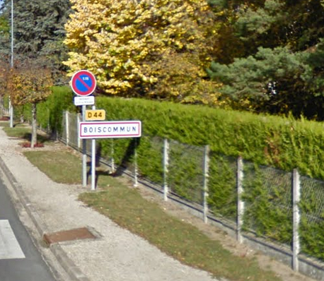

Boiscommun
- commune in Loiret, France
- Country:
- Postal Code: 45340
- Coordinates: 48° 2' 12" N, 2° 22' 59" E
- GPS tracks (wikiloc): [Link]
- Area: 16.06 sq km
- Population: 1137
Nibelle
- commune in Loiret, France
- Country:
- Postal Code: 45340
- Coordinates: 48° 1' 22" N, 2° 19' 38" E
- GPS tracks (wikiloc): [Link]
- Area: 27.18 sq km
- Population: 1155

Saint-Michel
- commune in Loiret, France
- Country:
- Postal Code: 45340
- Coordinates: 48° 4' 7" N, 2° 22' 44" E
- GPS tracks (wikiloc): [Link]
- Area: 5.14 sq km
- Population: 126


Courcelles
- commune in Loiret, France
- Country:
- Postal Code: 45300
- Coordinates: 48° 5' 48" N, 2° 19' 4" E
- GPS tracks (wikiloc): [Link]
- Area: 6.3 sq km
- Population: 296