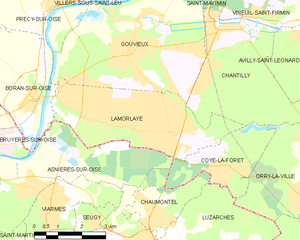
canton of Chantilly (canton de Chantilly)

- canton of France
- Country:

- Capital: Chantilly
- Coordinates: 49° 11' 22" N, 2° 27' 25" E


- GPS tracks (wikiloc): [Link]
- Population: 42680
- Wikipedia en: wiki(en)
- Wikipedia: wiki(fr)
- Wikidata storage: Wikidata: Q1718171
- Library of Congress authority ID: Alt: [n80004247]
- INSEE canton code: [6003]
Includes regions:

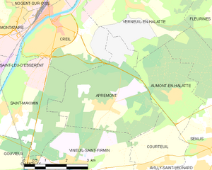
Apremont
- commune in Oise, France
- Country:
- Postal Code: 60300
- Coordinates: 49° 13' 24" N, 2° 30' 32" E
- GPS tracks (wikiloc): [Link]
- Area: 13.62 sq km
- Population: 679
- Web site: [Link]
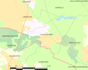
Coye-la-Forêt
- commune in Oise, France
- Country:
- Postal Code: 60580
- Coordinates: 49° 8' 32" N, 2° 28' 23" E
- GPS tracks (wikiloc): [Link]
- Area: 6.96 sq km
- Population: 3889
- Web site: [Link]

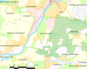
Saint-Maximin
- commune in Oise, France
- Country:
- Postal Code: 60740
- Coordinates: 49° 13' 16" N, 2° 26' 48" E
- GPS tracks (wikiloc): [Link]
- Area: 12.33 sq km
- Population: 3119
- Web site: [Link]


Gouvieux
- commune in Oise, France
- Country:
- Postal Code: 60270
- Coordinates: 49° 11' 16" N, 2° 24' 58" E
- GPS tracks (wikiloc): [Link]
- Area: 23.25 sq km
- Population: 9213
- Web site: [Link]

Lamorlaye
- commune in Oise, France
- Country:
- Postal Code: 60260
- Coordinates: 49° 9' 18" N, 2° 26' 27" E
- GPS tracks (wikiloc): [Link]
- Area: 15.34 sq km
- Population: 8989
- Web site: [Link]