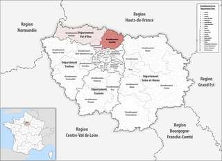
arrondissement of Senlis (arrondissement de Senlis)

- arrondissement of France
- Country:

- Capital: Senlis
- Coordinates: 49° 12' 0" N, 2° 35' 0" E


- GPS tracks (wikiloc): [Link]
- Area: 1344 sq km
- Population: 281400
- Wikipedia en: wiki(en)
- Wikipedia: wiki(fr)
- Wikidata storage: Wikidata: Q596974
- Freebase ID: [/m/0954p9]
- GeoNames ID: Alt: [2975086]
- INSEE arrondissement code: [604]
Includes regions:
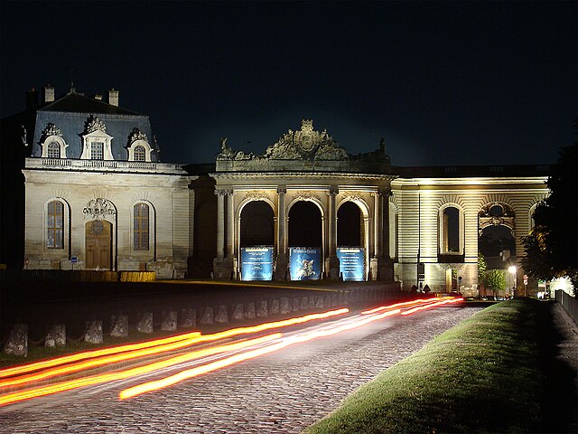

Chantilly
- commune in Oise, France
- Country:
- Postal Code: 60500
- Coordinates: 49° 11' 13" N, 2° 27' 39" E
- GPS tracks (wikiloc): [Link]
- AboveSeaLevel: 56 м m
- Area: 16.19 sq km
- Population: 10849
- Web site: [Link]

canton of Creil-Nogent-sur-Oise
- canton of France (until March 2015)
- Country:
- Capital: Nogent-sur-Oise
- Coordinates: 49° 16' 27" N, 2° 28' 46" E
- GPS tracks (wikiloc): [Link]

canton of Chantilly
- canton of France
- Country:
- Capital: Chantilly
- Coordinates: 49° 11' 22" N, 2° 27' 25" E
- GPS tracks (wikiloc): [Link]
- Population: 42680


canton of Montataire
- canton of France
- Country:
- Capital: Montataire
- Coordinates: 49° 14' 33" N, 2° 23' 29" E
- GPS tracks (wikiloc): [Link]
- Population: 36598


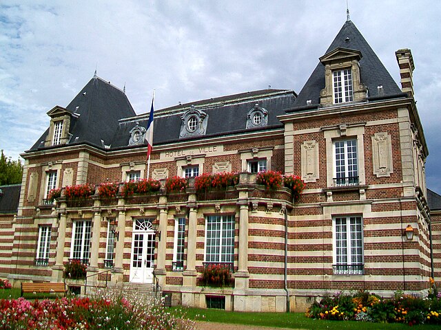
canton of Senlis
- canton of France
- Country:
- Capital: Senlis
- Coordinates: 49° 11' 8" N, 2° 35' 7" E
- GPS tracks (wikiloc): [Link]
- Population: 32103


canton of Pont-Sainte-Maxence
- canton of France
- Country:
- Capital: Pont-Sainte-Maxence
- Coordinates: 49° 16' 55" N, 2° 39' 39" E
- GPS tracks (wikiloc): [Link]
- Population: 31903


canton of Crépy-en-Valois
- canton of France
- Country:
- Capital: Crépy-en-Valois
- Coordinates: 49° 15' 45" N, 2° 53' 7" E
- GPS tracks (wikiloc): [Link]
- Population: 34981


canton of Nanteuil-le-Haudouin
- canton of France
- Country:
- Capital: Nanteuil-le-Haudouin
- Coordinates: 49° 8' 26" N, 2° 45' 34" E
- GPS tracks (wikiloc): [Link]
- Population: 31635

canton of Neuilly-en-Thelle
- canton of France (until March 2015)
- Country:
- Capital: Neuilly-en-Thelle
- Coordinates: 49° 13' 23" N, 2° 17' 28" E
- GPS tracks (wikiloc): [Link]
Shares border with regions:


arrondissement of Beauvais
- arrondissement of France
- Country:
- Capital: Beauvais
- Coordinates: 49° 26' 0" N, 2° 4' 0" E
- GPS tracks (wikiloc): [Link]
- Area: 2100 sq km
- Population: 227650


arrondissement of Meaux
- arrondissement of France
- Country:
- Capital: Meaux
- Coordinates: 48° 57' 28" N, 2° 53' 8" E
- GPS tracks (wikiloc): [Link]
- Area: 1400 sq km
- Population: 340528

arrondissement of Château-Thierry
- arrondissement of France
- Country:
- Capital: Château-Thierry
- Coordinates: 49° 2' 39" N, 3° 24' 5" E
- GPS tracks (wikiloc): [Link]
- Area: 1115 sq km
- Population: 69558


arrondissement of Clermont
- arrondissement of France
- Country:
- Capital: Clermont
- Coordinates: 49° 30' 0" N, 2° 25' 0" E
- GPS tracks (wikiloc): [Link]
- Area: 1142 sq km
- Population: 130675


arrondissement of Compiègne
- arrondissement of France
- Country:
- Capital: Compiègne
- Coordinates: 49° 25' 0" N, 2° 50' 0" E
- GPS tracks (wikiloc): [Link]
- Area: 1275 sq km
- Population: 181827


arrondissement of Pontoise
- arrondissement of France
- Country:
- Capital: Pontoise
- Coordinates: 49° 3' 3" N, 2° 5' 47" E
- GPS tracks (wikiloc): [Link]
- Area: 765.98 sq km
- Population: 337178

arrondissement of Sarcelles
- French arrondissement in Val-d'Oise
- Country:
- Capital: Sarcelles
- Coordinates: 48° 59' 50" N, 2° 22' 43" E
- GPS tracks (wikiloc): [Link]
- Area: 364 sq km
- Population: 469702

arrondissement of Soissons
- arrondissement of France in the Aisne department in the Picardy region
- Country:
- Capital: Soissons
- Coordinates: 49° 20' 0" N, 3° 20' 0" E
- GPS tracks (wikiloc): [Link]
- Area: 1351.44 sq km
- Population: 108093