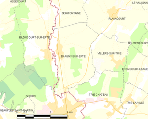
canton of Chaumont-en-Vexin (canton de Chaumont-en-Vexin)

- canton of France
- Country:

- Capital: Chaumont-en-Vexin
- Coordinates: 49° 15' 3" N, 1° 52' 8" E


- GPS tracks (wikiloc): [Link]
- Area: 552.65 sq km
- Population: 45634
- Wikipedia en: wiki(en)
- Wikipedia: wiki(fr)
- Wikidata storage: Wikidata: Q610795
- INSEE canton code: [6004]
Includes regions:


Hadancourt-le-Haut-Clocher
- commune in Oise, France
- Country:
- Postal Code: 60240
- Coordinates: 49° 11' 5" N, 1° 51' 23" E
- GPS tracks (wikiloc): [Link]
- AboveSeaLevel: 150 м m
- Area: 8.67 sq km
- Population: 362


Courcelles-lès-Gisors
- commune in Oise, France
- Country:
- Postal Code: 60240
- Coordinates: 49° 15' 39" N, 1° 44' 34" E
- GPS tracks (wikiloc): [Link]
- AboveSeaLevel: 142 м m
- Area: 6.92 sq km
- Population: 833


Delincourt
- commune in Oise, France
- Country:
- Postal Code: 60240
- Coordinates: 49° 14' 48" N, 1° 49' 49" E
- GPS tracks (wikiloc): [Link]
- Area: 8.05 sq km
- Population: 485

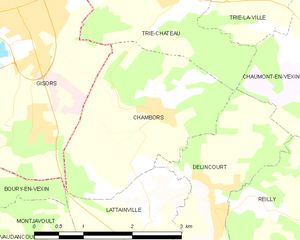
Chambors
- commune in Oise, France
- Country:
- Postal Code: 60240
- Coordinates: 49° 15' 38" N, 1° 48' 58" E
- GPS tracks (wikiloc): [Link]
- Area: 6.65 sq km
- Population: 317


Boubiers
- commune in Oise, France
- Country:
- Postal Code: 60240
- Coordinates: 49° 13' 15" N, 1° 52' 11" E
- GPS tracks (wikiloc): [Link]
- Area: 10.35 sq km
- Population: 422

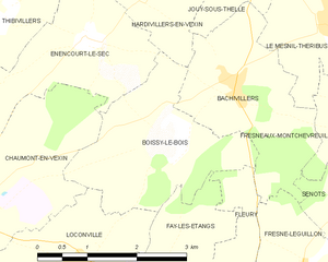
Boissy-le-Bois
- commune in Oise, France
- Country:
- Postal Code: 60240
- Coordinates: 49° 16' 38" N, 1° 56' 35" E
- GPS tracks (wikiloc): [Link]
- Area: 6.04 sq km
- Population: 194

Boury-en-Vexin
- commune in Oise, France
- Country:
- Postal Code: 60240
- Coordinates: 49° 14' 27" N, 1° 44' 10" E
- GPS tracks (wikiloc): [Link]
- Area: 11.09 sq km
- Population: 338


Bouconvillers
- commune in Oise, France
- Country:
- Postal Code: 60240
- Coordinates: 49° 10' 33" N, 1° 54' 13" E
- GPS tracks (wikiloc): [Link]
- Area: 4.79 sq km
- Population: 382

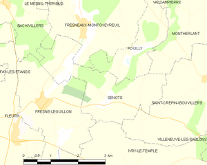
Senots
- commune in Oise, France
- Country:
- Postal Code: 60240
- Coordinates: 49° 15' 50" N, 1° 59' 32" E
- GPS tracks (wikiloc): [Link]
- Area: 6.25 sq km
- Population: 332


Énencourt-le-Sec
- commune in Oise, France
- Country:
- Postal Code: 60240
- Coordinates: 49° 17' 52" N, 1° 55' 20" E
- GPS tracks (wikiloc): [Link]
- Area: 5.99 sq km
- Population: 194
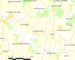
Fay-les-Étangs
- commune in Oise, France
- Country:
- Postal Code: 60240
- Coordinates: 49° 14' 46" N, 1° 56' 23" E
- GPS tracks (wikiloc): [Link]
- Area: 8.47 sq km
- Population: 468


Énencourt-Léage
- commune in Oise, France
- Country:
- Postal Code: 60590
- Coordinates: 49° 18' 14" N, 1° 50' 48" E
- GPS tracks (wikiloc): [Link]
- Area: 4.46 sq km
- Population: 141


Serans
- commune in Oise, France
- Country:
- Postal Code: 60240
- Coordinates: 49° 11' 11" N, 1° 49' 51" E
- GPS tracks (wikiloc): [Link]
- Area: 8.79 sq km
- Population: 223


Tourly
- commune in Oise, France
- Country:
- Postal Code: 60240
- Coordinates: 49° 13' 27" N, 1° 56' 49" E
- GPS tracks (wikiloc): [Link]
- Area: 3.32 sq km
- Population: 177


Vaudancourt
- commune in Oise, France
- Country:
- Postal Code: 60240
- Coordinates: 49° 14' 1" N, 1° 45' 20" E
- GPS tracks (wikiloc): [Link]
- Area: 4.67 sq km
- Population: 177


Montagny-en-Vexin
- commune in Oise, France
- Country:
- Postal Code: 60240
- Coordinates: 49° 11' 43" N, 1° 48' 1" E
- GPS tracks (wikiloc): [Link]
- Area: 4.18 sq km
- Population: 672
- Web site: [Link]

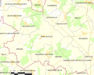
Montjavoult
- commune in Oise, France
- Country:
- Postal Code: 60240
- Coordinates: 49° 12' 51" N, 1° 46' 58" E
- GPS tracks (wikiloc): [Link]
- Area: 16.73 sq km
- Population: 473


Liancourt-Saint-Pierre
- commune in Oise, France
- Country:
- Postal Code: 60240
- Coordinates: 49° 14' 5" N, 1° 54' 29" E
- GPS tracks (wikiloc): [Link]
- Area: 12.69 sq km
- Population: 582


Lierville
- commune in Oise, France
- Country:
- Postal Code: 60240
- Coordinates: 49° 11' 26" N, 1° 52' 54" E
- GPS tracks (wikiloc): [Link]
- Area: 7.75 sq km
- Population: 242


Fresne-Léguillon
- commune in Oise, France
- Country:
- Postal Code: 60240
- Coordinates: 49° 15' 15" N, 1° 59' 1" E
- GPS tracks (wikiloc): [Link]
- AboveSeaLevel: 95 м m
- Area: 7.31 sq km
- Population: 454


Lattainville
- commune in Oise, France
- Country:
- Postal Code: 60240
- Coordinates: 49° 14' 30" N, 1° 48' 53" E
- GPS tracks (wikiloc): [Link]
- Area: 3.44 sq km
- Population: 152
- Web site: [Link]


Boutencourt
- commune in Oise, France
- Country:
- Postal Code: 60590
- Coordinates: 49° 19' 12" N, 1° 51' 31" E
- GPS tracks (wikiloc): [Link]
- Area: 7.51 sq km
- Population: 233


Reilly
- commune in Oise, France
- Country:
- Postal Code: 60240
- Coordinates: 49° 14' 37" N, 1° 50' 48" E
- GPS tracks (wikiloc): [Link]
- Area: 8.32 sq km
- Population: 121

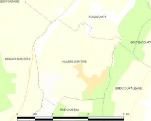
Villers-sur-Trie
- former commune in Oise, France
- Country:
- Postal Code: 60590
- Coordinates: 49° 18' 25" N, 1° 49' 22" E
- GPS tracks (wikiloc): [Link]
- AboveSeaLevel: 120 м m
- Area: 4.05 sq km
- Population: 329

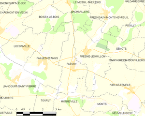
Fleury
- commune in Oise, France
- Country:
- Postal Code: 60240
- Coordinates: 49° 14' 41" N, 1° 58' 11" E
- GPS tracks (wikiloc): [Link]
- Area: 6.29 sq km
- Population: 545


Monneville
- commune in Oise, France
- Country:
- Postal Code: 60240
- Coordinates: 49° 12' 28" N, 1° 58' 27" E
- GPS tracks (wikiloc): [Link]
- Area: 9.19 sq km
- Population: 827
- Web site: [Link]


Hardivillers-en-Vexin
- commune in Oise, France
- Country:
- Postal Code: 60240
- Coordinates: 49° 18' 14" N, 1° 56' 19" E
- GPS tracks (wikiloc): [Link]
- Area: 4.82 sq km
- Population: 143

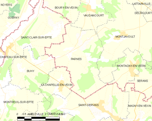
Parnes
- commune in Oise, France
- Country:
- Postal Code: 60240
- Coordinates: 49° 12' 12" N, 1° 44' 16" E
- GPS tracks (wikiloc): [Link]
- Area: 12.43 sq km
- Population: 350
- Web site: [Link]

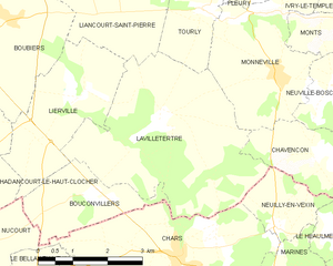
Lavilletertre
- commune in Oise, France
- Country:
- Postal Code: 60240
- Coordinates: 49° 11' 46" N, 1° 55' 46" E
- GPS tracks (wikiloc): [Link]
- Area: 16.22 sq km
- Population: 501

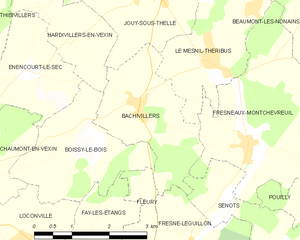
Bachivillers
- commune in Oise, France
- Country:
- Postal Code: 60240
- Coordinates: 49° 17' 25" N, 1° 57' 45" E
- GPS tracks (wikiloc): [Link]
- Area: 5.91 sq km
- Population: 478


Jaméricourt
- commune in Oise, France
- Country:
- Postal Code: 60240
- Coordinates: 49° 18' 14" N, 1° 52' 47" E
- GPS tracks (wikiloc): [Link]
- Area: 4.25 sq km
- Population: 318


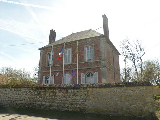
Chaumont-en-Vexin
- commune in Oise, France
- Country:
- Postal Code: 60240
- Coordinates: 49° 16' 3" N, 1° 53' 20" E
- GPS tracks (wikiloc): [Link]
- Area: 18.54 sq km
- Population: 3217
- Web site: [Link]


Loconville
- commune in Oise, France
- Country:
- Postal Code: 60240
- Coordinates: 49° 15' 21" N, 1° 55' 7" E
- GPS tracks (wikiloc): [Link]
- Area: 5.53 sq km
- Population: 342


Trie-la-Ville
- commune in Oise, France
- Country:
- Postal Code: 60590
- Coordinates: 49° 17' 23" N, 1° 49' 57" E
- GPS tracks (wikiloc): [Link]
- Area: 4.55 sq km
- Population: 317


Trie-Château
- former commune in Oise, France
- Country:
- Postal Code: 60590
- Coordinates: 49° 17' 5" N, 1° 49' 16" E
- GPS tracks (wikiloc): [Link]
- Area: 9.29 sq km
- Population: 1592
- Web site: [Link]


Thibivillers
- commune in Oise, France
- Country:
- Postal Code: 60240
- Coordinates: 49° 18' 6" N, 1° 54' 0" E
- GPS tracks (wikiloc): [Link]
- Area: 6.35 sq km
- Population: 174

Éragny-sur-Epte
- commune in Oise, France
- Country:
- Postal Code: 60590
- Coordinates: 49° 18' 56" N, 1° 46' 26" E
- GPS tracks (wikiloc): [Link]
- Area: 8.53 sq km
- Population: 611
- Web site: [Link]