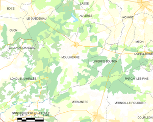
canton of Longué-Jumelles (canton de Longué-Jumelles)
- canton of France
- Country:

- Capital: Longué-Jumelles
- Coordinates: 47° 24' 20" N, 0° 0' 13" E


- GPS tracks (wikiloc): [Link]
- Population: 30646
- Wikipedia en: wiki(en)
- Wikipedia: wiki(fr)
- Wikidata storage: Wikidata: Q1725962
- INSEE canton code: [4915]
Includes regions:


Courléon
- commune in Maine-et-Loire, France
- Country:

- Postal Code: 49390
- Coordinates: 47° 23' 26" N, 0° 8' 36" E


- GPS tracks (wikiloc): [Link]
- Area: 13.77 sq km
- Population: 149


Blou
- commune in Maine-et-Loire, France
- Country:

- Postal Code: 49160
- Coordinates: 47° 21' 44" N, 0° 2' 14" E


- GPS tracks (wikiloc): [Link]
- Area: 21.46 sq km
- Population: 1007


La Lande-Chasles
- commune in Maine-et-Loire, France
- Country:

- Postal Code: 49150
- Coordinates: 47° 28' 10" N, 0° 3' 55" E


- GPS tracks (wikiloc): [Link]
- Area: 4.99 sq km
- Population: 118
- Web site: [Link]


Vernantes
- commune in Maine-et-Loire, France
- Country:

- Postal Code: 49390
- Coordinates: 47° 23' 35" N, 0° 3' 7" E


- GPS tracks (wikiloc): [Link]
- Area: 40.77 sq km
- Population: 1988


Mouliherne
- commune in Maine-et-Loire, France
- Country:

- Postal Code: 49390
- Coordinates: 47° 28' 0" N, 0° 1' 0" E


- GPS tracks (wikiloc): [Link]
- Area: 40.79 sq km
- Population: 866
- Web site: [Link]


Saint-Philbert-du-Peuple
- commune in Maine-et-Loire, France
- Country:

- Postal Code: 49160
- Coordinates: 47° 23' 35" N, 0° 2' 39" E


- GPS tracks (wikiloc): [Link]
- Area: 16.38 sq km
- Population: 1288


Longué-Jumelles
- commune in Maine-et-Loire, France
- Country:

- Postal Code: 49160
- Coordinates: 47° 22' 41" N, 0° 6' 29" E


- GPS tracks (wikiloc): [Link]
- AboveSeaLevel: 40 м m
- Area: 96.2 sq km
- Population: 6825
- Web site: [Link]


Vernoil-le-Fourrier
- commune in Maine-et-Loire, France
- Country:

- Postal Code: 49390
- Coordinates: 47° 23' 15" N, 0° 4' 45" E


- GPS tracks (wikiloc): [Link]
- Area: 33.1 sq km
- Population: 1271
