canton of Lucé (canton de Lucé)

- canton of France
- Country:

- Capital: Lucé
- Coordinates: 48° 26' 37" N, 1° 24' 28" E


- GPS tracks (wikiloc): [Link]
- Population: 27658
- Wikipedia en: wiki(en)
- Wikipedia: wiki(fr)
- Wikidata storage: Wikidata: Q1543250
Includes regions:
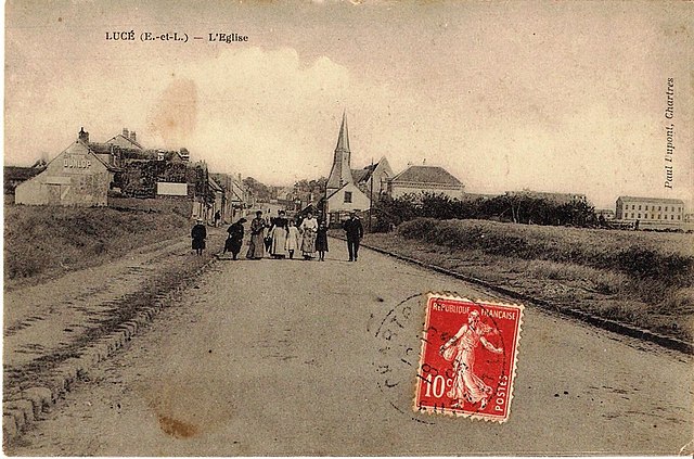
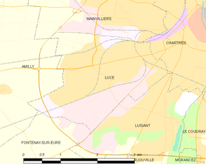
Lucé
- commune in Eure-et-Loir, France
- Country:
- Postal Code: 28110
- Coordinates: 48° 26' 18" N, 1° 27' 54" E
- GPS tracks (wikiloc): [Link]
- AboveSeaLevel: 157 м m
- Area: 6.06 sq km
- Population: 16107
- Web site: [Link]


Fontenay-sur-Eure
- commune in Eure-et-Loir, France
- Country:
- Postal Code: 28630
- Coordinates: 48° 23' 47" N, 1° 24' 25" E
- GPS tracks (wikiloc): [Link]
- Area: 13.8 sq km
- Population: 914


Cintray
- commune in Eure-et-Loir, France
- Country:
- Postal Code: 28300
- Coordinates: 48° 26' 54" N, 1° 21' 56" E
- GPS tracks (wikiloc): [Link]
- Area: 4 sq km
- Population: 412


Amilly
- commune in Eure-et-Loir, France
- Country:
- Postal Code: 28300
- Coordinates: 48° 26' 31" N, 1° 23' 32" E
- GPS tracks (wikiloc): [Link]
- Area: 20.01 sq km
- Population: 1831
- Web site: [Link]

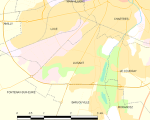
Luisant
- commune in Eure-et-Loir, France
- Country:
- Postal Code: 28600
- Coordinates: 48° 25' 54" N, 1° 28' 35" E
- GPS tracks (wikiloc): [Link]
- AboveSeaLevel: 75 м m
- Area: 4.43 sq km
- Population: 6659
- Web site: [Link]


Barjouville
- commune in Eure-et-Loir, France
- Country:
- Postal Code: 28630
- Coordinates: 48° 24' 31" N, 1° 28' 38" E
- GPS tracks (wikiloc): [Link]
- AboveSeaLevel: 130 м m
- Area: 4.1 sq km
- Population: 1735
- Web site: [Link]