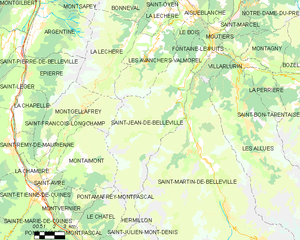
canton of Moûtiers (canton de Moûtiers)
- canton of France
The Canton of Moûtiers, located in the Savoie region of the French Alps, offers a variety of hiking opportunities that cater to different skill levels and interests. This area is renowned for its stunning alpine scenery, diverse wildlife, and charming mountain villages. Here are some key points about hiking in this region:
1.
- Vanoise National Park: Adjacent to Moûtiers, this park boasts a network of well-marked trails that lead through breathtaking landscapes, including glaciers, alpine meadows, and mountain lakes. Popular hikes include the loop to Lac de la Sassière and routes leading to the Grande Casse peak.
- Les Trois Vallées: This massive ski area transforms into a hiker’s paradise in the summer. You can explore various trails that connect the valleys and offer panoramic views of the surrounding peaks.
2.
- The canton has trails suitable for all levels, from easy walks ideal for families to challenging ascents for experienced hikers. Beginners may enjoy gentle lake-side strolls or easy mountain paths, while seasoned hikers can tackle steep ascents and multi-day treks.
3.
- The region is rich in biodiversity. While hiking, you may encounter native wildlife such as chamois, ibex, and a variety of bird species. Don't forget to appreciate the alpine flora, which blooms beautifully during the warmer months.
4.
- The area is rich in culture, and many trails lead to historical sites, such as abandoned chalets and ancient shepherding routes. Additionally, exploring the quaint towns and villages, such as Moûtiers itself, can provide insights into local traditions and alpine life.
5.
- Weather Awareness: Mountain weather can change rapidly, so it's essential to check forecasts and be prepared for sudden changes.
- Gear and Preparation: Wear appropriate hiking gear, including sturdy footwear and layered clothing. Always carry enough water, snacks, a map, and a first aid kit.
- Guided Tours: For those unfamiliar with the area or seeking to learn more about the environment, consider joining a guided hike.
6.
- The hiking season generally runs from late spring to early autumn. July and August are the peak months for hiking, but early June and September can also be lovely for fewer crowds and pleasant weather.
Whether you're looking for an easy day hike or a more adventurous multi-day trek, the Canton of Moûtiers provides a fantastic backdrop for enjoying nature and exploring the beauty of the French Alps. Always respect local regulations and the natural environment while hiking. Happy trails!
- Country:

- Capital: Moûtiers
- Coordinates: 45° 28' 37" N, 6° 32' 47" E


- GPS tracks (wikiloc): [Link]
- Population: 25655
- Wikipedia en: wiki(en)
- Wikipedia: wiki(fr)
- Wikidata storage: Wikidata: Q1565368
- INSEE canton code: [7313]
Includes regions:


Feissons-sur-Isère
- commune in Savoie, France
Feissons-sur-Isère is a small commune located in the Savoie department of the Auvergne-Rhône-Alpes region in France, nestled in the scenic French Alps. The area is known for its stunning landscapes, rich history, and outdoor recreational opportunities, making it a great spot for hiking enthusiasts....
- Country:

- Postal Code: 73260
- Coordinates: 45° 33' 34" N, 6° 28' 14" E


- GPS tracks (wikiloc): [Link]
- Area: 12.1 sq km
- Population: 571


La Léchère
- commune in Savoie, France
La Léchère, located in the French Alps, is a beautiful destination for hiking enthusiasts. The region is known for its stunning landscapes, which include alpine meadows, serene lakes, and striking mountain peaks. Here are some highlights and tips for hiking in La Léchère:...
- Country:

- Postal Code: 73260
- Coordinates: 45° 31' 56" N, 6° 28' 24" E


- GPS tracks (wikiloc): [Link]
- Area: 134.54 sq km
- Population: 1823


Aigueblanche
- commune in Savoie, France
Aigueblanche is a charming town located in the Savoie region of the French Alps, known for its stunning natural scenery and access to various outdoor activities, including hiking. The area offers a mix of trails suitable for different skill levels, with panoramic views of the surrounding mountains, lush valleys, and sometimes even alpine lakes....
- Country:

- Postal Code: 73260
- Coordinates: 45° 30' 3" N, 6° 30' 35" E


- GPS tracks (wikiloc): [Link]
- Area: 19.67 sq km
- Population: 3155
- Web site: [Link]


Le Bois
- commune in Savoie, France
Le Bois is a charming area that offers various hiking opportunities, typically characterized by lush forests, scenic landscapes, and well-maintained trails. While specific details can vary depending on your exact location and the region you're referring to (since "Le Bois" can refer to various wooded areas in different countries), here are some general insights into what you might expect when hiking in a wooded area like Le Bois:...
- Country:

- Postal Code: 73260
- Coordinates: 45° 29' 28" N, 6° 29' 52" E


- GPS tracks (wikiloc): [Link]
- Area: 5.55 sq km
- Population: 408


Les Avanchers-Valmorel
- commune in Savoie, France
 Hiking in Les Avanchers-Valmorel
Les Avanchers-Valmorel is a picturesque destination in the French Alps that attracts hikers with its stunning landscapes, diverse trails, and a range of outdoor activities. Situated in the Savoie region, this area is known for its beautiful mountain scenery, charming alpine villages, and a rich natural environment....
- Country:

- Postal Code: 73260
- Coordinates: 45° 28' 39" N, 6° 27' 22" E


- GPS tracks (wikiloc): [Link]
- Area: 21.93 sq km
- Population: 766
- Web site: [Link]
Saint-Oyen
- commune in Savoie, France
Saint-Oyen, located in the Savoie region of the French Alps, is a wonderful destination for hiking enthusiasts looking to explore both the natural beauty and alpine culture of the area. Here’s an overview of what you can expect when hiking in and around Saint-Oyen:...
- Country:

- Postal Code: 73260
- Coordinates: 45° 30' 13" N, 6° 29' 3" E


- GPS tracks (wikiloc): [Link]
- Area: 2.11 sq km
- Population: 220
- Web site: [Link]

Saint-Marcel
- commune in Savoie, France
Saint-Marcel, located in the Savoie region of the French Alps, is a fantastic destination for hiking enthusiasts. The area is characterized by its stunning alpine landscapes, diverse ecosystems, and a wealth of trails that cater to various skill levels....
- Country:

- Postal Code: 73600
- Coordinates: 45° 29' 53" N, 6° 33' 33" E


- GPS tracks (wikiloc): [Link]
- Area: 8.76 sq km
- Population: 615


Saint-Martin-de-Belleville
- former commune in Savoie, France
 Hiking in Saint-Martin-de-Belleville
Saint-Martin-de-Belleville, located in the Tarentaise Valley of the French Alps, offers a fantastic hiking experience, making it a great destination for outdoor enthusiasts. Located in the heart of the Three Valleys ski area, it's not only a winter sports paradise but also a beautiful spot for summer hikes....
- Country:

- Postal Code: 73440
- Coordinates: 45° 22' 49" N, 6° 30' 16" E


- GPS tracks (wikiloc): [Link]
- Area: 161.79 sq km
- Population: 2641
- Web site: [Link]
Bonneval, Savoie
- commune in Savoie, France
Bonneval, located in the Savoie region of the French Alps, is a fantastic destination for hiking enthusiasts. This area is characterized by its stunning alpine landscapes, mountain peaks, and diverse flora and fauna, making it ideal for both casual walkers and experienced hikers. Here are some highlights of hiking in Bonneval:...
- Country:

- Postal Code: 73260
- Coordinates: 45° 31' 8" N, 6° 27' 16" E


- GPS tracks (wikiloc): [Link]
- Area: 19.58 sq km
- Population: 108
Villarlurin
- former commune in Savoie, France
Villarlurin is a picturesque village located in the South Tyrol region of northern Italy, close to the renowned city of Bolzano. The area is known for its breathtaking landscapes, rolling hills, and beautiful mountain scenery, making it a fantastic destination for hiking enthusiasts....
- Country:

- Postal Code: 73600
- Coordinates: 45° 27' 42" N, 6° 31' 39" E


- GPS tracks (wikiloc): [Link]
- Area: 5.45 sq km
- Population: 334


Hautecour
- commune in Savoie, France
Hautecour is a charming village located in the Savoie region of the French Alps, known for its stunning landscapes, rich wildlife, and excellent hiking opportunities. Here are some highlights of hiking in and around Hautecour:...
- Country:

- Postal Code: 73600
- Coordinates: 45° 30' 29" N, 6° 32' 50" E


- GPS tracks (wikiloc): [Link]
- Area: 11.65 sq km
- Population: 304


Salins-les-Thermes
- former commune in Savoie, France
Salins-les-Thermes is a charming commune located in the Savoie region of the French Alps, known for its thermal baths and stunning mountain scenery. Hiking in this area offers a variety of trails that cater to different skill levels, making it an excellent destination for both seasoned hikers and families looking for a leisurely outing....
- Country:

- Postal Code: 73600
- Coordinates: 45° 28' 19" N, 6° 31' 43" E


- GPS tracks (wikiloc): [Link]
- Area: 4.17 sq km
- Population: 882
- Web site: [Link]


Saint-Jean-de-Belleville
- commune in Savoie, France
 Hiking in Saint-Jean-de-Belleville
Saint-Jean-de-Belleville is a charming alpine village located in the Savoie region of the French Alps, offering beautiful landscapes and a variety of hiking opportunities. Situated near the Trois Vallées ski area, it serves as a fantastic base for exploring the surrounding mountains, particularly in the warmer months when the snow melts and trails become accessible....
- Country:

- Postal Code: 73440
- Coordinates: 45° 25' 37" N, 6° 29' 6" E


- GPS tracks (wikiloc): [Link]
- Area: 59.6 sq km
- Population: 535
- Web site: [Link]


Notre-Dame-du-Pré
- commune in Savoie, France
Notre-Dame-du-Pré is a charming Alpine village located in the Savoie region of France, nestled in the breathtaking landscapes of the French Alps. It's a great destination for hikers of various skill levels, offering stunning views and well-marked trails....
- Country:

- Postal Code: 73600
- Coordinates: 45° 30' 43" N, 6° 35' 37" E


- GPS tracks (wikiloc): [Link]
- Area: 18.2 sq km
- Population: 256


Moûtiers
- commune in Savoie, France
Moûtiers is a charming town located in the Savoie region of the French Alps, often serving as a gateway to the surrounding mountainous areas, including the famous Three Valleys ski area. While Moûtiers is more well-known for its winter sports, it also offers some fantastic hiking opportunities in the warmer months. Here are a few highlights for hiking in and around Moûtiers:...
- Country:

- Postal Code: 73600
- Coordinates: 45° 29' 6" N, 6° 32' 2" E


- GPS tracks (wikiloc): [Link]
- Area: 3.16 sq km
- Population: 3607
- Web site: [Link]
Fontaine-le-Puits
- former commune in Savoie, France
Fontaine-le-Puits, located in the Normandy region of France, is a scenic spot offering a variety of hiking opportunities that cater to nature lovers and outdoor enthusiasts. The area is characterized by rolling hills, lush forests, and charming countryside, making it ideal for peaceful hikes....
- Country:

- Postal Code: 73600
- Coordinates: 45° 27' 26" N, 6° 30' 26" E


- GPS tracks (wikiloc): [Link]
- Area: 4.47 sq km
- Population: 123
- Web site: [Link]
