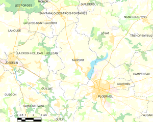
canton of Ploërmel (canton de Ploërmel)
.png)
- canton of France
- Country:

- Capital: Ploërmel
- Coordinates: 47° 56' 36" N, 2° 22' 54" E


- GPS tracks (wikiloc): [Link]
- Area: 778.34 sq km
- Population: 39961
- Wikipedia en: wiki(en)
- Wikipedia: wiki(fr)
- Wikidata storage: Wikidata: Q1399305
- INSEE canton code: [5613]
Includes regions:


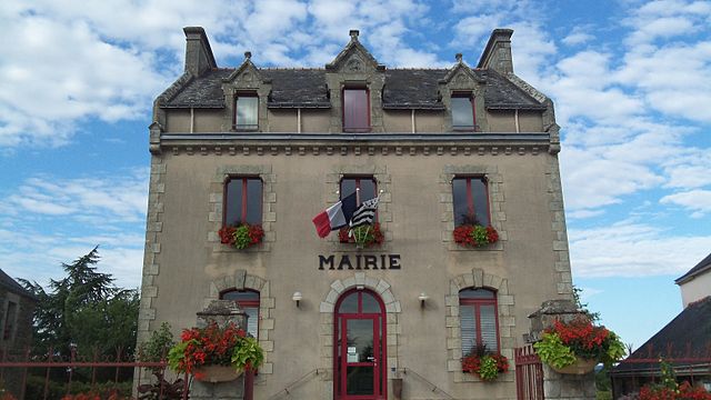
Ploërmel
- commune in Morbihan, France
- Country:
- Postal Code: 56800
- Coordinates: 47° 55' 54" N, 2° 23' 51" E
- GPS tracks (wikiloc): [Link]
- AboveSeaLevel: 75 м m
- Area: 57.82 sq km
- Population: 9571
- Web site: [Link]

Taupont
- commune in Morbihan, France
- Country:
- Postal Code: 56800
- Coordinates: 47° 57' 31" N, 2° 26' 19" E
- GPS tracks (wikiloc): [Link]
- Area: 29.17 sq km
- Population: 2212


Gourhel
- commune in Morbihan, France
- Country:
- Postal Code: 56800
- Coordinates: 47° 56' 15" N, 2° 21' 39" E
- GPS tracks (wikiloc): [Link]
- Area: 2.83 sq km
- Population: 681


Campénéac
- commune in Morbihan, France
- Country:
- Postal Code: 56800
- Coordinates: 47° 57' 28" N, 2° 17' 41" E
- GPS tracks (wikiloc): [Link]
- Area: 60.57 sq km
- Population: 1944
- Web site: [Link]


Montertelot
- commune in Morbihan, France
- Country:
- Postal Code: 56800
- Coordinates: 47° 52' 50" N, 2° 25' 19" E
- GPS tracks (wikiloc): [Link]
- Area: 2.64 sq km
- Population: 364

Loyat
- commune in Morbihan, France
- Country:
- Postal Code: 56800
- Coordinates: 47° 59' 24" N, 2° 23' 0" E
- GPS tracks (wikiloc): [Link]
- Area: 41.52 sq km
- Population: 1640
- Web site: [Link]