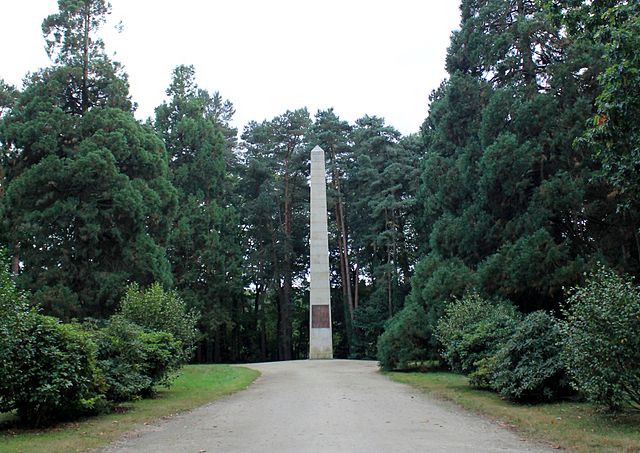
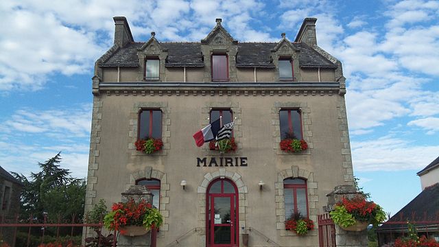
Ploërmel (Ploërmel)


- commune in Morbihan, France
- Country:

- Postal Code: 56800
- Coordinates: 47° 55' 54" N, 2° 23' 51" E


- GPS tracks (wikiloc): [Link]
- AboveSeaLevel: 75 м m
- Area: 57.82 sq km
- Population: 9571
- Web site: http://www.ploermel.com
- Wikipedia en: wiki(en)
- Wikipedia: wiki(fr)
- Wikidata storage: Wikidata: Q127775
- Wikipedia Commons Gallery: [Link]
- Wikipedia Commons Category: [Link]
- Freebase ID: [/m/03hx83]
- GeoNames ID: Alt: [6437338]
- SIREN number: [215601659]
- BnF ID: [15265414f]
- VIAF ID: Alt: [125520674]
- GND ID: Alt: [4243297-2]
- Library of Congress authority ID: Alt: [nr92018757]
- MusicBrainz area ID: [d761a1fa-b44b-439f-9c1b-ba731bdb4b34]
- WOEID: [616944]
- INSEE municipality code: 56165
Shares border with regions:

Guillac
- commune in Morbihan, France
- Country:
- Postal Code: 56800
- Coordinates: 47° 54' 38" N, 2° 27' 58" E
- GPS tracks (wikiloc): [Link]
- Area: 21.83 sq km
- Population: 1376
- Web site: [Link]

Caro
- commune in Morbihan, France
- Country:
- Postal Code: 56140
- Coordinates: 47° 51' 51" N, 2° 19' 9" E
- GPS tracks (wikiloc): [Link]
- Area: 37.74 sq km
- Population: 1178
- Web site: [Link]


La Chapelle-Caro
- former commune in Morbihan, France
- Country:
- Postal Code: 56460
- Coordinates: 47° 51' 55" N, 2° 25' 23" E
- GPS tracks (wikiloc): [Link]
- Area: 16.49 sq km
- Population: 1380
- Web site: [Link]

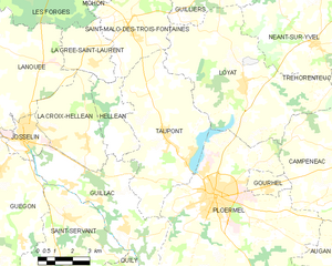
Taupont
- commune in Morbihan, France
- Country:
- Postal Code: 56800
- Coordinates: 47° 57' 31" N, 2° 26' 19" E
- GPS tracks (wikiloc): [Link]
- Area: 29.17 sq km
- Population: 2212


Le Roc-Saint-André
- former commune in Morbihan, France
- Country:
- Postal Code: 56460
- Coordinates: 47° 51' 53" N, 2° 26' 56" E
- GPS tracks (wikiloc): [Link]
- Area: 9.93 sq km
- Population: 917
- Web site: [Link]


Augan
- commune in Morbihan, France
- Country:
- Postal Code: 56800
- Coordinates: 47° 55' 11" N, 2° 16' 41" E
- GPS tracks (wikiloc): [Link]
- Area: 40.93 sq km
- Population: 1574
- Web site: [Link]


Gourhel
- commune in Morbihan, France
- Country:
- Postal Code: 56800
- Coordinates: 47° 56' 15" N, 2° 21' 39" E
- GPS tracks (wikiloc): [Link]
- Area: 2.83 sq km
- Population: 681


Campénéac
- commune in Morbihan, France
- Country:
- Postal Code: 56800
- Coordinates: 47° 57' 28" N, 2° 17' 41" E
- GPS tracks (wikiloc): [Link]
- Area: 60.57 sq km
- Population: 1944
- Web site: [Link]


Montertelot
- commune in Morbihan, France
- Country:
- Postal Code: 56800
- Coordinates: 47° 52' 50" N, 2° 25' 19" E
- GPS tracks (wikiloc): [Link]
- Area: 2.64 sq km
- Population: 364

Loyat
- commune in Morbihan, France
- Country:
- Postal Code: 56800
- Coordinates: 47° 59' 24" N, 2° 23' 0" E
- GPS tracks (wikiloc): [Link]
- Area: 41.52 sq km
- Population: 1640
- Web site: [Link]


Monterrein
- former commune in Morbihan, France
- Country:
- Postal Code: 56800
- Coordinates: 47° 52' 49" N, 2° 21' 28" E
- GPS tracks (wikiloc): [Link]
- Area: 7.01 sq km
- Population: 391