canton of Ploufragan (canton de Ploufragan)
.png)
- canton of France
- Country:

- Capital: Ploufragan
- Coordinates: 48° 29' 24" N, 2° 47' 40" E


- GPS tracks (wikiloc): [Link]
- Population: 22598
- Wikipedia en: wiki(en)
- Wikipedia: wiki(fr)
- Wikidata storage: Wikidata: Q1268157
- INSEE canton code: [2221]
Includes regions:

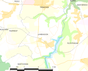
La Méaugon
- commune in Côtes-d'Armor, France
- Country:
- Postal Code: 22440
- Coordinates: 48° 29' 55" N, 2° 50' 18" E
- GPS tracks (wikiloc): [Link]
- Area: 6.78 sq km
- Population: 1279
- Web site: [Link]


Saint-Donan
- commune in Côtes-d'Armor, France
- Country:
- Postal Code: 22800
- Coordinates: 48° 28' 11" N, 2° 53' 7" E
- GPS tracks (wikiloc): [Link]
- Area: 22.92 sq km
- Population: 1440
- Web site: [Link]

Ploufragan
- commune in Côtes-d'Armor, France
- Country:
- Postal Code: 22440
- Coordinates: 48° 29' 22" N, 2° 47' 45" E
- GPS tracks (wikiloc): [Link]
- Area: 27.06 sq km
- Population: 11326
- Web site: [Link]

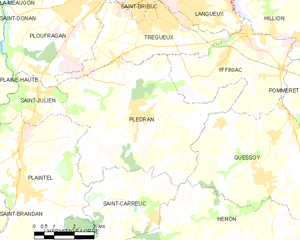
Plédran
- commune in Côtes-d'Armor, France
- Country:
- Postal Code: 22960
- Coordinates: 48° 26' 45" N, 2° 44' 46" E
- GPS tracks (wikiloc): [Link]
- Area: 34.71 sq km
- Population: 6491


Saint-Julien
- commune in Côtes-d'Armor, France
- Country:
- Postal Code: 22940
- Coordinates: 48° 27' 9" N, 2° 48' 59" E
- GPS tracks (wikiloc): [Link]
- Area: 5.69 sq km
- Population: 2062
- Web site: [Link]