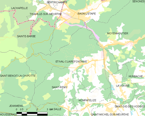
canton of Raon-l'Étape (canton de Raon-l'Étape)

- canton of France
- Country:

- Capital: Raon-l'Étape
- Coordinates: 48° 24' 8" N, 6° 49' 49" E


- GPS tracks (wikiloc): [Link]
- Population: 24343
- Wikipedia en: wiki(en)
- Wikipedia: wiki(fr)
- Wikidata storage: Wikidata: Q1726888
- Freebase ID: [/m/05q8pyn]
- INSEE canton code: [8811]
Includes regions:


Celles-sur-Plaine
- commune in Vosges, France
- Country:
- Postal Code: 88110
- Coordinates: 48° 27' 23" N, 6° 57' 0" E
- GPS tracks (wikiloc): [Link]
- Area: 20.09 sq km
- Population: 870

Étival-Clairefontaine
- commune in Vosges, France
- Country:
- Postal Code: 88480
- Coordinates: 48° 21' 50" N, 6° 51' 29" E
- GPS tracks (wikiloc): [Link]
- Area: 27.12 sq km
- Population: 2603
- Web site: [Link]


Raon-sur-Plaine
- commune in Vosges, France
- Country:
- Postal Code: 88110
- Coordinates: 48° 30' 41" N, 7° 5' 49" E
- GPS tracks (wikiloc): [Link]
- Area: 3.54 sq km
- Population: 152
- Web site: [Link]

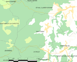
Saint-Remy
- commune in Vosges, France
- Country:
- Postal Code: 88480
- Coordinates: 48° 20' 49" N, 6° 49' 40" E
- GPS tracks (wikiloc): [Link]
- AboveSeaLevel: 350 м m
- Area: 12.25 sq km
- Population: 518


Nompatelize
- commune in Vosges, France
- Country:
- Postal Code: 88470
- Coordinates: 48° 19' 32" N, 6° 51' 10" E
- GPS tracks (wikiloc): [Link]
- Area: 6.91 sq km
- Population: 556