canton of Sin-le-Noble (canton de Sin-le-Noble)

- canton of France
- Country:

- Capital: Sin-le-Noble
- Coordinates: 50° 21' 49" N, 3° 6' 50" E


- GPS tracks (wikiloc): [Link]
- Area: 116.56 sq km
- Population: 69438
- Wikipedia en: wiki(en)
- Wikipedia: wiki(fr)
- Wikidata storage: Wikidata: Q19799892
- INSEE canton code: [5935]
Includes regions:


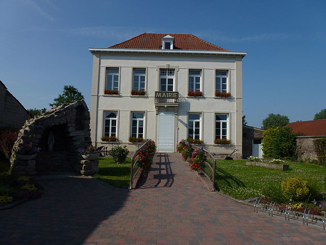
Lallaing
- commune in Nord, France
- Country:
- Postal Code: 59167
- Coordinates: 50° 23' 24" N, 3° 10' 5" E
- GPS tracks (wikiloc): [Link]
- Area: 5.99 sq km
- Population: 6188
- Web site: [Link]


Tilloy-lez-Marchiennes
- commune in Nord, France
- Country:
- Postal Code: 59870
- Coordinates: 50° 25' 42" N, 3° 19' 7" E
- GPS tracks (wikiloc): [Link]
- Area: 5.5 sq km
- Population: 541

Rieulay
- commune in Nord, France
- Country:
- Postal Code: 59870
- Coordinates: 50° 22' 47" N, 3° 15' 26" E
- GPS tracks (wikiloc): [Link]
- Area: 7.29 sq km
- Population: 1364


Erre
- commune in Nord, France
- Country:
- Postal Code: 59171
- Coordinates: 50° 21' 45" N, 3° 18' 54" E
- GPS tracks (wikiloc): [Link]
- Area: 5.88 sq km
- Population: 1574


Hornaing
- commune in Nord, France
- Country:
- Postal Code: 59171
- Coordinates: 50° 22' 4" N, 3° 20' 7" E
- GPS tracks (wikiloc): [Link]
- Area: 8.95 sq km
- Population: 3560


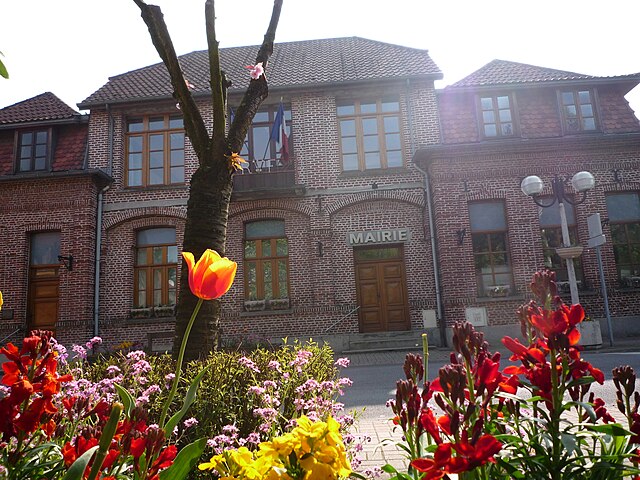
Sin-le-Noble
- commune in Nord, France
- Country:
- Postal Code: 59450
- Coordinates: 50° 21' 47" N, 3° 6' 47" E
- GPS tracks (wikiloc): [Link]
- Area: 11.53 sq km
- Population: 15593
- Web site: [Link]

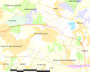
Pecquencourt
- commune in Nord, France
- Country:
- Postal Code: 59146
- Coordinates: 50° 22' 38" N, 3° 12' 57" E
- GPS tracks (wikiloc): [Link]
- Area: 9.6 sq km
- Population: 5942

Waziers
- commune in Nord, France
- Country:
- Postal Code: 59119
- Coordinates: 50° 23' 14" N, 3° 6' 47" E
- GPS tracks (wikiloc): [Link]
- Area: 4.34 sq km
- Population: 7498
- Web site: [Link]


Somain
- commune in Nord, France
- Country:
- Postal Code: 59490
- Coordinates: 50° 21' 27" N, 3° 16' 49" E
- GPS tracks (wikiloc): [Link]
- Area: 12.32 sq km
- Population: 12696
- Web site: [Link]


Fenain
- commune in Nord, France
- Country:
- Postal Code: 59179
- Coordinates: 50° 21' 57" N, 3° 18' 2" E
- GPS tracks (wikiloc): [Link]
- Area: 5.78 sq km
- Population: 5335
- Web site: [Link]


Vred
- commune in Nord, France
- Country:
- Postal Code: 59870
- Coordinates: 50° 23' 38" N, 3° 13' 53" E
- GPS tracks (wikiloc): [Link]
- Area: 3.42 sq km
- Population: 1386


Marchiennes
- commune in Nord, France
- Country:
- Postal Code: 59870
- Coordinates: 50° 24' 29" N, 3° 16' 56" E
- GPS tracks (wikiloc): [Link]
- Area: 21.44 sq km
- Population: 4621
- Web site: [Link]


Bruille-lez-Marchiennes
- commune in Nord, France
- Country:
- Postal Code: 59490
- Coordinates: 50° 21' 32" N, 3° 14' 38" E
- GPS tracks (wikiloc): [Link]
- Area: 4.33 sq km
- Population: 1305

Warlaing
- commune in Nord, France
- Country:
- Postal Code: 59870
- Coordinates: 50° 24' 37" N, 3° 19' 31" E
- GPS tracks (wikiloc): [Link]
- Area: 3.89 sq km
- Population: 560


Wandignies-Hamage
- commune in Nord, France
- Country:
- Postal Code: 59870
- Coordinates: 50° 23' 58" N, 3° 18' 52" E
- GPS tracks (wikiloc): [Link]
- Area: 6.3 sq km
- Population: 1275