canton of Troyes-6 (canton de Troyes-6)
- canton of France (until March 2015)
- Country:

- Capital: Troyes
- Coordinates: 48° 17' 51" N, 4° 4' 29" E


- GPS tracks (wikiloc): [Link]
- Wikipedia en: wiki(en)
- Wikipedia: wiki(fr)
- Wikidata storage: Wikidata: Q955011
- Freebase ID: [/m/04ygclb]
- INSEE canton code: [1031]
Includes regions:

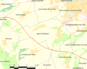
Saint-Germain
- commune in Aube, France
- Country:
- Postal Code: 10120
- Coordinates: 48° 15' 28" N, 4° 1' 55" E
- GPS tracks (wikiloc): [Link]
- Area: 13.8 sq km
- Population: 2298


Saint-André-les-Vergers
- commune in Aube, France
- Country:
- Postal Code: 10120
- Coordinates: 48° 16' 47" N, 4° 3' 14" E
- GPS tracks (wikiloc): [Link]
- Area: 5.86 sq km
- Population: 12204


Laines-aux-Bois
- commune in Aube, France
- Country:
- Postal Code: 10120
- Coordinates: 48° 14' 0" N, 3° 59' 16" E
- GPS tracks (wikiloc): [Link]
- Area: 16.43 sq km
- Population: 517