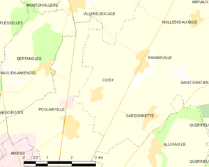
canton of Villers-Bocage (canton de Villers-Bocage)
- Somme Department
- Country:

- Capital: Villers-Bocage
- Coordinates: 49° 58' 54" N, 2° 22' 33" E


- GPS tracks (wikiloc): [Link]
- Wikipedia en: wiki(en)
- Wikipedia: wiki(fr)
- Wikidata storage: Wikidata: Q1727927
- Freebase ID: [/m/03y6gms]
- INSEE canton code: [8041]
Includes regions:

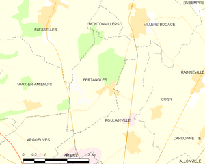
Bertangles
- commune in Somme, France
- Country:
- Postal Code: 80260
- Coordinates: 49° 58' 13" N, 2° 17' 59" E
- GPS tracks (wikiloc): [Link]
- Area: 8.57 sq km
- Population: 569
- Web site: [Link]

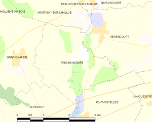
Fréchencourt
- commune in Somme, France
- Country:
- Postal Code: 80260
- Coordinates: 49° 57' 56" N, 2° 26' 28" E
- GPS tracks (wikiloc): [Link]
- Area: 5.59 sq km
- Population: 270


Flesselles
- commune in Somme, France
- Country:
- Postal Code: 80260
- Coordinates: 50° 0' 5" N, 2° 15' 36" E
- GPS tracks (wikiloc): [Link]
- Area: 20.49 sq km
- Population: 2102

Pierregot
- commune in Somme, France
- Country:
- Postal Code: 80260
- Coordinates: 50° 0' 7" N, 2° 22' 46" E
- GPS tracks (wikiloc): [Link]
- Area: 2.46 sq km
- Population: 276


Pont-Noyelles
- commune in Somme, France
- Country:
- Postal Code: 80115
- Coordinates: 49° 56' 25" N, 2° 26' 28" E
- GPS tracks (wikiloc): [Link]
- Area: 8.62 sq km
- Population: 846
- Web site: [Link]


Mirvaux
- commune in Somme, France
- Country:
- Postal Code: 80260
- Coordinates: 50° 0' 10" N, 2° 23' 42" E
- GPS tracks (wikiloc): [Link]
- Area: 2.29 sq km
- Population: 150

Molliens-au-Bois
- commune in Somme, France
- Country:
- Postal Code: 80260
- Coordinates: 49° 59' 18" N, 2° 23' 7" E
- GPS tracks (wikiloc): [Link]
- Area: 7.28 sq km
- Population: 324

Montigny-sur-l'Hallue
- commune in Somme, France
- Country:
- Postal Code: 80260
- Coordinates: 49° 58' 47" N, 2° 26' 35" E
- GPS tracks (wikiloc): [Link]
- Area: 4.91 sq km
- Population: 216


Montonvillers
- commune in Somme, France
- Country:
- Postal Code: 80260
- Coordinates: 49° 59' 37" N, 2° 17' 44" E
- GPS tracks (wikiloc): [Link]
- AboveSeaLevel: 118 м m
- Area: 1.48 sq km
- Population: 87

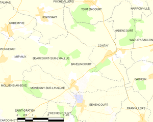
Bavelincourt
- commune in Somme, France
- Country:
- Postal Code: 80260
- Coordinates: 49° 59' 11" N, 2° 27' 17" E
- GPS tracks (wikiloc): [Link]
- Area: 7.75 sq km
- Population: 126

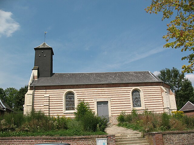
Béhencourt
- commune in Somme, France
- Country:
- Postal Code: 80260
- Coordinates: 49° 58' 29" N, 2° 27' 10" E
- GPS tracks (wikiloc): [Link]
- Area: 7.06 sq km
- Population: 337

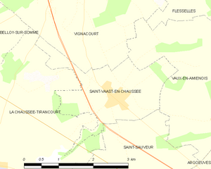
Saint-Vaast-en-Chaussée
- commune in Somme, France
- Country:
- Postal Code: 80310
- Coordinates: 49° 58' 12" N, 2° 12' 20" E
- GPS tracks (wikiloc): [Link]
- AboveSeaLevel: 52 м m
- Area: 4.72 sq km
- Population: 503


Rubempré
- commune in Somme, France
- Country:
- Postal Code: 80260
- Coordinates: 50° 1' 8" N, 2° 23' 9" E
- GPS tracks (wikiloc): [Link]
- Area: 10.08 sq km
- Population: 721


Contay
- commune in Somme, France
- Country:
- Postal Code: 80560
- Coordinates: 50° 0' 16" N, 2° 28' 35" E
- GPS tracks (wikiloc): [Link]
- Area: 8.41 sq km
- Population: 362

Coisy
- commune in Somme, France
- Country:
- Postal Code: 80260
- Coordinates: 49° 57' 36" N, 2° 19' 39" E
- GPS tracks (wikiloc): [Link]
- Area: 6.08 sq km
- Population: 323


Querrieu
- commune in Somme, France
- Country:
- Postal Code: 80115
- Coordinates: 49° 56' 19" N, 2° 25' 50" E
- GPS tracks (wikiloc): [Link]
- Area: 10.03 sq km
- Population: 650


Rainneville
- commune in Somme, France
- Country:
- Postal Code: 80260
- Coordinates: 49° 58' 23" N, 2° 21' 16" E
- GPS tracks (wikiloc): [Link]
- Area: 7.11 sq km
- Population: 933


Cardonnette
- commune in Somme, France
- Country:
- Postal Code: 80260
- Coordinates: 49° 57' 5" N, 2° 21' 33" E
- GPS tracks (wikiloc): [Link]
- Area: 5.46 sq km
- Population: 490
- Web site: [Link]


Beaucourt-sur-l'Hallue
- commune in Somme, France
- Country:
- Postal Code: 80260
- Coordinates: 49° 59' 14" N, 2° 26' 41" E
- GPS tracks (wikiloc): [Link]
- Area: 5.47 sq km
- Population: 284


Saint-Gratien
- commune in Somme, France
- Country:
- Postal Code: 80260
- Coordinates: 49° 57' 57" N, 2° 24' 31" E
- GPS tracks (wikiloc): [Link]
- Area: 6.95 sq km
- Population: 374


Talmas
- commune in Somme, France
- Country:
- Postal Code: 80260
- Coordinates: 50° 1' 47" N, 2° 19' 35" E
- GPS tracks (wikiloc): [Link]
- Area: 19.2 sq km
- Population: 1064


Vaux-en-Amiénois
- commune in Somme, France
- Country:
- Postal Code: 80260
- Coordinates: 49° 57' 44" N, 2° 14' 54" E
- GPS tracks (wikiloc): [Link]
- Area: 11.18 sq km
- Population: 413

Vadencourt
- commune in Somme, France
- Country:
- Postal Code: 80560
- Coordinates: 50° 0' 26" N, 2° 29' 22" E
- GPS tracks (wikiloc): [Link]
- Area: 4.92 sq km
- Population: 94


Villers-Bocage
- commune in Somme, France
- Country:
- Postal Code: 80260
- Coordinates: 49° 59' 50" N, 2° 19' 2" E
- GPS tracks (wikiloc): [Link]
- Area: 14.17 sq km
- Population: 1382