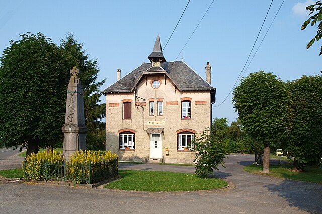
canton of Vouziers (canton de Vouziers)

- canton of France
- Country:

- Capital: Vouziers
- Coordinates: 49° 23' 50" N, 4° 41' 54" E


- GPS tracks (wikiloc): [Link]
- Population: 13198
- Wikipedia en: wiki(en)
- Wikipedia: wiki(fr)
- Wikidata storage: Wikidata: Q1673994
- INSEE canton code: [0819]
Includes regions:

Vouziers
- former commune in Ardennes, France
- Country:
- Postal Code: 08400
- Coordinates: 49° 23' 53" N, 4° 42' 4" E
- GPS tracks (wikiloc): [Link]
- AboveSeaLevel: 148 м m
- Area: 27.8 sq km
- Population: 3954
- Web site: [Link]

Mars-sous-Bourcq
- commune in Ardennes, France
- Country:
- Postal Code: 08400
- Coordinates: 49° 23' 48" N, 4° 38' 28" E
- GPS tracks (wikiloc): [Link]
- Area: 4.73 sq km
- Population: 52
Sainte-Marie
- commune in Ardennes, France
- Country:
- Postal Code: 08400
- Coordinates: 49° 22' 20" N, 4° 40' 3" E
- GPS tracks (wikiloc): [Link]
- Area: 5.57 sq km
- Population: 82

Bourcq
- commune in Ardennes, France
- Country:
- Postal Code: 08400
- Coordinates: 49° 23' 6" N, 4° 37' 56" E
- GPS tracks (wikiloc): [Link]
- Area: 9.85 sq km
- Population: 53

La Croix-aux-Bois
- commune in Ardennes, France
- Country:
- Postal Code: 08400
- Coordinates: 49° 24' 10" N, 4° 47' 36" E
- GPS tracks (wikiloc): [Link]
- Area: 5.77 sq km
- Population: 147

Vandy
- commune in Ardennes, France
- Country:
- Postal Code: 08400
- Coordinates: 49° 26' 4" N, 4° 42' 21" E
- GPS tracks (wikiloc): [Link]
- Area: 11.11 sq km
- Population: 203

Longwé
- commune in Ardennes, France
- Country:
- Postal Code: 08400
- Coordinates: 49° 23' 24" N, 4° 47' 22" E
- GPS tracks (wikiloc): [Link]
- Area: 10.78 sq km
- Population: 85
Terron-sur-Aisne
- former commune in Ardennes, France
- Country:
- Postal Code: 08400
- Coordinates: 49° 27' 10" N, 4° 41' 48" E
- GPS tracks (wikiloc): [Link]
- Area: 6.5 sq km
- Population: 108

Contreuve
- commune in Ardennes, France
- Country:
- Postal Code: 08400
- Coordinates: 49° 21' 42" N, 4° 37' 28" E
- GPS tracks (wikiloc): [Link]
- Area: 11.02 sq km
- Population: 73

Toges
- commune in Ardennes, France
- Country:
- Postal Code: 08400
- Coordinates: 49° 25' 32" N, 4° 46' 38" E
- GPS tracks (wikiloc): [Link]
- Area: 3.44 sq km
- Population: 97

Vrizy
- former commune in Ardennes, France
- Country:
- Postal Code: 08400
- Coordinates: 49° 25' 35" N, 4° 40' 44" E
- GPS tracks (wikiloc): [Link]
- Area: 8.18 sq km
- Population: 321

Grivy-Loisy
- commune in Ardennes, France
- Country:
- Postal Code: 08400
- Coordinates: 49° 24' 59" N, 4° 37' 52" E
- GPS tracks (wikiloc): [Link]
- Area: 11.56 sq km
- Population: 181

Quatre-Champs
- commune in Ardennes, France
- Country:
- Postal Code: 08400
- Coordinates: 49° 26' 43" N, 4° 46' 2" E
- GPS tracks (wikiloc): [Link]
- Area: 11.51 sq km
- Population: 203
Falaise
- commune in Ardennes, France
- Country:
- Postal Code: 08400
- Coordinates: 49° 22' 42" N, 4° 43' 46" E
- GPS tracks (wikiloc): [Link]
- Area: 9.52 sq km
- Population: 324

Ballay
- commune in Ardennes, France
- Country:
- Postal Code: 08400
- Coordinates: 49° 25' 48" N, 4° 44' 57" E
- GPS tracks (wikiloc): [Link]
- Area: 10.46 sq km
- Population: 277