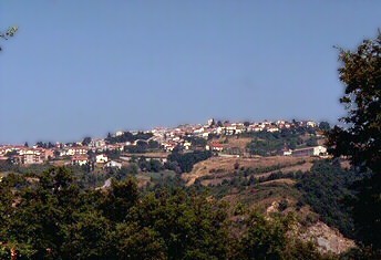
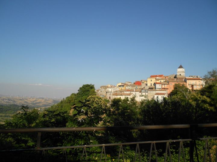
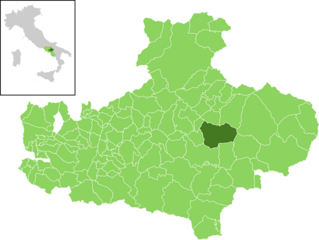
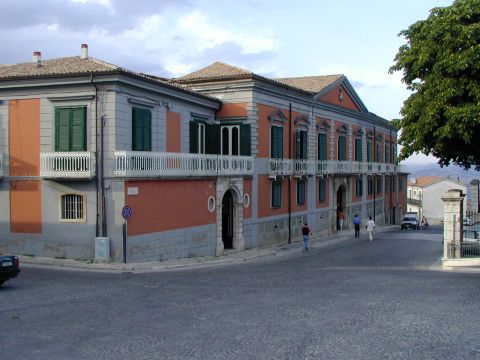
Carife (Carife)
- Italian comune
 Hiking in Carife
Carife is a small town located in the Sicilian province of Catania, Italy. It is surrounded by beautiful landscapes and offers several opportunities for hiking and outdoor activities. Here are some aspects to consider when hiking in and around Carife:
Scenic Trails
-
Surrounding Natural Beauty: Carife is set against the backdrop of the Etna region, which provides a unique setting for hiking. You can explore trails that lead you through lush forests, volcanic landscapes, and scenic viewpoints.
-
Etna National Park: Just a short drive from Carife lies Etna National Park, which offers numerous trails for different skill levels. You can hike up to the craters of Mount Etna, and enjoy views of the surrounding area, including lava fields, unique geological formations, and diverse flora and fauna.
Important Considerations
-
Trail Difficulty: Trails in the area can range from easy walks to more challenging hikes. It's essential to choose a trail that matches your fitness level and experience.
-
Weather Conditions: Be mindful of the weather, especially in the mountainous regions around Mount Etna, as conditions can change rapidly. Check local forecasts before heading out.
-
Preparation: Ensure you have appropriate gear, including sturdy hiking boots, weather-appropriate clothing, water, snacks, and a map or GPS device. Cell service might be limited in some areas.
Local Culture
- Take time to appreciate the local culture and cuisine, possibly trying traditional Sicilian dishes after your hike. Engaging with locals can provide insights into the best trails and hidden gems in the area.
Hiking in Carife and its surroundings can be a rewarding experience with breathtaking landscapes, unique geological features, and a chance to connect with nature. Always prioritize safety and respect local guidelines while exploring.
- Country:

- Postal Code: 83040
- Local Dialing Code: 0827
- Licence Plate Code: AV
- Coordinates: 41° 1' 38" N, 15° 12' 35" E


- GPS tracks (wikiloc): [Link]
- AboveSeaLevel: 740 м m
- Area: 16.72 sq km
- Population: 1381
- Web site: http://carife.asmenet.it/
- Wikipedia en: wiki(en)
- Wikipedia: wiki(it)
- Wikidata storage: Wikidata: Q55016
- Wikipedia Commons Category: [Link]
- Freebase ID: [/m/0ffy_t]
- GeoNames ID: Alt: [6540689]
- VIAF ID: Alt: [236625214]
- OSM relation ID: [41015]
- UN/LOCODE: [ITAC9]
- Digital Atlas of the Roman Empire ID: [29192]
- ISTAT ID: 064019
- Italian cadastre code: B776
Shares border with regions:

Castel Baronia
- Italian comune
Hiking in Castel Baronia
Castel Baronia is a charming hill town located in the province of Avellino in the Campania region of Italy. It is surrounded by the beautiful landscapes of the Irpinia area, which offers numerous hiking opportunities....
- Country:
- Postal Code: 83040
- Local Dialing Code: 0827
- Licence Plate Code: AV
- Coordinates: 41° 2' 54" N, 15° 11' 23" E
- GPS tracks (wikiloc): [Link]
- AboveSeaLevel: 639 м m
- Area: 15.37 sq km
- Population: 1102
- Web site: [Link]
Frigento
- Italian comune
Hiking in Frigento
Frigento, a town in the Avellino province of Italy, is surrounded by beautiful landscapes that offer various hiking opportunities. The area is characterized by rolling hills, lush greenery, and scenic views, making it a great destination for outdoor enthusiasts....
- Country:
- Postal Code: 83040
- Local Dialing Code: 0825
- Licence Plate Code: AV
- Coordinates: 41° 0' 44" N, 15° 6' 2" E
- GPS tracks (wikiloc): [Link]
- AboveSeaLevel: 911 м m
- Area: 38.04 sq km
- Population: 3663
- Web site: [Link]
Guardia Lombardi
- comune in Campania, Italy
Hiking in Guardia Lombardi
Guardia Lombardi is a charming village located in the Avellino province of Campania, Italy. Its mountainous terrain and beautiful landscapes make it a great destination for hiking enthusiasts. Here are some insights into hiking in the area:...
- Country:
- Postal Code: 83040
- Local Dialing Code: 0827
- Licence Plate Code: AV
- Coordinates: 40° 57' 17" N, 15° 12' 35" E
- GPS tracks (wikiloc): [Link]
- AboveSeaLevel: 998 м m
- Area: 55.77 sq km
- Population: 1698
- Web site: [Link]
San Nicola Baronia
- Italian comune
Hiking in San Nicola Baronia
San Nicola Baronia is a small village located in the province of Avellino in the Campania region of Italy. It is situated in a picturesque area characterized by rolling hills, lush vegetation, and stunning views of the surrounding landscapes. Hiking in and around San Nicola Baronia can provide a unique experience for those looking to explore the natural beauty and cultural heritage of this part of Italy....
- Country:
- Postal Code: 83050
- Local Dialing Code: 0827
- Licence Plate Code: AV
- Coordinates: 41° 3' 0" N, 15° 11' 0" E
- GPS tracks (wikiloc): [Link]
- AboveSeaLevel: 610 м m
- Area: 6.9 sq km
- Population: 765
- Web site: [Link]
Sturno
- Italian comune
Hiking in Sturno
Sturno is a small town located in the province of Avellino in the Campania region of Italy. While it might not be as well-known for hiking as some other locations in Italy, there are still opportunities for outdoor enthusiasts to explore the surrounding area....
- Country:
- Postal Code: 83055
- Local Dialing Code: 0825
- Licence Plate Code: AV
- Coordinates: 41° 1' 0" N, 15° 6' 0" E
- GPS tracks (wikiloc): [Link]
- AboveSeaLevel: 662 м m
- Area: 16.67 sq km
- Population: 3038
- Web site: [Link]

Trevico
- Italian comune
Hiking in Trevico
Trevico, a charming town located in the province of Avellino in the Campania region of Italy, offers stunning natural landscapes and various hiking opportunities. Situated in the Apennine Mountains, Trevico is known for its breathtaking views, diverse flora and fauna, and rich cultural heritage. Here are some highlights of hiking in the area:...
- Country:
- Postal Code: 83058
- Local Dialing Code: 0827
- Licence Plate Code: AV
- Coordinates: 41° 3' 0" N, 15° 14' 0" E
- GPS tracks (wikiloc): [Link]
- AboveSeaLevel: 1094 м m
- Area: 11 sq km
- Population: 932
- Web site: [Link]
Vallata
- Italian comune
Hiking in Vallata
Vallata, located in the Campania region of Italy, is a wonderful destination for hiking enthusiasts. Nestled within the foothills of the Apennine Mountains, it offers a variety of trails suitable for different skill levels, with breathtaking landscapes, diverse flora, and opportunities to explore local culture....
- Country:
- Postal Code: 83059
- Local Dialing Code: 0827
- Licence Plate Code: AV
- Coordinates: 41° 2' 25" N, 15° 15' 14" E
- GPS tracks (wikiloc): [Link]
- AboveSeaLevel: 870 м m
- Area: 47.91 sq km
- Population: 2659
- Web site: [Link]