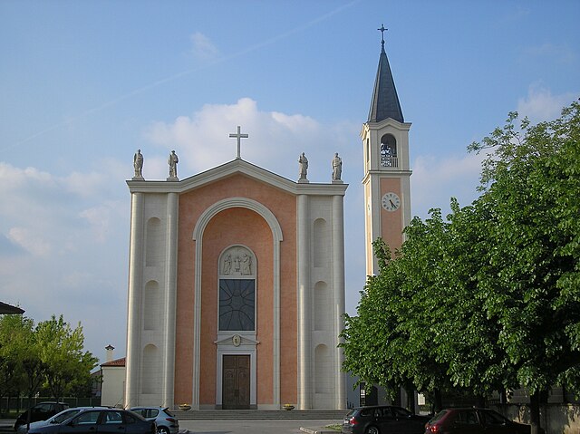
Carmignano di Brenta (Carmignano di Brenta)
.svg)
- Italian comune
 Hiking in Carmignano di Brenta
Carmignano di Brenta is a charming town located in the province of Padua in the Veneto region of Italy. It is known for its beautiful natural landscapes and historical sites. Hiking in and around Carmignano di Brenta offers a variety of trails that cater to different skill levels, allowing hikers to explore the stunning countryside, forests, and hills.
Popular Hiking Trails
-
The Berici Hills: Not far from Carmignano di Brenta, the Berici Hills provide numerous trails that offer panoramic views of the surrounding landscape. These trails vary in difficulty, making them suitable for both beginners and experienced hikers.
-
The Brenta River Path: This scenic route follows the river, providing hikers with an opportunity to enjoy nature and wildlife. It’s relatively flat, making it accessible for families and casual walkers.
-
Nature Reserves: The area around Carmignano di Brenta is home to several nature reserves, which feature well-marked trails. These reserves are perfect for birdwatching and enjoying the local flora and fauna.
-
Cultural and Historical Routes: Some trails take you through charming villages and historical sites, allowing you to combine hiking with cultural exploration. You might encounter ancient churches, villas, and local architecture.
Best Practices for Hiking
- Trail Maps: Always carry a map or use a hiking app to help navigate the trails.
- Stay Hydrated: Bring plenty of water, especially during the warmer months.
- Wear Appropriate Footwear: Good hiking boots are essential for comfortable and safe hiking.
- Respect Nature: Follow Leave No Trace principles by staying on trails and disposing of waste properly.
Local Amenities
Carmignano di Brenta has amenities such as cafes, restaurants, and accommodations where hikers can relax after a day on the trails. Local cuisine is worth exploring, with options that feature delicious regional dishes, including polenta and risotto.
Best Time to Visit
The best times to hike in Carmignano di Brenta are during the spring (April to June) and fall (September to October), when temperatures are mild and the scenery is particularly beautiful.
Whether you're looking for a peaceful trek through nature or a challenging hike with stunning views, Carmignano di Brenta and its surroundings offer a delightful experience for hiking enthusiasts!
- Country:

- Postal Code: 35010
- Local Dialing Code: 049
- Licence Plate Code: PD
- Coordinates: 45° 38' 0" N, 11° 42' 0" E


- GPS tracks (wikiloc): [Link]
- AboveSeaLevel: 46 м m
- Area: 14.68 sq km
- Population: 7576
- Web site: http://www.comune.carmignano.pd.it/
- Wikipedia en: wiki(en)
- Wikipedia: wiki(it)
- Wikidata storage: Wikidata: Q34683
- Wikipedia Commons Category: [Link]
- Freebase ID: [/m/0gk449]
- GeoNames ID: Alt: [6538331]
- VIAF ID: Alt: [233895346]
- OSM relation ID: [45535]
- GND ID: Alt: [4716459-1]
- TGN ID: [1043897]
- UN/LOCODE: [ITCMI]
- ISTAT ID: 028023
- Italian cadastre code: B795
Shares border with regions:
Fontaniva
- Italian comune
Hiking in Fontaniva
Fontaniva is a charming town located in the Veneto region of Italy, not too far from the larger city of Padua. The surrounding area offers various hiking opportunities, with scenic trails that showcase the natural beauty of the region, including gentle hills, vineyards, and picturesque landscapes....
- Country:
- Postal Code: 35014
- Local Dialing Code: 049
- Licence Plate Code: PD
- Coordinates: 45° 38' 7" N, 11° 45' 14" E
- GPS tracks (wikiloc): [Link]
- AboveSeaLevel: 45 м m
- Area: 20.61 sq km
- Population: 8061
- Web site: [Link]
San Pietro in Gu
- Italian comune
Hiking in San Pietro in Gu
San Pietro in Gu is a quaint village located in the Veneto region of Italy, nestled among the rolling hills and picturesque countryside. While it may not be a well-known hiking destination, the surrounding area offers various opportunities for outdoor enthusiasts....
- Country:
- Postal Code: 35010
- Local Dialing Code: 049
- Licence Plate Code: PD
- Coordinates: 45° 36' 37" N, 11° 40' 40" E
- GPS tracks (wikiloc): [Link]
- AboveSeaLevel: 44 м m
- Area: 17.9 sq km
- Population: 4435
- Web site: [Link]

Grantorto
- Italian comune
Hiking in Grantorto
Grantorto, a small town located in the Province of Padua in Veneto, Italy, is not commonly known as a hiking destination. However, the surrounding region offers beautiful landscapes and opportunities for outdoor activities....
- Country:
- Postal Code: 35010
- Local Dialing Code: 049
- Licence Plate Code: PD
- Coordinates: 45° 36' 0" N, 11° 44' 0" E
- GPS tracks (wikiloc): [Link]
- AboveSeaLevel: 36 м m
- Area: 14.1 sq km
- Population: 4591
- Web site: [Link]

Pozzoleone
- Italian comune
Hiking in Pozzoleone
Pozzoleone is a small town located in the Veneto region of Italy, not far from the larger cities of Vicenza and Verona. While it may not be as widely recognized as a primary hiking destination, it offers various opportunities for outdoor enthusiasts looking to explore the natural beauty of the surrounding areas....
- Country:
- Postal Code: 36050
- Local Dialing Code: 0444
- Licence Plate Code: VI
- Coordinates: 45° 38' 58" N, 11° 40' 28" E
- GPS tracks (wikiloc): [Link]
- AboveSeaLevel: 56 м m
- Area: 11.26 sq km
- Population: 2780
- Web site: [Link]

Cittadella
- Italian comune
Hiking in Cittadella
Cittadella, located in the Veneto region of Italy, is known for its well-preserved medieval walls and rich history. While the town itself is small and doesn't offer extensive hiking trails, the surrounding area does present some opportunities for outdoor enthusiasts looking to enjoy nature and explore on foot....
- Country:
- Postal Code: 35013
- Local Dialing Code: 049
- Licence Plate Code: PD
- Coordinates: 45° 38' 55" N, 11° 47' 1" E
- GPS tracks (wikiloc): [Link]
- AboveSeaLevel: 48 м m
- Area: 36.68 sq km
- Population: 20145
- Web site: [Link]