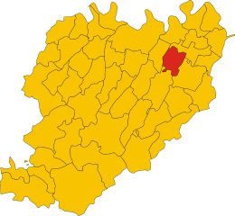
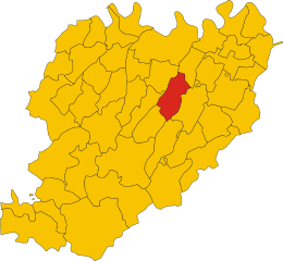
Carpaneto Piacentino (Carpaneto Piacentino)
.svg)
- Italian comune
 Hiking in Carpaneto Piacentino
Carpaneto Piacentino is a charming town located in the Piacenza province of Emilia-Romagna, Italy. It is surrounded by beautiful landscapes, rolling hills, and vineyards, making it a delightful destination for hiking enthusiasts. Here are some highlights to consider if you're planning a hiking trip in and around Carpaneto Piacentino:
Trails and Routes
-
Sentiero dei Sette Colori (Trail of the Seven Colors): This trail is known for its vibrant scenery and diversity of landscapes, featuring hills, vineyards, and picturesque villages. It's a moderate hike, suitable for various skill levels.
-
Parco Regionale dei Boschi di Carrega: Located not too far from Carpaneto, this regional park offers numerous trails through lush forests, wetlands, and open areas. You can experience the local flora and fauna, making it perfect for nature lovers.
-
Circuito del Monte Moria (Monte Moria Circuit): This trail takes you around Monte Moria, providing stunning views of the surrounding valleys and the chance to explore traditional rural areas. It's ideal for those looking for a mix of physical activity and cultural immersion.
Preparing for Your Hike
- Gear: Ensure you have sturdy hiking boots, weather-appropriate clothing, a backpack, water, snacks, and navigation tools (map or GPS).
- Weather: Check the weather forecast before heading out. Spring and fall are particularly pleasant for hiking, while summer can be hot.
- Local Regulations: Respect local regulations and guidelines, especially when hiking in protected areas or parks. Stick to marked trails to minimize your impact on the environment.
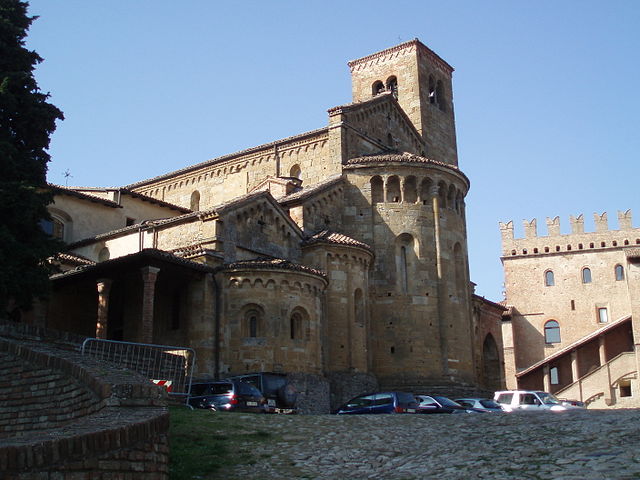
Cultural and Culinary Stops
After a day of hiking, explore Carpaneto Piacentino itself. The town has several local trattorias where you can enjoy traditional Emilia-Romagna cuisine. Don’t miss trying local specialties like tortelli di patate (potato-filled pasta) or salumi (cured meats) from the region.
Conclusion
Hiking in and around Carpaneto Piacentino promises a mix of stunning landscapes, cultural experiences, and culinary delights. Whether you're a seasoned hiker or a nature lover looking to explore, the area offers a range of options to suit your interests. Always remember to hike responsibly and enjoy the beauty that this Italian region has to offer!
- Country:

- Postal Code: 29013
- Local Dialing Code: 0523
- Licence Plate Code: PC
- Coordinates: 44° 55' 0" N, 9° 47' 0" E


- GPS tracks (wikiloc): [Link]
- AboveSeaLevel: 400 м m
- Area: 63.08 sq km
- Population: 7733
- Web site: http://www.comune.carpaneto.pc.it
- Wikipedia en: wiki(en)
- Wikipedia: wiki(it)
- Wikidata storage: Wikidata: Q102621
- Wikipedia Commons Category: [Link]
- Freebase ID: [/m/0gkcq8]
- GeoNames ID: Alt: [6538411]
- VIAF ID: Alt: [234419327]
- OSM relation ID: [43750]
- TGN ID: [1043906]
- UN/LOCODE: [ITAPP]
- ISTAT ID: 033011
- Italian cadastre code: B812
Shares border with regions:

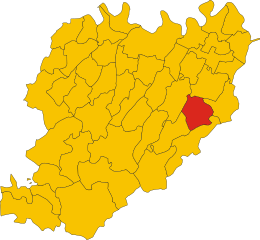
Cadeo
- Italian comune
Hiking in Cadeo
Cadeo is a small town in the province of Piacenza in the Emilia-Romagna region of Italy. While it may not be as well-known for hiking as some of the larger national parks or mountainous regions in Italy, it can still serve as a good base for exploring the surrounding countryside and nearby natural areas....
- Country:
- Postal Code: 29010
- Local Dialing Code: 0523
- Licence Plate Code: PC
- Coordinates: 44° 58' 0" N, 9° 50' 0" E
- GPS tracks (wikiloc): [Link]
- AboveSeaLevel: 65 м m
- Area: 38.48 sq km
- Population: 6083
- Web site: [Link]
Castell'Arquato
- Italian comune
Hiking in Castell'Arquato
Castell'Arquato is a picturesque medieval village located in the Emilia-Romagna region of Italy, surrounded by rolling hills and stunning landscapes, making it a fantastic destination for hiking enthusiasts. The area around Castell'Arquato offers a variety of hiking trails that cater to different skill levels, from easy walks suitable for families to more challenging routes for experienced hikers....
- Country:
- Postal Code: 29014
- Local Dialing Code: 0523
- Licence Plate Code: PC
- Coordinates: 44° 51' 0" N, 9° 52' 0" E
- GPS tracks (wikiloc): [Link]
- AboveSeaLevel: 224 м m
- Area: 52.75 sq km
- Population: 4621
- Web site: [Link]


Fiorenzuola d'Arda
- Italian comune
Hiking in Fiorenzuola d'Arda
Fiorenzuola d'Arda is a charming town located in the Emilia-Romagna region of Italy, offering a mix of historical attractions and access to beautiful natural landscapes. While it may not be as well-known as some other hiking destinations, it’s a great starting point for exploring the surrounding areas, including the nearby hills and countryside that are ideal for hiking....
- Country:
- Postal Code: 29017
- Local Dialing Code: 0523
- Licence Plate Code: PC
- Coordinates: 44° 56' 0" N, 9° 54' 0" E
- GPS tracks (wikiloc): [Link]
- AboveSeaLevel: 82 м m
- Area: 59.77 sq km
- Population: 15276
- Web site: [Link]


Gropparello
- Italian comune
Hiking in Gropparello
Gropparello is a picturesque area located in the Emilia-Romagna region of Italy, known for its beautiful landscapes, historical sites, and outdoor activities, including hiking. The surroundings are characterized by rolling hills, dense forests, and stunning views, making it an ideal spot for nature lovers and hiking enthusiasts....
- Country:
- Postal Code: 29025
- Local Dialing Code: 0523
- Licence Plate Code: PC
- Coordinates: 44° 50' 0" N, 9° 44' 0" E
- GPS tracks (wikiloc): [Link]
- AboveSeaLevel: 355 м m
- Area: 56.33 sq km
- Population: 2268
- Web site: [Link]


Lugagnano Val d'Arda
- Italian comune
Hiking in Lugagnano Val d'Arda
Lugagnano Val d'Arda is a charming village located in the Piacenza province of Emilia-Romagna, Italy. The surrounding area offers a mix of scenic landscapes, rolling hills, and rural charm, making it an attractive destination for hiking enthusiasts. Here are some highlights and tips for hiking in this area:...
- Country:
- Postal Code: 29018
- Local Dialing Code: 0523
- Licence Plate Code: PC
- Coordinates: 44° 49' 0" N, 9° 49' 0" E
- GPS tracks (wikiloc): [Link]
- AboveSeaLevel: 229 м m
- Area: 54.4 sq km
- Population: 3976
- Web site: [Link]

Pontenure
- Italian comune
Hiking in Pontenure
Pontenure is a small town in the Emilia-Romagna region of Italy, located near Piacenza. While it may not be a primary hiking destination, the surrounding areas offer beautiful landscapes and opportunities for outdoor activities. Here are some things to consider if you're looking to hike around Pontenure:...
- Country:
- Postal Code: 29010
- Local Dialing Code: 0523
- Licence Plate Code: PC
- Coordinates: 45° 0' 0" N, 9° 47' 0" E
- GPS tracks (wikiloc): [Link]
- AboveSeaLevel: 65 м m
- Area: 33.85 sq km
- Population: 6499
- Web site: [Link]

San Giorgio Piacentino
- Italian comune
Hiking in San Giorgio Piacentino
San Giorgio Piacentino is a quaint municipality located in the Emilia-Romagna region of Italy, known for its beautiful landscapes, rolling hills, and rich agricultural heritage. While it may not be a major hiking destination compared to larger national parks or mountainous regions, it offers several opportunities for outdoor enthusiasts to enjoy hiking in a serene and picturesque environment....
- Country:
- Postal Code: 29019
- Local Dialing Code: 0523
- Licence Plate Code: PC
- Coordinates: 44° 57' 0" N, 9° 44' 0" E
- GPS tracks (wikiloc): [Link]
- AboveSeaLevel: 103 м m
- Area: 49.19 sq km
- Population: 5673
- Web site: [Link]