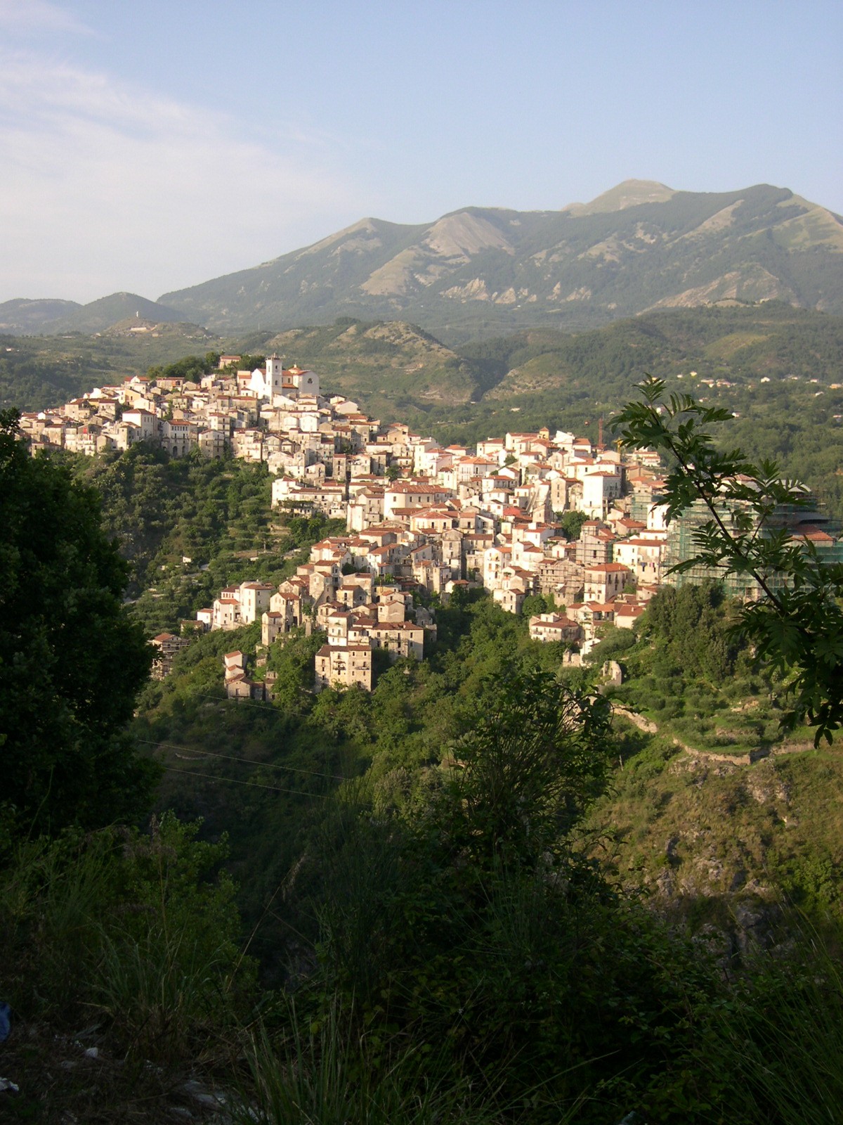
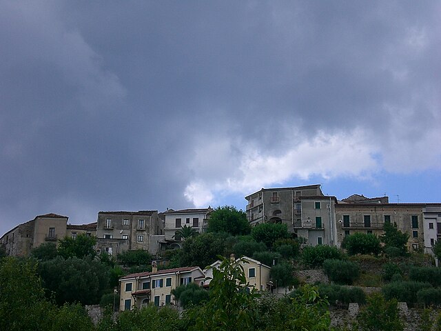
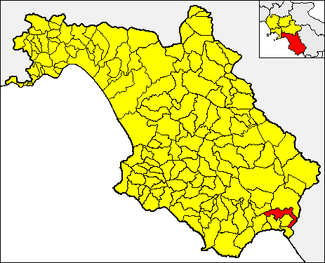
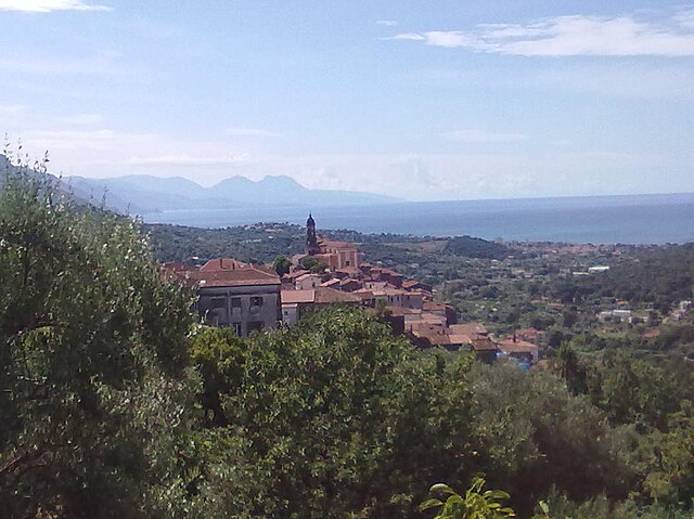
Casaletto Spartano (Casaletto Spartano)

- Italian comune
 Hiking in Casaletto Spartano
Casaletto Spartano, located in the Campania region of Italy, is a hidden gem for outdoor enthusiasts and hikers. Nestled in the charming Cilento and Vallo di Diano National Park, this area is characterized by its stunning landscapes, rich biodiversity, and cultural heritage. Here are some highlights about hiking in and around Casaletto Spartano:
Trails and Nature
-
Diverse Terrain: The trails vary in difficulty, from easy walks suitable for families to more challenging routes for seasoned hikers. Expect a mix of rolling hills, rugged terrain, and beautiful valleys.
-
Scenic Views: Many trails offer breathtaking views of the surrounding mountains, valleys, and nearby coastal areas. Sunrise and sunset hikes can be particularly rewarding for their stunning vistas.
-
Flora and Fauna: The National Park is home to various plant and animal species, some of which are endemic to the region. Hikers can encounter diverse ecosystems, from Mediterranean scrub to beech forests.
Cultural Experience
-
Historical Sites: Along the hiking routes, you might find ancient ruins, old churches, and traditional villages that provide insight into the region's history and culture.
-
Local Cuisine: After a day of hiking, you can enjoy traditional dishes made from local ingredients in the nearby villages. Don't miss the chance to taste specialty cheeses, cured meats, and local wines.
Practical Tips
-
Best Time to Hike: The ideal times for hiking in Casaletto Spartano are spring (April to June) and autumn (September to November) when the weather is mild and the landscape is particularly beautiful.
-
Safety Precautions: Always inform someone about your hiking plans and check the weather forecast. Some trails might be less marked, so carrying a map or using a GPS app is recommended.
-
Gear: Proper footwear is essential, as some paths can be rocky or uneven. Also, pack water, snacks, and sun protection, as amenities along the trails may be limited.
Local Guide Services
Consider hiring a local guide who can enhance your hiking experience with knowledge about the trails, local culture, and wildlife. They can also ensure your safety and help you navigate the less-marked trails.
Overall, hiking in Casaletto Spartano offers a unique experience to connect with nature while immersing yourself in the rich culture of the Cilento region. Whether you're a solo traveler, a couple, or with family, the natural beauty and tranquility of this area can provide a memorable adventure.
- Country:

- Postal Code: 84030
- Local Dialing Code: 0973
- Licence Plate Code: SA
- Coordinates: 40° 9' 0" N, 15° 37' 0" E


- GPS tracks (wikiloc): [Link]
- AboveSeaLevel: 540 м m
- Area: 86.57 sq km
- Population: 1376
- Web site: http://www.comune.casalettospartano.sa.it
- Wikipedia en: wiki(en)
- Wikipedia: wiki(it)
- Wikidata storage: Wikidata: Q80757
- Wikipedia Commons Category: [Link]
- Freebase ID: [/m/0frf87]
- GeoNames ID: Alt: [6537393]
- OSM relation ID: [40282]
- TGN ID: [1043933]
- ISTAT ID: 065027
- Italian cadastre code: B888
Shares border with regions:
Lagonegro
- Italian comune
Hiking in Lagonegro
Lagonegro is a beautiful town located in the southern Italian region of Basilicata, surrounded by stunning natural landscapes, mountains, and the Pollino National Park. Hiking in Lagonegro offers a variety of trails that cater to different experience levels, making it a fantastic destination for nature lovers and outdoor enthusiasts....
- Country:
- Postal Code: 85042
- Local Dialing Code: 0973
- Licence Plate Code: PZ
- Coordinates: 40° 8' 0" N, 15° 46' 0" E
- GPS tracks (wikiloc): [Link]
- AboveSeaLevel: 666 м m
- Area: 113.07 sq km
- Population: 5442
- Web site: [Link]

Rivello
- Italian comune
Hiking in Rivello
Rivello is a picturesque village located in the Basilicata region of southern Italy, known for its stunning landscapes and charming architecture. The area around Rivello offers various hiking opportunities that cater to different skill levels, appealing to both experienced hikers and those looking for leisurely walks....
- Country:
- Postal Code: 85040
- Local Dialing Code: 0973
- Licence Plate Code: PZ
- Coordinates: 40° 4' 42" N, 15° 45' 29" E
- GPS tracks (wikiloc): [Link]
- AboveSeaLevel: 479 м m
- Area: 69.58 sq km
- Population: 2731
- Web site: [Link]
Casalbuono
- Italian comune
Hiking in Casalbuono
Casalbuono, located in the scenic region of Basilicata in Italy, offers beautiful hiking opportunities due to its picturesque landscapes and rugged terrain. This area is known for its natural beauty, including forests, mountains, and valleys, which make it a great destination for outdoor enthusiasts....
- Country:
- Postal Code: 84030
- Local Dialing Code: 0975
- Licence Plate Code: SA
- Coordinates: 40° 12' 55" N, 15° 41' 20" E
- GPS tracks (wikiloc): [Link]
- AboveSeaLevel: 661 м m
- Area: 34.82 sq km
- Population: 1168
- Web site: [Link]


Caselle in Pittari
- Italian comune
Hiking in Caselle in Pittari
Caselle in Pittari is a charming village located in the Campania region of southern Italy, specifically in the province of Salerno. It is nestled in the hills of the Cilento National Park, making it an ideal destination for hiking and outdoor activities....
- Country:
- Postal Code: 84030
- Local Dialing Code: 0974
- Licence Plate Code: SA
- Coordinates: 40° 10' 0" N, 15° 33' 0" E
- GPS tracks (wikiloc): [Link]
- AboveSeaLevel: 444 м m
- Area: 45.56 sq km
- Population: 1946
- Web site: [Link]


Morigerati
- Italian comune
Hiking in Morigerati
Morigerati, a charming town in the Campania region of Italy, is nestled within the breathtaking landscapes of the Cilento and Vallo di Diano National Park. This area is known for its stunning natural beauty, rich biodiversity, and historical significance, making it a fantastic destination for hiking enthusiasts....
- Country:
- Postal Code: 84030
- Local Dialing Code: 0974
- Licence Plate Code: SA
- Coordinates: 40° 8' 0" N, 15° 33' 0" E
- GPS tracks (wikiloc): [Link]
- AboveSeaLevel: 281 м m
- Area: 21.19 sq km
- Population: 653
- Web site: [Link]


Sanza
- Italian comune
Hiking in Sanza
Sanza is a beautiful destination for hiking enthusiasts, situated in the province of Salerno in southern Italy's Campania region. It offers a striking landscape with mountains, forests, and natural scenery that caters to a range of hiking abilities, from beginners to seasoned trekkers. Here are some highlights about hiking in Sanza:...
- Country:
- Postal Code: 84030
- Local Dialing Code: 0975
- Licence Plate Code: SA
- Coordinates: 40° 15' 0" N, 15° 33' 0" E
- GPS tracks (wikiloc): [Link]
- AboveSeaLevel: 558 м m
- Area: 128.75 sq km
- Population: 2565
- Web site: [Link]
Torraca
- Italian comune
Hiking in Torraca
Torraca is a charming village located in the province of Salerno in southern Italy, nestled in the beautiful landscape of the Cilento and Vallo di Diano National Park. This area is rich in natural beauty, culture, and history, making it an excellent destination for hiking enthusiasts....
- Country:
- Postal Code: 84030
- Local Dialing Code: 0973
- Licence Plate Code: SA
- Coordinates: 40° 7' 0" N, 15° 38' 0" E
- GPS tracks (wikiloc): [Link]
- AboveSeaLevel: 452 м m
- Area: 16.01 sq km
- Population: 1251
- Web site: [Link]
Tortorella
- Italian comune
Hiking in Tortorella
Tortorella is a charming village located in the province of Salerno, in the Campania region of Italy. It's nestled in the beautiful landscapes of the Cilento and Vallo di Diano National Park, which offers a plethora of hiking opportunities. Here’s a guide to help you explore the hiking potential in and around Tortorella:...
- Country:
- Postal Code: 84030
- Local Dialing Code: 0973
- Licence Plate Code: SA
- Coordinates: 40° 8' 0" N, 15° 36' 0" E
- GPS tracks (wikiloc): [Link]
- AboveSeaLevel: 582 м m
- Area: 34.22 sq km
- Population: 506
- Web site: [Link]

Vibonati
- Italian comune
Hiking in Vibonati
Vibonati, a charming coastal town located in the Cilento region of Italy, offers a variety of hiking opportunities that showcase the region’s stunning natural beauty, rich history, and diverse ecosystems. Here are some highlights to consider when planning a hiking trip in and around Vibonati:...
- Country:
- Postal Code: 84079
- Local Dialing Code: 0973
- Licence Plate Code: SA
- Coordinates: 40° 6' 0" N, 15° 35' 0" E
- GPS tracks (wikiloc): [Link]
- AboveSeaLevel: 110 м m
- Area: 20.54 sq km
- Population: 3321
- Web site: [Link]