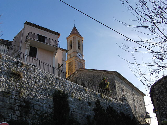
Castagniers (Castagniers)
- commune in Alpes-Maritimes, France
 Hiking in Castagniers
Castagniers is a charming village located in the Alpes-Maritimes region of France, not far from Nice. It offers a mix of scenic views, cultural heritage, and well-marked hiking trails that cater to all levels of hikers.
Hiking Trails:
-
Local Trails: The area features several local trails that can be explored directly from the village. These trails offer stunning views of the surrounding countryside and are often surrounded by beautiful flora.
-
GR5 Trail: Part of the long-distance GR (Grande Randonnée) network, the GR5 trail passes close to Castagniers. This trail can take you through diverse landscapes, from coastal paths to mountainous terrain.
-
Montagne de l’Escarpent: A popular hike in the region that provides breathtaking panoramic views from the summit. The trail is relatively moderate, making it accessible for many hikers.
Tips for Hiking in Castagniers:
- Seasonal Considerations: Spring and autumn are ideal times for hiking in this region, as the weather is generally mild and pleasant.
- Local Weather: Always check the local weather forecasts before heading out, as conditions can change rapidly, especially in mountainous areas.
- Hydration and Gear: Make sure to carry enough water, wear appropriate footwear, and pack essential gear like a map, snacks, and sun protection.
- Respect Nature: Follow Leave No Trace principles. Stay on marked trails, and take all your waste with you.
Additional Activities:
After a day of hiking, you can explore the village itself, enjoy local cuisine, or visit nearby attractions like the town of Vence or the beautiful French Riviera coast.
With its picturesque landscapes and delightful trails, hiking in Castagniers can be a truly rewarding experience. Enjoy your adventures!
- Country:

- Postal Code: 06670
- Coordinates: 43° 47' 29" N, 7° 13' 54" E


- GPS tracks (wikiloc): [Link]
- Area: 7.52 sq km
- Population: 1575
- Web site: http://www.mairie-castagniers.com
- Wikipedia en: wiki(en)
- Wikipedia: wiki(fr)
- Wikidata storage: Wikidata: Q287504
- Wikipedia Commons Category: [Link]
- Freebase ID: [/m/03m4z90]
- Freebase ID: [/m/03m4z90]
- GeoNames ID: Alt: [6446688]
- GeoNames ID: Alt: [6446688]
- SIREN number: [210600342]
- SIREN number: [210600342]
- VIAF ID: Alt: [234754644]
- VIAF ID: Alt: [234754644]
- INSEE municipality code: 06034
- INSEE municipality code: 06034
Shares border with regions:


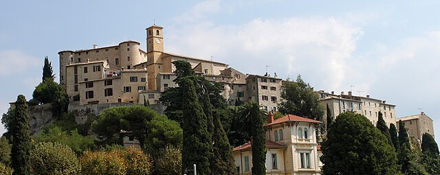
Tourrette-Levens
- commune in Alpes-Maritimes, France
Hiking in Tourrette-Levens
Tourrette-Levens is a charming commune located in the Alpes-Maritimes region of southeastern France, not far from Nice. It offers a delightful mix of hiking opportunities, showcasing stunning Mediterranean landscapes, hills, and views over the surrounding areas....
- Country:
- Postal Code: 06690
- Coordinates: 43° 47' 12" N, 7° 16' 33" E
- GPS tracks (wikiloc): [Link]
- Area: 16.5 sq km
- Population: 4877
- Web site: [Link]


Saint-Blaise
- commune in Alpes-Maritimes, France
Hiking in Saint-Blaise
Saint-Blaise, situated in the Alpes-Maritimes region of France, offers a beautiful backdrop for hiking enthusiasts. Nestled near Nice and the Mediterranean coast, it provides not only stunning views but also a variety of trails suitable for different skill levels....
- Country:
- Postal Code: 06670
- Coordinates: 43° 49' 18" N, 7° 14' 15" E
- GPS tracks (wikiloc): [Link]
- Area: 8.04 sq km
- Population: 1013

Aspremont
- commune in Alpes-Maritimes, France
Hiking in Aspremont
Aspremont, located in the Alpes-Maritimes department in the Provence-Alpes-Côte d'Azur region of France, offers a variety of hiking opportunities with stunning views and a rich natural environment. Nestled in the foothills near Nice, this area provides a blend of beautiful landscape, historical sites, and a taste of local culture....
- Country:
- Postal Code: 06790
- Coordinates: 43° 47' 0" N, 7° 14' 39" E
- GPS tracks (wikiloc): [Link]
- Area: 9.44 sq km
- Population: 2139
- Web site: [Link]

Carros
- commune in Alpes-Maritimes, France
Hiking in Carros
Carros, located in the Alpes-Maritimes region of France near Nice, offers a variety of hiking opportunities that cater to all skill levels. The area is characterized by its stunning natural landscapes, including hills, forests, and panoramic views of the Mediterranean coast....
- Country:
- Postal Code: 06510
- Coordinates: 43° 46' 21" N, 7° 11' 36" E
- GPS tracks (wikiloc): [Link]
- Area: 15.11 sq km
- Population: 12008
- Web site: [Link]

Colomars
- commune in Alpes-Maritimes, France
Hiking in Colomars
Colomars is a charming commune located in the Alpes-Maritimes department in the South of France, near Nice. It’s known for its beautiful landscapes, giving hikers a variety of trails that cater to different skill levels. Here’s an overview of what you can expect when hiking in Colomars:...
- Country:
- Postal Code: 06670
- Coordinates: 43° 45' 49" N, 7° 13' 20" E
- GPS tracks (wikiloc): [Link]
- Area: 6.72 sq km
- Population: 3377