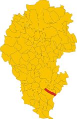
Castegnero (Castegnero)
.svg)
- Italian comune
 Hiking in Castegnero
Castegnero, a municipality located in the province of Vicenza in Italy, offers some picturesque hiking opportunities that showcase the beautiful natural landscapes of the region. While it may not be as well-known as other hiking destinations, it provides a tranquil setting for outdoor enthusiasts.
Hiking Trails:
-
Local Trails: The area around Castegnero features several shorter local trails that wind through lush forests, vineyards, and rolling hills. These trails are suitable for hikers of all levels.
-
Monte Veronese: Nearby, you can find trails leading to Monte Veronese, which offers stunning views of the surrounding landscape. Hikers can explore various paths that range from moderate to challenging.
-
Bacchiglione River Path: Additionally, the Bacchiglione River offers scenic paths alongside the water where you can enjoy leisurely hikes with opportunities for birdwatching and photography.
Best Seasons for Hiking:
- Spring (March to May): This is an ideal time for hiking, as the weather is mild and wildflowers are in bloom.
- Fall (September to November): Another great season, with cooler temperatures and beautiful fall foliage.
Essential Tips:
- Footwear: Make sure to wear sturdy hiking boots for better grip and support.
- Water: Carry enough water, especially during warmer months.
- Map: It’s advisable to have a map or a GPS device, as some paths may not be well-marked.
- Check Weather Conditions: Always check the weather before heading out, as conditions can change quickly.
Local Culture:
While in Castegnero, take the chance to explore local cuisine, particularly traditional Italian dishes. You might find local osterias or restaurants that serve regional specialties, making for a delightful post-hike experience.
Conclusion:
Castegnero may not be on the main hiking tourism radar, but its serene environment and beautiful trails make it a charming destination for those looking to escape into nature. Whether you're looking for a short hike or a more challenging adventure, you can find it in this picturesque part of Italy. Always remember to hike responsibly and respect the local environment.
- Country:

- Postal Code: 36020
- Local Dialing Code: 0444
- Licence Plate Code: VI
- Coordinates: 45° 27' 0" N, 11° 35' 0" E


- GPS tracks (wikiloc): [Link]
- AboveSeaLevel: 22 м m
- Area: 11.62 sq km
- Population: 2905
- Web site: http://www.comune.castegnero.vi.it/
- Wikipedia en: wiki(en)
- Wikipedia: wiki(it)
- Wikidata storage: Wikidata: Q46336
- Wikipedia Commons Category: [Link]
- Freebase ID: [/m/0g8nk9]
- GeoNames ID: Alt: [6542734]
- VIAF ID: Alt: [145865596]
- OSM relation ID: [45033]
- UN/LOCODE: [ITATG]
- ISTAT ID: 024027
- Italian cadastre code: C056
Shares border with regions:


Montegaldella
- Italian comune
Hiking in Montegaldella
Montegaldella is a charming area located in the Veneto region of Italy, known for its beautiful natural landscapes and hiking opportunities. The region offers a range of trails that cater to various skill levels, making it a great destination for both beginners and experienced hikers....
- Country:
- Postal Code: 36047
- Local Dialing Code: 0444
- Licence Plate Code: VI
- Coordinates: 45° 26' 0" N, 11° 40' 0" E
- GPS tracks (wikiloc): [Link]
- AboveSeaLevel: 23 м m
- Area: 13.57 sq km
- Population: 1774
- Web site: [Link]

Nanto
- Italian comune
Hiking in Nanto
Nanto, located in the Veneto region of Italy, offers a delightful experience for hikers, featuring beautiful landscapes, scenic trails, and cultural landmarks. The area is characterized by rolling hills, vineyards, and stunning views of the surrounding countryside, making it a picturesque destination for outdoor enthusiasts....
- Country:
- Postal Code: 36024
- Local Dialing Code: 0444
- Licence Plate Code: VI
- Coordinates: 45° 26' 0" N, 11° 35' 0" E
- GPS tracks (wikiloc): [Link]
- AboveSeaLevel: 20 м m
- Area: 14.35 sq km
- Population: 3091
- Web site: [Link]
Arcugnano
- Italian comune
Hiking in Arcugnano
Arcugnano, a picturesque town located in the Veneto region of Northern Italy, offers some delightful hiking opportunities amidst stunning landscapes. Nestled near the city of Vicenza, Arcugnano is surrounded by rolling hills, vineyards, and lush countryside, making it an ideal location for outdoor enthusiasts....
- Country:
- Postal Code: 36057
- Local Dialing Code: 0444
- Licence Plate Code: VI
- Coordinates: 45° 29' 45" N, 11° 32' 52" E
- GPS tracks (wikiloc): [Link]
- AboveSeaLevel: 60 м m
- Area: 41.57 sq km
- Population: 7853
- Web site: [Link]
Longare
- Italian comune
Hiking in Longare
Longare is a picturesque area located in the province of Vicenza, Italy, surrounded by beautiful landscapes and rolling hills of the Veneto region. While it may not be as well-known as other hiking destinations, it offers several opportunities for outdoor enthusiasts who want to explore nature and enjoy the scenic views....
- Country:
- Postal Code: 36023
- Local Dialing Code: 0444
- Licence Plate Code: VI
- Coordinates: 45° 29' 0" N, 11° 37' 0" E
- GPS tracks (wikiloc): [Link]
- AboveSeaLevel: 29 м m
- Area: 22.77 sq km
- Population: 5684
- Web site: [Link]