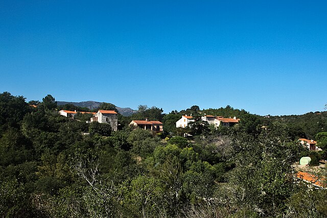
Castelnou (Castelnou)
- commune in Pyrénées-Orientales, France
- Country:

- Postal Code: 66300
- Coordinates: 42° 37' 11" N, 2° 42' 10" E


- GPS tracks (wikiloc): [Link]
- Area: 19.28 sq km
- Population: 328
- Web site: http://www.castelnou.com
- Wikipedia en: wiki(en)
- Wikipedia: wiki(fr)
- Wikidata storage: Wikidata: Q191094
- Wikipedia Commons Category: [Link]
- Freebase ID: [/m/03qltg1]
- GeoNames ID: Alt: [6450524]
- SIREN number: [216600445]
- BnF ID: [15270955d]
- OSM relation ID: [24457]
- Gran Enciclopèdia Catalana ID: [0016131]
- INSEE municipality code: 66044
Shares border with regions:


Caixas
- commune in Pyrénées-Orientales, France
- Country:

- Postal Code: 66300
- Coordinates: 42° 34' 58" N, 2° 40' 59" E


- GPS tracks (wikiloc): [Link]
- AboveSeaLevel: 350 м m
- Area: 28.11 sq km
- Population: 145


Sainte-Colombe-de-la-Commanderie
- commune in Pyrénées-Orientales, France
- Country:

- Postal Code: 66300
- Coordinates: 42° 36' 53" N, 2° 44' 52" E


- GPS tracks (wikiloc): [Link]
- AboveSeaLevel: 127 м m
- Area: 4.74 sq km
- Population: 149
- Web site: [Link]


Saint-Féliu-d'Amont
- commune in Pyrénées-Orientales, France
- Country:

- Postal Code: 66170
- Coordinates: 42° 41' 12" N, 2° 43' 21" E


- GPS tracks (wikiloc): [Link]
- Area: 6.11 sq km
- Population: 1060
- Web site: [Link]


Terrats
- commune in Pyrénées-Orientales, France
- Country:

- Postal Code: 66300
- Coordinates: 42° 36' 32" N, 2° 46' 17" E


- GPS tracks (wikiloc): [Link]
- Area: 7.32 sq km
- Population: 646


Camélas
- commune in Pyrénées-Orientales, France
- Country:

- Postal Code: 66300
- Coordinates: 42° 39' 5" N, 2° 42' 17" E


- GPS tracks (wikiloc): [Link]
- AboveSeaLevel: 350 м m
- Area: 12.72 sq km
- Population: 450
- Web site: [Link]


Saint-Féliu-d'Avall
- commune in Pyrénées-Orientales, France
- Country:

- Postal Code: 66170
- Coordinates: 42° 40' 53" N, 2° 44' 19" E


- GPS tracks (wikiloc): [Link]
- Area: 10.79 sq km
- Population: 2732


Thuir
- commune in Pyrénées-Orientales, France
- Country:

- Postal Code: 66300
- Coordinates: 42° 37' 55" N, 2° 45' 23" E


- GPS tracks (wikiloc): [Link]
- Area: 19.9 sq km
- Population: 7401
- Web site: [Link]


Montauriol
- commune in Pyrénées-Orientales, France
- Country:

- Postal Code: 66300
- Coordinates: 42° 34' 33" N, 2° 43' 28" E


- GPS tracks (wikiloc): [Link]
- Area: 11.1 sq km
- Population: 226
