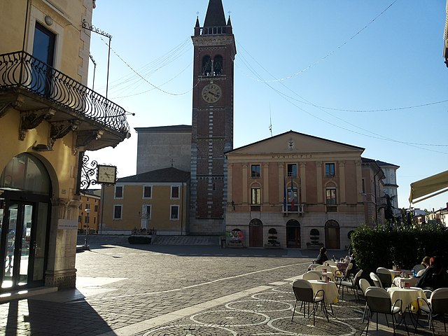
Castelnuovo del Garda (Castelnuovo del Garda)
- Italian comune
 Hiking in Castelnuovo del Garda
Castelnuovo del Garda, located near Lake Garda in Italy, offers beautiful hiking opportunities with stunning landscapes, diverse trails, and rich natural beauty. Here are some key points about hiking in the area:
Scenic Trails
-
Sentiero del Monte Baldo: This trail leads up to Monte Baldo, which provides breathtaking views of Lake Garda. The ascent can be challenging but is well worth it for the panoramic vistas.
-
Lakeside Paths: The trails along the shores of Lake Garda are more leisurely and suitable for families. These paths often connect beautiful towns and offer great spots for resting and enjoying the lake’s beauty.
-
Nature Reserves and Parks: Nearby natural reserves, such as the Parco botanico di Gardone Riviera, can be explored for their unique fauna and flora, allowing hikers to experience the diversity of the region.
Hiking Levels
- Beginner: Many flat and easy paths around the lake.
- Intermediate: Trails that ascend into the hills, offering moderate climbs and rewarding views.
- Advanced: Steeper routes that may require more experience and physical fitness, particularly around Monte Baldo.
Best Time to Hike
The best times for hiking in Castelnuovo del Garda are in the spring and fall when temperatures are mild, and the landscapes are particularly beautiful. Summer can be hot, making early morning or late afternoon hikes preferable, while winter may involve snow on the higher trails.
Essentials for Hiking
- Footwear: Sturdy hiking boots are recommended, especially for more challenging trails.
- Gear: Bring plenty of water, snacks, sunscreen, and appropriate clothing for changing weather.
- Navigation: It’s helpful to have a good map or a GPS-enabled device since some trails may not be well marked.
Local Attractions
After a hike, you can indulge in local cuisine at the numerous inns and restaurants in Castelnuovo del Garda or explore nearby attractions like Gardaland amusement park and the charming towns of Bardolino and Lazise.
Ensure to check trail conditions and any local regulations before heading out. Enjoy your hiking adventure in this beautiful part of Italy!
- Country:

- Postal Code: 37014
- Local Dialing Code: 045
- Licence Plate Code: VR
- Coordinates: 45° 26' 0" N, 10° 46' 0" E


- GPS tracks (wikiloc): [Link]
- AboveSeaLevel: 130 м m
- Area: 34.43 sq km
- Population: 13137
- Web site: http://www.comune.castelnuovodelgarda.vr.it/
- Wikipedia en: wiki(en)
- Wikipedia: wiki(it)
- Wikidata storage: Wikidata: Q46722
- Wikipedia Commons Category: [Link]
- Freebase ID: [/m/0gb213]
- GeoNames ID: Alt: [6542299]
- OSM relation ID: [44965]
- UN/LOCODE: [ITCED]
- Digital Atlas of the Roman Empire ID: [17147]
- ISTAT ID: 023022
- Italian cadastre code: C225
Shares border with regions:


Sirmione
- Italian comune
Sirmione, a charming town located on the southern shore of Lake Garda in Italy, is known for its stunning scenery, historical sites, and relaxed atmosphere. While Sirmione itself is not primarily known for extensive hiking trails, there are several beautiful walks and nearby hiking opportunities that you can explore....
- Country:

- Postal Code: 25019
- Local Dialing Code: 030
- Licence Plate Code: BS
- Coordinates: 45° 28' 10" N, 10° 36' 22" E


- GPS tracks (wikiloc): [Link]
- AboveSeaLevel: 68 м m
- Area: 26.25 sq km
- Population: 8243
- Web site: [Link]


Bussolengo
- Italian comune
Bussolengo is a charming town located in the Veneto region of northern Italy, near the beautiful Lake Garda. While Bussolengo itself is not a major hiking destination, it is strategically positioned near several hiking trails and natural parks that offer stunning views and diverse landscapes....
- Country:

- Postal Code: 37012; 37010
- Local Dialing Code: 045
- Licence Plate Code: VR
- Coordinates: 45° 28' 0" N, 10° 51' 0" E


- GPS tracks (wikiloc): [Link]
- AboveSeaLevel: 127 м m
- Area: 24.23 sq km
- Population: 19483
- Web site: [Link]


Lazise
- Italian comune
Lazise is a charming town located on the eastern shore of Lake Garda in Italy. Known for its beautiful landscapes, historical sites, and Mediterranean climate, it offers a variety of hiking opportunities for outdoor enthusiasts....
- Country:

- Postal Code: 37017
- Local Dialing Code: 045
- Licence Plate Code: VR
- Coordinates: 45° 30' 19" N, 10° 43' 57" E


- GPS tracks (wikiloc): [Link]
- AboveSeaLevel: 76 м m
- Area: 63.15 sq km
- Population: 6958
- Web site: [Link]

Sona
- Italian comune
Sona, located in the Veneto region of Italy, is a charming area that offers a mix of rural landscapes, historical sites, and natural beauty, making it a great destination for hiking enthusiasts. Here are some points to consider when exploring hiking in and around Sona:...
- Country:

- Postal Code: 37060
- Local Dialing Code: 045
- Licence Plate Code: VR
- Coordinates: 45° 26' 0" N, 10° 50' 0" E


- GPS tracks (wikiloc): [Link]
- AboveSeaLevel: 169 м m
- Area: 41.15 sq km
- Population: 17694
- Web site: [Link]

Peschiera del Garda
- Italian comune
Peschiera del Garda, located on the southeastern shore of Lake Garda in Italy, is not only a picturesque town known for its charming canals and historical architecture but also an excellent base for hiking enthusiasts. The surrounding landscapes offer a variety of trails, ranging from easy walks to more challenging hikes, suitable for all skill levels....
- Country:

- Postal Code: 37010; 37019
- Local Dialing Code: 045
- Licence Plate Code: VR
- Coordinates: 45° 26' 19" N, 10° 41' 19" E


- GPS tracks (wikiloc): [Link]
- AboveSeaLevel: 68 м m
- Area: 18.27 sq km
- Population: 10583
- Web site: [Link]


Valeggio sul Mincio
- Italian comune
Valeggio sul Mincio is a charming town in northern Italy, located along the Mincio River in the province of Verona. The area is known for its beautiful landscapes, rich history, and the nearby Sigurtà Botanical Park, making it a great destination for hiking enthusiasts. Here are some key points about hiking in and around Valeggio sul Mincio:...
- Country:

- Postal Code: 37060; 37067
- Local Dialing Code: 045
- Licence Plate Code: VR
- Coordinates: 45° 21' 0" N, 10° 44' 0" E


- GPS tracks (wikiloc): [Link]
- AboveSeaLevel: 88 м m
- Area: 63.96 sq km
- Population: 15424
- Web site: [Link]
