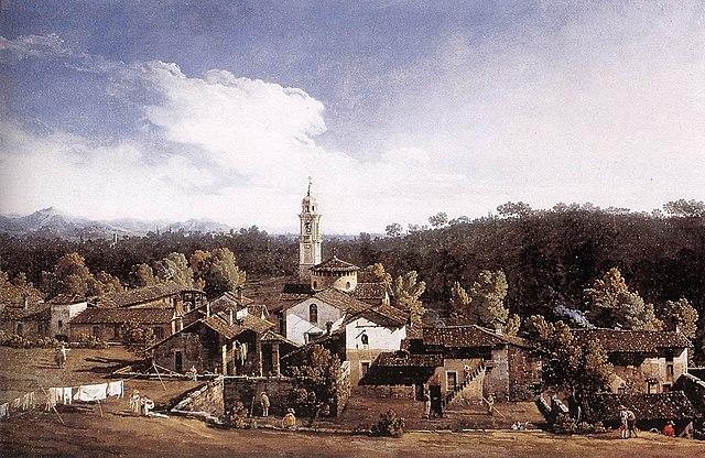
Castronno (Castronno)
.svg)
- Italian comune
 Hiking in Castronno
Castronno is a small town located in the Lombardy region of Italy, near the larger city of Varese. While it may not be widely known as a hiking destination, the surrounding area offers several opportunities for walking and hiking enthusiasts. Here are some highlights regarding hiking in and around Castronno:
Trails and Natural Areas
-
Parco Regionale Campo dei Fiori: Located a short drive away from Castronno, this vast regional park features numerous trails ranging from easy to challenging. The park is characterized by its diverse flora and fauna, scenic views, and historical sites, making it a great spot for nature lovers.
-
Lake Varese (Lago di Varese): The area around Lake Varese is perfect for hiking, with trails that loop around the lake and offer beautiful views of the water and surrounding hills. The paths are usually well-marked, making them accessible for people of varying hiking abilities.
-
The Pre-Alps: The Pre-Alp region offers more challenging hikes with rewarding panoramic views. You can find various routes catering to different skill levels, from easier walks to more demanding mountain trails.
Tips for Hiking in Castronno
-
Preparation: Check local weather conditions before heading out. The climate can vary, especially in the hilly areas.
-
Trail Maps: It’s advisable to carry a map or download a hiking app with available trails in the area. The trails vary in difficulty, so make sure to choose one that matches your experience level.
-
Local Advice: Consider reaching out to local hiking groups or guides if you’re uncertain about the trails. They can provide valuable insights on the best routes, especially if you'd like to explore lesser-known paths.
-
Pack Essentials: Don’t forget to bring adequate water, snacks, sun protection, and a first-aid kit. Proper footwear is also essential, especially if you're taking on rocky or uneven trails.
-
Respect Nature: Always follow the Leave No Trace principles to preserve the natural beauty of the area.
Additional Activities
While hiking is a fantastic way to explore Castronno and its surroundings, the area also offers other activities such as cycling, birdwatching, and exploring historical sites, so consider incorporating these into your visit as well.
In conclusion, while Castronno itself may not be a bustling hiking hub, its proximity to stunning natural parks and trails makes it a great base for outdoor enthusiasts looking to explore the beautiful Italian landscape!
- Country:

- Postal Code: 21040
- Local Dialing Code: 0332
- Licence Plate Code: VA
- Coordinates: 45° 44' 0" N, 8° 48' 0" E


- GPS tracks (wikiloc): [Link]
- AboveSeaLevel: 325 м m
- Area: 3.76 sq km
- Population: 5253
- Web site: http://www.comune.castronno.va.it
- Wikipedia en: wiki(en)
- Wikipedia: wiki(it)
- Wikidata storage: Wikidata: Q39935
- Wikipedia Commons Category: [Link]
- Freebase ID: [/m/0ghyfh]
- GeoNames ID: Alt: [6536483]
- VIAF ID: Alt: [243878676]
- OSM relation ID: [45961]
- UN/LOCODE: [ITCNN]
- ISTAT ID: 012047
- Italian cadastre code: C343
Shares border with regions:
Caronno Varesino
- Italian comune
Hiking in Caronno Varesino
Caronno Varesino is a charming town located in the province of Varese, in the northern part of Italy, surrounded by lush landscapes and natural beauty, making it a great starting point for hiking adventures....
- Country:
- Postal Code: 21040
- Local Dialing Code: 0331
- Licence Plate Code: VA
- Coordinates: 45° 44' 0" N, 8° 50' 0" E
- GPS tracks (wikiloc): [Link]
- AboveSeaLevel: 403 м m
- Area: 5.75 sq km
- Population: 4860
- Web site: [Link]


Morazzone
- Italian comune
Hiking in Morazzone
Morazzone, located in the Lombardy region of Italy, is surrounded by beautiful landscapes and offers various hiking opportunities. Nestled between the provinces of Varese and Como, it features scenic trails that appeal to hikers of all levels, from beginners to more experienced adventurers. Here are some aspects to consider if you're planning to hike in Morazzone:...
- Country:
- Postal Code: 21040
- Local Dialing Code: 0332
- Licence Plate Code: VA
- Coordinates: 45° 46' 0" N, 8° 50' 0" E
- GPS tracks (wikiloc): [Link]
- AboveSeaLevel: 432 м m
- Area: 5.6 sq km
- Population: 4287
- Web site: [Link]
Sumirago
- Italian comune
Hiking in Sumirago
Sumirago is a charming town located in the Lombardy region of Italy, known for its scenic landscapes and proximity to nature trails that offer wonderful hiking opportunities. While not as widely recognized as some other hiking destinations in Italy, Sumirago can be a great spot for both novice and experienced hikers....
- Country:
- Postal Code: 21040
- Local Dialing Code: 0331
- Licence Plate Code: VA
- Coordinates: 45° 44' 21" N, 8° 46' 51" E
- GPS tracks (wikiloc): [Link]
- AboveSeaLevel: 392 м m
- Area: 11.75 sq km
- Population: 6149
- Web site: [Link]

Gazzada Schianno
- Italian comune
Hiking in Gazzada Schianno
Gazzada Schianno is located in the Lombardy region of Italy, nestled within the beautiful Varese province. This area is known for its picturesque landscapes, charming villages, and access to nature, making it a fantastic spot for hiking enthusiasts....
- Country:
- Postal Code: 21045
- Local Dialing Code: 0332
- Licence Plate Code: VA
- Coordinates: 45° 47' 0" N, 8° 49' 0" E
- GPS tracks (wikiloc): [Link]
- AboveSeaLevel: 368 м m
- Area: 4.84 sq km
- Population: 4632
- Web site: [Link]
Brunello
- Italian comune
Hiking in Brunello
Brunello, a wine-producing area located in the province of Sondrio, Lombardy, is renowned for its stunning landscapes, charming villages, and of course, its vineyards. While the region is primarily known for its wine, it also offers beautiful hiking opportunities that allow you to experience the natural beauty of the Italian Alps and the surrounding areas....
- Country:
- Postal Code: 21020
- Local Dialing Code: 0332
- Licence Plate Code: VA
- Coordinates: 45° 45' 57" N, 8° 47' 47" E
- GPS tracks (wikiloc): [Link]
- AboveSeaLevel: 337 м m
- Area: 1.62 sq km
- Population: 969
- Web site: [Link]
Albizzate
- Italian comune
Hiking in Albizzate
Albizzate is a small town located in the Lombardy region of Italy, close to the larger city of Varese. While it might not be a highly recognized hiking destination, there are some scenic routes and nearby areas that nature enthusiasts can explore....
- Country:
- Postal Code: 21041
- Local Dialing Code: 0331
- Licence Plate Code: VA
- Coordinates: 45° 43' 0" N, 8° 48' 0" E
- GPS tracks (wikiloc): [Link]
- AboveSeaLevel: 334 м m
- Area: 3.88 sq km
- Population: 5299
- Web site: [Link]