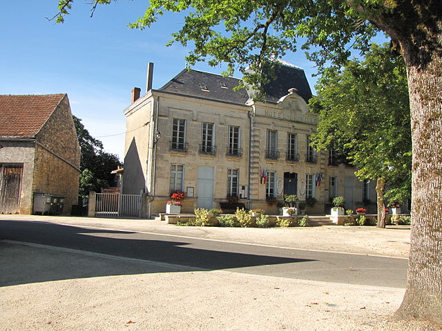
Catus (Catus)

- commune in Lot, France
- Country:

- Postal Code: 46150
- Coordinates: 44° 33' 23" N, 1° 20' 13" E


- GPS tracks (wikiloc): [Link]
- Area: 21.32 sq km
- Population: 881
- Wikipedia en: wiki(en)
- Wikipedia: wiki(fr)
- Wikidata storage: Wikidata: Q1381814
- Wikipedia Commons Category: [Link]
- Freebase ID: [/m/03nwky4]
- GeoNames ID: Alt: [6455127]
- SIREN number: [214600645]
- BnF ID: [15260805c]
- INSEE municipality code: 46064
Shares border with regions:
Nuzéjouls
- commune in Lot, France
- Country:
- Postal Code: 46150
- Coordinates: 44° 32' 20" N, 1° 22' 47" E
- GPS tracks (wikiloc): [Link]
- Area: 4.74 sq km
- Population: 380
Boissières
- commune in Lot, France
- Country:
- Postal Code: 46150
- Coordinates: 44° 32' 36" N, 1° 24' 2" E
- GPS tracks (wikiloc): [Link]
- Area: 13.03 sq km
- Population: 392
- Web site: [Link]

Thédirac
- commune in Lot, France
- Country:
- Postal Code: 46150
- Coordinates: 44° 36' 2" N, 1° 19' 3" E
- GPS tracks (wikiloc): [Link]
- Area: 16.51 sq km
- Population: 307


Saint-Médard
- commune in Lot, France
- Country:
- Postal Code: 46150
- Coordinates: 44° 32' 18" N, 1° 17' 39" E
- GPS tracks (wikiloc): [Link]
- AboveSeaLevel: 139 м m
- Area: 11.78 sq km
- Population: 170
Saint-Denis-Catus
- commune in Lot, France
- Country:
- Postal Code: 46150
- Coordinates: 44° 33' 54" N, 1° 23' 32" E
- GPS tracks (wikiloc): [Link]
- Area: 10.78 sq km
- Population: 172
Uzech
- commune in Lot, France
- Country:
- Postal Code: 46310
- Coordinates: 44° 35' 29" N, 1° 23' 45" E
- GPS tracks (wikiloc): [Link]
- Area: 12.21 sq km
- Population: 219

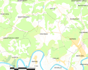
Crayssac
- commune in Lot, France
- Country:
- Postal Code: 46150
- Coordinates: 44° 30' 35" N, 1° 19' 39" E
- GPS tracks (wikiloc): [Link]
- Area: 14.95 sq km
- Population: 769


Montgesty
- commune in Lot, France
- Country:
- Postal Code: 46150
- Coordinates: 44° 34' 44" N, 1° 17' 49" E
- GPS tracks (wikiloc): [Link]
- Area: 11.88 sq km
- Population: 333