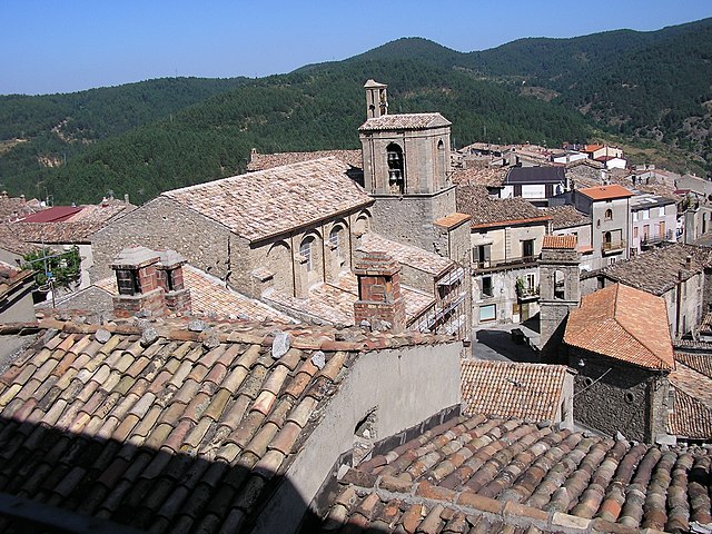
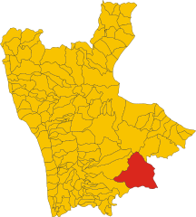
Cerenzia (Cerenzia)
.svg)
- Italian comune
 Hiking in Cerenzia
Cerenzia is a charming municipality located in the Calabria region of southern Italy, surrounded by picturesque landscapes and rich natural beauty. Hiking in Cerenzia offers a unique experience for outdoor enthusiasts, with various trails that cater to different skill levels.
Highlights of Hiking in Cerenzia:
-
Scenic Trails: The area offers a mix of coastal and inland trails. You can enjoy lush forests, rolling hills, and stunning views of the surrounding landscapes.
-
Flora and Fauna: As you hike, keep an eye out for the diverse wildlife and plant species. The region is part of the Aspromonte National Park, home to many endemic species.
-
Historical Sites: Some hiking routes may lead you to historical sites or rural villages, allowing you to experience the local culture and history.
-
Local Culture: Cerenzia is known for its agricultural beauty, and you might come across local farms or traditional practices, making your hiking experience even more enriching.
-
Accessibility: Trails can vary in difficulty, making it accessible for families, casual walkers, and seasoned hikers. Always check the trail difficulty and prepare accordingly.
Tips for Hiking in Cerenzia:
- Dress Appropriately: Wear suitable hiking footwear and clothing for the terrain and weather conditions.
- Stay Hydrated: Bring enough water and snacks, especially for longer hikes.
- Map and GPS: Familiarize yourself with the trails using maps or GPS devices. Local guides can provide insights and enhance your experience.
- Respect Nature: Follow the Leave No Trace principles to help preserve the stunning environment.
Best Time to Hike:
The ideal months for hiking in Cerenzia are typically late spring (May to June) and early autumn (September to October) when the weather is mild and the scenery is vibrant.
Overall, hiking in Cerenzia can be a rewarding experience filled with breathtaking views, cultural encounters, and a chance to explore the natural beauty of Calabria.
- Country:

- Postal Code: 88833
- Local Dialing Code: 0984
- Licence Plate Code: KR
- Coordinates: 39° 15' 0" N, 16° 47' 0" E


- GPS tracks (wikiloc): [Link]
- AboveSeaLevel: 900 м m
- Area: 21.97 sq km
- Population: 1123
- Web site: http://cerenzia.asmenet.it/
- Wikipedia en: wiki(en)
- Wikipedia: wiki(it)
- Wikidata storage: Wikidata: Q54500
- Wikipedia Commons Category: [Link]
- Freebase ID: [/m/0fk1s6]
- GeoNames ID: Alt: [6539424]
- OSM relation ID: [39862]
- TGN ID: [7024893]
- ISTAT ID: 101006
- Italian cadastre code: C501
Shares border with regions:
San Giovanni in Fiore
- Italian comune
Hiking in San Giovanni in Fiore
San Giovanni in Fiore, located in the Calabria region of southern Italy, is an excellent destination for hiking enthusiasts. Nestled in the Sila National Park, this area boasts stunning natural landscapes, diverse wildlife, and rich cultural heritage. Here are some key points to consider when planning your hiking trip in San Giovanni in Fiore:...
- Country:
- Postal Code: 87055
- Local Dialing Code: 0984
- Licence Plate Code: CS
- Coordinates: 39° 15' 51" N, 16° 42' 1" E
- GPS tracks (wikiloc): [Link]
- AboveSeaLevel: 1049 м m
- Area: 279.45 sq km
- Population: 17059
- Web site: [Link]


Caccuri
- Italian comune
Hiking in Caccuri
Caccuri, a quaint town in the Calabria region of southern Italy, offers a unique hiking experience characterized by its scenic landscapes, historical landmarks, and rich biodiversity. Here are some details about hiking in and around Caccuri:...
- Country:
- Postal Code: 88833
- Local Dialing Code: 0984
- Licence Plate Code: KR
- Coordinates: 39° 14' 0" N, 16° 47' 0" E
- GPS tracks (wikiloc): [Link]
- AboveSeaLevel: 646 м m
- Area: 61.38 sq km
- Population: 1621
- Web site: [Link]


Castelsilano
- Italian comune
Hiking in Castelsilano
Castelsilano is a picturesque area in the Calabria region of southern Italy, known for its stunning landscapes, rich history, and diverse flora and fauna. While it may not be as famous as other hiking destinations in Italy, it offers a unique and serene hiking experience for those willing to explore its trails....
- Country:
- Postal Code: 88834
- Local Dialing Code: 0984
- Licence Plate Code: KR
- Coordinates: 39° 16' 0" N, 16° 46' 0" E
- GPS tracks (wikiloc): [Link]
- AboveSeaLevel: 900 м m
- Area: 40.06 sq km
- Population: 979
- Web site: [Link]