Cerisy-la-Salle (Cerisy-la-Salle)

- commune in Manche, France
- Country:

- Postal Code: 50210
- Coordinates: 49° 1' 34" N, 1° 16' 56" E


- GPS tracks (wikiloc): [Link]
- Area: 16.86 sq km
- Population: 1060
- Wikipedia en: wiki(en)
- Wikipedia: wiki(fr)
- Wikidata storage: Wikidata: Q958633
- Wikipedia Commons Category: [Link]
- Freebase ID: [/m/03qcqqx]
- Freebase ID: [/m/03qcqqx]
- GeoNames ID: Alt: [6435368]
- GeoNames ID: Alt: [6435368]
- SIREN number: [215001116]
- SIREN number: [215001116]
- BnF ID: [152620885]
- BnF ID: [152620885]
- VIAF ID: Alt: [145447807]
- VIAF ID: Alt: [145447807]
- Library of Congress authority ID: Alt: [n82233076]
- Library of Congress authority ID: Alt: [n82233076]
- PACTOLS thesaurus ID: [pcrtzZKjofIvpK]
- PACTOLS thesaurus ID: [pcrtzZKjofIvpK]
- INSEE municipality code: 50111
- INSEE municipality code: 50111
Shares border with regions:


Dangy
- commune in Manche, France
- Country:
- Postal Code: 50750
- Coordinates: 49° 2' 42" N, 1° 13' 29" E
- GPS tracks (wikiloc): [Link]
- Area: 9.93 sq km
- Population: 647


Carantilly
- commune in Manche, France
- Country:
- Postal Code: 50570
- Coordinates: 49° 3' 55" N, 1° 14' 26" E
- GPS tracks (wikiloc): [Link]
- Area: 10.7 sq km
- Population: 653

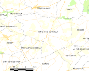
Notre-Dame-de-Cenilly
- commune in Manche, France
- Country:
- Postal Code: 50210
- Coordinates: 48° 59' 43" N, 1° 15' 29" E
- GPS tracks (wikiloc): [Link]
- Area: 25.23 sq km
- Population: 675


Cametours
- commune in Manche, France
- Country:
- Postal Code: 50570
- Coordinates: 49° 4' 6" N, 1° 16' 49" E
- GPS tracks (wikiloc): [Link]
- Area: 7.22 sq km
- Population: 431


Montpinchon
- commune in Manche, France
- Country:
- Postal Code: 50210
- Coordinates: 49° 1' 20" N, 1° 18' 36" E
- GPS tracks (wikiloc): [Link]
- Area: 16.94 sq km
- Population: 546