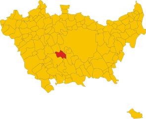
Cesano Boscone (Cesano Boscone)
.svg)
- Italian comune
 Hiking in Cesano Boscone
Cesano Boscone is a municipality located just outside Milan, Italy. While it may not be widely known as a hiking destination, there are still opportunities to enjoy nature and some walking trails in and around the area.
-
Nearby Parks: In and around Cesano Boscone, there are small parks where you can enjoy leisurely walks. For more immersive nature experiences, you could explore larger green areas such as Parco Agricolo Sud Milano, located a short drive away. This park features various trails suitable for walking and light hiking.
-
Trails: The area may not have extensive hiking trails directly in Cesano Boscone, but you can find paths along the Navigli canal system, perfect for walking, cycling, or jogging. These paths connect with the city’s historical and natural sites.
-
Transportation Links: If you're looking for more serious hiking opportunities, public transportation options from Cesano Boscone can take you to the surrounding hills and parks, such as the Ticino Natural Park, which offers a variety of trails.
-
Hiking Tips:
- Dress in layers as temperatures can vary.
- Stay hydrated and bring snacks for longer walks.
- Check local resources or hiking apps for updated trail conditions.
- Be mindful of the weather and ensure you have proper footwear.
-
Local Attractions: While hiking isn't a primary draw, the region is rich in history and culture, so consider combining your outdoor activities with visits to local sites or eateries to experience the area’s charm.
For a more dedicated hiking experience, consider venturing to larger natural areas near Milan, such as the Alps or the lakes in the Lombardy region.
- Country:

- Postal Code: 20090
- Local Dialing Code: 02
- Licence Plate Code: MI
- Coordinates: 45° 27' 0" N, 9° 6' 0" E


- GPS tracks (wikiloc): [Link]
- AboveSeaLevel: 119 м m
- Area: 3.94 sq km
- Population: 23755
- Web site: http://www.comune.cesano-boscone.mi.it/
- Wikipedia en: wiki(en)
- Wikipedia: wiki(it)
- Wikidata storage: Wikidata: Q42974
- Wikipedia Commons Category: [Link]
- Freebase ID: [/m/0gj5kf]
- GeoNames ID: Alt: [6542351]
- VIAF ID: Alt: [246293176]
- OSM relation ID: [45005]
- archINFORM location ID: [16451]
- MusicBrainz area ID: [fdb29608-2407-45db-9eb8-5c199449ebb1]
- UN/LOCODE: [ITEBO]
- Gran Enciclopèdia Catalana ID: [0017205]
- ISTAT ID: 015074
- Italian cadastre code: C565
Shares border with regions:


Corsico
- Italian comune
Hiking in Corsico
Corsico, a town located near Milan in Italy, is not primarily known for its hiking trails, as it is more urban and industrial. However, if you are interested in hiking in the wider Lombardy region, there are numerous opportunities around Milan and in nearby areas....
- Country:
- Postal Code: 20094
- Local Dialing Code: 02
- Licence Plate Code: MI
- Coordinates: 45° 26' 0" N, 9° 7' 0" E
- GPS tracks (wikiloc): [Link]
- AboveSeaLevel: 113 м m
- Area: 5.36 sq km
- Population: 34891
- Web site: [Link]

Trezzano sul Naviglio
- Italian comune
Hiking in Trezzano sul Naviglio
Trezzano sul Naviglio, located in the metropolitan area of Milan, Italy, is not primarily known for extensive hiking opportunities compared to mountainous regions. However, it provides some pleasant walking and outdoor activities suitable for those looking to enjoy nature and the nearby surroundings....
- Country:
- Postal Code: 20090
- Local Dialing Code: 02
- Licence Plate Code: MI
- Coordinates: 45° 26' 0" N, 9° 4' 0" E
- GPS tracks (wikiloc): [Link]
- AboveSeaLevel: 116 м m
- Area: 10.77 sq km
- Population: 20944
- Web site: [Link]
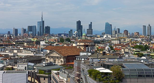

Milan
- second-largest city in Italy
Hiking in Milan
Hiking in and around Milan offers a unique blend of urban and natural experiences. While Milan itself is a bustling metropolitan area, it is also well-positioned near several excellent hiking spots in the surrounding regions. Here are some noteworthy areas and tips for hiking near Milan:...
- Country:
- Postal Code: 20162; 20161; 20159; 20158; 20157; 20156; 20155; 20154; 20153; 20152; 20151; 20149; 20148; 20147; 20146; 20145; 20144; 20143; 20142; 20141; 20139; 20138; 20137; 20136; 20135; 20134; 20133; 20132; 20131; 20129; 20128; 20127; 20126; 20125; 20124; 20123; 20122; 20121
- Local Dialing Code: 02
- Licence Plate Code: MI
- Coordinates: 45° 27' 51" N, 9° 11' 25" E
- GPS tracks (wikiloc): [Link]
- AboveSeaLevel: 120 м m
- Area: 181.67 sq km
- Population: 1351562
- Web site: [Link]