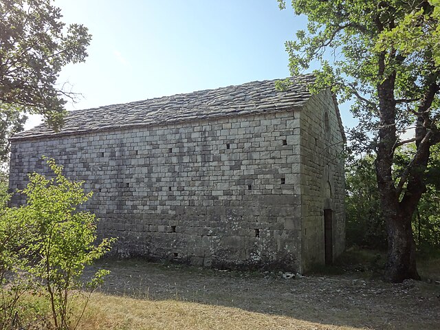
Château-Arnoux-Saint-Auban (Château-Arnoux-Saint-Auban)
- commune in Alpes-de-Haute-Provence, France
 Hiking in Château-Arnoux-Saint-Auban
Château-Arnoux-Saint-Auban, located in the Alpes-de-Haute-Provence region of southeastern France, offers a picturesque backdrop for hiking enthusiasts. The area is characterized by beautiful landscapes, including rolling hills, rocky outcrops, and lush greenery.
Hiking Trails
There are various trails in and around Château-Arnoux-Saint-Auban that cater to different skill levels:
-
Local Trails: The village itself often has local trails that allow hikers to explore the countryside, offering scenic views of the surrounding mountains and valleys.
-
Le Montagne de Lure: This nearby mountain offers hiking opportunities with trails that reward hikers with stunning panoramic views of the Provence countryside.
-
L'Ubaye Valley: A bit further away, this valley provides multiple hiking routes, from easy walks to more challenging hikes, ideal for those wanting to explore the natural beauty of the region.
Nature and Wildlife
The region is rich in biodiversity. As you hike, you may encounter various flora and fauna, including local wildflowers and potentially wildlife such as deer or various bird species.
Best Time to Hike
The most favorable seasons for hiking in Château-Arnoux-Saint-Auban are spring (April to June) and autumn (September to November), when the weather is mild and the landscapes are vibrant. Summer can be hot, and it's important to bring enough water and sunscreen.
Preparation Tips
- Footwear: Wear sturdy hiking boots for support and traction on varied terrain.
- Map: Keep a detailed map or GPS device, as some trails may not be well-marked.
- Hydration: Always carry enough water, especially during the warmer months.
- Weather: Check the local weather forecast before heading out, and dress in layers to adapt to changing conditions.
Local Culture
Hiking around Château-Arnoux-Saint-Auban also gives you the opportunity to experience local culture, cuisine, and perhaps visit historical sites or enjoy the charming architecture of the village.
In summary, Château-Arnoux-Saint-Auban is a great destination for hikers looking to explore the natural beauty of the Alpes-de-Haute-Provence region, with a range of trails suitable for different skill levels and stunning landscapes to enjoy.
- Country:

- Postal Code: 04160
- Coordinates: 44° 5' 36" N, 6° 0' 30" E


- GPS tracks (wikiloc): [Link]
- Area: 18.34 sq km
- Population: 5184
- Wikipedia en: wiki(en)
- Wikipedia: wiki(fr)
- Wikidata storage: Wikidata: Q320205
- Wikipedia Commons Category: [Link]
- Freebase ID: [/m/02vngt3]
- Freebase ID: [/m/02vngt3]
- GeoNames ID: Alt: [3026312]
- GeoNames ID: Alt: [3026312]
- SIREN number: [210400495]
- SIREN number: [210400495]
- VIAF ID: Alt: [125991693]
- VIAF ID: Alt: [125991693]
- Library of Congress authority ID: Alt: [n96001713]
- Library of Congress authority ID: Alt: [n96001713]
- INSEE municipality code: 04049
- INSEE municipality code: 04049
Shares border with regions:

Aubignosc
- commune in Alpes-de-Haute-Provence, France
Aubignosc is a charming village located in the Provence-Alpes-Côte d'Azur region of southeastern France. Surrounded by scenic landscapes, it offers a variety of hiking opportunities that cater to different skill levels. Here are some highlights for hiking in and around Aubignosc:...
- Country:

- Postal Code: 04200
- Coordinates: 44° 7' 47" N, 5° 58' 8" E


- GPS tracks (wikiloc): [Link]
- Area: 14.74 sq km
- Population: 556

Volonne
- commune in Alpes-de-Haute-Provence, France
Volonne is a charming village located in the Alpes-de-Haute-Provence region of southeastern France. Set against the backdrop of beautiful landscapes and rolling hills, it offers a variety of hiking opportunities for both beginners and seasoned hikers. Here are some key highlights and tips for hiking in and around Volonne:...
- Country:

- Postal Code: 04290
- Coordinates: 44° 6' 39" N, 6° 0' 52" E


- GPS tracks (wikiloc): [Link]
- Area: 24.61 sq km
- Population: 1659
- Web site: [Link]

L'Escale
- commune in Alpes-de-Haute-Provence, France
L'Escale, located in the French region of Provence-Alpes-Côte d'Azur, offers a variety of hiking opportunities for outdoor enthusiasts. The region is known for its stunning landscapes, including rugged mountains, scenic valleys, and picturesque villages. Here are some key points to consider when hiking in L'Escale:...
- Country:

- Postal Code: 04160
- Coordinates: 44° 5' 7" N, 6° 1' 23" E


- GPS tracks (wikiloc): [Link]
- Area: 20.36 sq km
- Population: 1408

Les Mées
- commune in Alpes-de-Haute-Provence, France
Les Mées, located in the Alpes-de-Haute-Provence region of France, is known for its stunning landscapes, diverse trails, and the unique geological formations that characterize the area. Here’s what you can expect when hiking in Les Mées:...
- Country:

- Postal Code: 04190
- Coordinates: 44° 1' 46" N, 5° 58' 35" E


- GPS tracks (wikiloc): [Link]
- Area: 65.4 sq km
- Population: 3664
- Web site: [Link]

Châteauneuf-Val-Saint-Donat
- commune in Alpes-de-Haute-Provence, France
 Hiking in Châteauneuf-Val-Saint-Donat
Châteauneuf-Val-Saint-Donat, located in the Alpes-de-Haute-Provence region of France, offers a range of beautiful hiking opportunities that showcase the picturesque landscapes of the area. Here are some aspects of hiking in this region:...
- Country:

- Postal Code: 04200
- Coordinates: 44° 5' 39" N, 5° 56' 58" E


- GPS tracks (wikiloc): [Link]
- Area: 21.1 sq km
- Population: 503

Montfort
- commune in Alpes-de-Haute-Provence, France
Montfort is a charming village in the Alpes-de-Haute-Provence region of France, surrounded by stunning natural landscapes that are perfect for hiking enthusiasts. The area is characterized by its picturesque scenery, including rolling hills, lush forests, and the nearby Verdon River, which offers a variety of hiking trails suitable for different skill levels....
- Country:

- Postal Code: 04600
- Coordinates: 44° 3' 49" N, 5° 58' 22" E


- GPS tracks (wikiloc): [Link]
- Area: 12.08 sq km
- Population: 346
- Web site: [Link]