Chaignes (Chaignes)

- commune in Eure, France
- Country:

- Postal Code: 27120
- Coordinates: 49° 0' 59" N, 1° 26' 24" E


- GPS tracks (wikiloc): [Link]
- Area: 6.41 sq km
- Population: 276
- Wikipedia en: wiki(en)
- Wikipedia: wiki(fr)
- Wikidata storage: Wikidata: Q1009234
- Wikipedia Commons Category: [Link]
- Freebase ID: [/m/03mhr30]
- Freebase ID: [/m/03mhr30]
- GeoNames ID: Alt: [6430307]
- GeoNames ID: Alt: [6430307]
- SIREN number: [212701361]
- SIREN number: [212701361]
- BnF ID: [15253375p]
- BnF ID: [15253375p]
- INSEE municipality code: 27136
- INSEE municipality code: 27136
Shares border with regions:
Aigleville
- commune in Eure, France
- Country:
- Postal Code: 27120
- Coordinates: 49° 0' 27" N, 1° 25' 13" E
- GPS tracks (wikiloc): [Link]
- Area: 3.24 sq km
- Population: 389


Pacy-sur-Eure
- former commune in Eure, France
- Country:
- Postal Code: 27120
- Coordinates: 49° 0' 57" N, 1° 22' 55" E
- GPS tracks (wikiloc): [Link]
- Area: 13.53 sq km
- Population: 4556
- Web site: [Link]

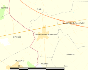
Chaufour-lès-Bonnières
- commune in Yvelines, France
- Country:
- Postal Code: 78270
- Coordinates: 49° 0' 58" N, 1° 29' 0" E
- GPS tracks (wikiloc): [Link]
- Area: 3.02 sq km
- Population: 456


Douains
- commune in Eure, France
- Country:
- Postal Code: 27120
- Coordinates: 49° 2' 25" N, 1° 25' 44" E
- GPS tracks (wikiloc): [Link]
- Area: 11.27 sq km
- Population: 506


Hécourt
- commune in Eure, France
- Country:
- Postal Code: 27120
- Coordinates: 48° 58' 42" N, 1° 25' 17" E
- GPS tracks (wikiloc): [Link]
- Area: 7.73 sq km
- Population: 347


Blaru
- commune in Yvelines, France
- Country:
- Postal Code: 78270
- Coordinates: 49° 2' 56" N, 1° 28' 42" E
- GPS tracks (wikiloc): [Link]
- Area: 14.84 sq km
- Population: 899