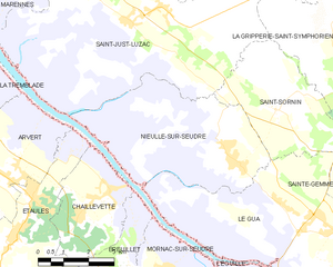
.jpg)
Chaillevette (Chaillevette)

- commune in Charente-Maritime, France
- Country:

- Postal Code: 17890
- Coordinates: 45° 43' 54" N, 1° 4' 10" E


- GPS tracks (wikiloc): [Link]
- Area: 10.03 sq km
- Population: 1531
- Web site: http://www.chaillevette.fr
- Wikipedia en: wiki(en)
- Wikipedia: wiki(fr)
- Wikidata storage: Wikidata: Q1147453
- Wikipedia Commons Category: [Link]
- Freebase ID: [/m/03mcgdy]
- GeoNames ID: Alt: [3027621]
- SIREN number: [211700794]
- BnF ID: [152489411]
- VIAF ID: Alt: [158603553]
- OSM relation ID: [121748]
- Library of Congress authority ID: Alt: [no2001059244]
- INSEE municipality code: 17079
Shares border with regions:


Étaules
- commune in Charente-Maritime, France
- Country:
- Postal Code: 17750
- Coordinates: 45° 43' 56" N, 1° 5' 52" E
- GPS tracks (wikiloc): [Link]
- Area: 11.55 sq km
- Population: 2379
- Web site: [Link]


Breuillet
- commune in Charente-Maritime, France
- Country:
- Postal Code: 17920
- Coordinates: 45° 41' 34" N, 1° 3' 6" E
- GPS tracks (wikiloc): [Link]
- Area: 19.99 sq km
- Population: 2777
- Web site: [Link]


Le Gua
- commune in Charente-Maritime, France
- Country:
- Postal Code: 17600
- Coordinates: 45° 43' 34" N, 0° 56' 37" E
- GPS tracks (wikiloc): [Link]
- Area: 36.09 sq km
- Population: 2070
- Web site: [Link]


Saint-Augustin
- commune in Charente-Maritime, France
- Country:
- Postal Code: 17570
- Coordinates: 45° 40' 41" N, 1° 5' 58" E
- GPS tracks (wikiloc): [Link]
- Area: 18.83 sq km
- Population: 1329
- Web site: [Link]

Nieulle-sur-Seudre
- commune in Charente-Maritime, France
- Country:
- Postal Code: 17600
- Coordinates: 45° 45' 1" N, 1° 0' 0" E
- GPS tracks (wikiloc): [Link]
- Area: 20.75 sq km
- Population: 1230