Charbonnières-les-Sapins (Charbonnières-les-Sapins)

- former commune in Doubs, France
 Hiking in Charbonnières-les-Sapins
Charbonnières-les-Sapins, located in the Jura region of France, offers a beautiful setting for hiking enthusiasts. The area is known for its lush forests, rolling hills, and picturesque landscapes, making it a great destination for outdoor activities.
Hiking Trails
-
Local Trails: There are several marked trails in and around Charbonnières-les-Sapins that cater to various skill levels. Trails often range from easy walks for families to more challenging hikes for experienced trekkers.
-
Scenic Views: As you hike, you can expect to enjoy scenic views of the Jura mountains, valleys, and possibly catch glimpses of local wildlife. The region's natural beauty is accentuated by changing seasons, offering a different experience year-round.
-
Nature Reserves: The area is close to nature reserves and parks, where you can explore diverse flora and fauna. The nearby massif provides opportunities for longer hikes that can take you through more rugged terrain.
Preparing for Your Hike
-
Gear: Ensure you have the right hiking gear, including sturdy boots, weather-appropriate clothing, a backpack with enough water, snacks, and possibly a map or a GPS device to help navigate the trails.
-
Weather: Check the local weather conditions before you head out, as they can change quickly. It's best to dress in layers.
-
Safety: Always let someone know your hiking plans and estimated return time, especially if you're venturing into less populated areas.
Expert Tips
-
Guided Tours: If you're new to the area or hiking in general, consider joining a guided tour. This can enhance your experience and provide you with insight into the local environment.
-
Local Attractions: In addition to hiking, take some time to explore the local culture and attractions. Charbonnières-les-Sapins has charming villages and local cuisine that can enrich your visit.
Best Times to Visit
The ideal hiking seasons in this region are typically spring (April to June) and fall (September to October), when temperatures are mild, and the scenery is breathtaking.
Whether you're a seasoned hiker or just looking to enjoy a leisurely stroll in nature, Charbonnières-les-Sapins is a fantastic area to explore. Enjoy your hike!
- Country:

- Postal Code: 25620
- Coordinates: 47° 8' 49" N, 6° 12' 54" E


- GPS tracks (wikiloc): [Link]
- Area: 9.1 sq km
- Population: 193
- Web site: http://www.charbonnieres-les-sapins.fr
- Wikipedia en: wiki(en)
- Wikipedia: wiki(fr)
- Wikidata storage: Wikidata: Q837432
- Wikipedia Commons Category: [Link]
- Freebase ID: [/m/03mgrxc]
- Freebase ID: [/m/03mgrxc]
- GeoNames ID: Alt: [6429707]
- GeoNames ID: Alt: [6429707]
- BnF ID: [15252349w]
- BnF ID: [15252349w]
- INSEE municipality code: 25123
- INSEE municipality code: 25123
Shares border with regions:

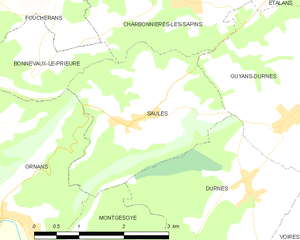
Saules
- commune in Doubs, France
Hiking in Saules
Saules is a charming commune in the Doubs department of the Bourgogne-Franche-Comté region in eastern France. It is surrounded by stunning natural landscapes, making it a wonderful destination for hiking enthusiasts....
- Country:
- Postal Code: 25580
- Coordinates: 47° 7' 24" N, 6° 11' 56" E
- GPS tracks (wikiloc): [Link]
- Area: 7.64 sq km
- Population: 225


L'Hôpital-du-Grosbois
- commune in Doubs, France
Hiking in L'Hôpital-du-Grosbois
L'Hôpital-du-Grosbois is a charming village located in the Doubs department of France, surrounded by beautiful landscapes ideal for hiking. Here are some details to help you make the most of your hiking experience in the area:...
- Country:
- Postal Code: 25620
- Coordinates: 47° 10' 19" N, 6° 12' 59" E
- GPS tracks (wikiloc): [Link]
- Area: 7.84 sq km
- Population: 586
- Web site: [Link]


Trépot
- commune in Doubs, France
Hiking in Trépot
Trépot is a small, picturesque village in the Jura region of France, known for its stunning natural landscapes and outdoor activities. While it may not be as famous as other hiking destinations, it offers a unique experience for those looking to explore the Jura mountains and its beautiful surroundings....
- Country:
- Postal Code: 25620
- Coordinates: 47° 9' 58" N, 6° 9' 0" E
- GPS tracks (wikiloc): [Link]
- Area: 14.5 sq km
- Population: 531