Charmes (Charmes)

- commune in Vosges, France
- Country:

- Postal Code: 88130
- Coordinates: 48° 22' 18" N, 6° 17' 33" E


- GPS tracks (wikiloc): [Link]
- Area: 23.49 sq km
- Population: 4695
- Web site: http://www.ville-charmes.fr
- Wikipedia en: wiki(en)
- Wikipedia: wiki(fr)
- Wikidata storage: Wikidata: Q206523
- Wikipedia Commons Category: [Link]
- Freebase ID: [/m/03qgwld]
- Freebase ID: [/m/03qgwld]
- GeoNames ID: Alt: [6455323]
- GeoNames ID: Alt: [6455323]
- SIREN number: [218800902]
- SIREN number: [218800902]
- BnF ID: [15279018w]
- BnF ID: [15279018w]
- Library of Congress authority ID: Alt: [n91095266]
- Library of Congress authority ID: Alt: [n91095266]
- INSEE municipality code: 88090
- INSEE municipality code: 88090
Shares border with regions:


Saint-Rémy-aux-Bois
- commune in Meurthe-et-Moselle, France
- Country:
- Postal Code: 54290
- Coordinates: 48° 24' 57" N, 6° 23' 36" E
- GPS tracks (wikiloc): [Link]
- Area: 9.76 sq km
- Population: 76


Brantigny
- commune in Vosges, France
- Country:
- Postal Code: 88130
- Coordinates: 48° 20' 33" N, 6° 16' 37" E
- GPS tracks (wikiloc): [Link]
- Area: 3.01 sq km
- Population: 208


Ubexy
- commune in Vosges, France
- Country:
- Postal Code: 88130
- Coordinates: 48° 20' 6" N, 6° 16' 22" E
- GPS tracks (wikiloc): [Link]
- Area: 5.01 sq km
- Population: 176


Essegney
- commune in Vosges, France
- Country:
- Postal Code: 88130
- Coordinates: 48° 22' 3" N, 6° 19' 0" E
- GPS tracks (wikiloc): [Link]
- Area: 8.41 sq km
- Population: 768


Chamagne
- commune in Vosges, France
- Country:
- Postal Code: 88130
- Coordinates: 48° 24' 30" N, 6° 16' 48" E
- GPS tracks (wikiloc): [Link]
- Area: 15.29 sq km
- Population: 460
- Web site: [Link]


Saint-Germain
- commune in Meurthe-et-Moselle, France
- Country:
- Postal Code: 54290
- Coordinates: 48° 25' 52" N, 6° 20' 20" E
- GPS tracks (wikiloc): [Link]
- Area: 7.68 sq km
- Population: 160


Loromontzey
- commune in Meurthe-et-Moselle, France
- Country:
- Postal Code: 54290
- Coordinates: 48° 26' 8" N, 6° 22' 39" E
- GPS tracks (wikiloc): [Link]
- Area: 7.68 sq km
- Population: 89


Socourt
- commune in Vosges, France
- Country:
- Postal Code: 88130
- Coordinates: 48° 23' 49" N, 6° 14' 57" E
- GPS tracks (wikiloc): [Link]
- Area: 3.85 sq km
- Population: 272
- Web site: [Link]

Florémont
- commune in Vosges, France
- Country:
- Postal Code: 88130
- Coordinates: 48° 22' 0" N, 6° 15' 17" E
- GPS tracks (wikiloc): [Link]
- Area: 8.09 sq km
- Population: 441

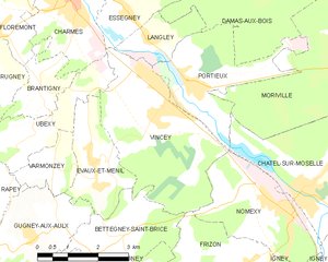
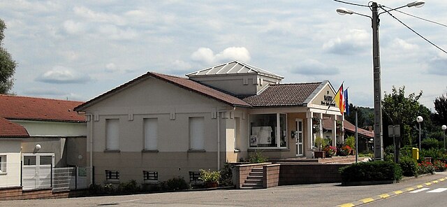
Vincey
- commune in Vosges, France
- Country:
- Postal Code: 88450
- Coordinates: 48° 20' 13" N, 6° 19' 43" E
- GPS tracks (wikiloc): [Link]
- Area: 12.81 sq km
- Population: 2209
- Web site: [Link]