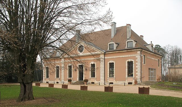
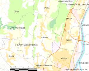
Charnay-lès-Mâcon (Charnay-lès-Mâcon)
- commune in Saône-et-Loire, France
- Country:

- Postal Code: 71850
- Coordinates: 46° 18' 33" N, 4° 47' 4" E


- GPS tracks (wikiloc): [Link]
- Area: 12.56 sq km
- Population: 7018
- Web site: http://www.charnay.com
- Wikipedia en: wiki(en)
- Wikipedia: wiki(fr)
- Wikidata storage: Wikidata: Q1423628
- Wikipedia Commons Category: [Link]
- Wikipedia Commons Maps Category: [Link]
- Freebase ID: [/m/02q__72]
- Freebase ID: [/m/02q__72]
- GeoNames ID: Alt: [6442184]
- GeoNames ID: Alt: [6442184]
- SIREN number: [217101054]
- SIREN number: [217101054]
- BnF ID: [152730789]
- BnF ID: [152730789]
- PACTOLS thesaurus ID: [pcrt4ct8PuGDi2]
- PACTOLS thesaurus ID: [pcrt4ct8PuGDi2]
- WOEID: [584724]
- WOEID: [584724]
- INSEE municipality code: 71105
- INSEE municipality code: 71105
Shares border with regions:


Chevagny-les-Chevrières
- commune in Saône-et-Loire, France
- Country:

- Postal Code: 71960
- Coordinates: 46° 19' 57" N, 4° 46' 21" E


- GPS tracks (wikiloc): [Link]
- AboveSeaLevel: 237 м m
- Area: 3.8 sq km
- Population: 597
- Web site: [Link]


Davayé
- commune in Saône-et-Loire, France
- Country:

- Postal Code: 71960
- Coordinates: 46° 18' 4" N, 4° 44' 42" E


- GPS tracks (wikiloc): [Link]
- Area: 4.17 sq km
- Population: 670
- Web site: [Link]


Prissé
- commune in Saône-et-Loire, France
- Country:

- Postal Code: 71960
- Coordinates: 46° 19' 17" N, 4° 44' 41" E


- GPS tracks (wikiloc): [Link]
- Area: 10.85 sq km
- Population: 2018
- Web site: [Link]


Mâcon
- commune in Saône-et-Loire, France
- Country:

- Postal Code: 71000
- Coordinates: 46° 18' 24" N, 4° 49' 55" E


- GPS tracks (wikiloc): [Link]
- AboveSeaLevel: 175 м m
- Area: 27.04 sq km
- Population: 33236
- Web site: [Link]


Hurigny
- commune in Saône-et-Loire, France
- Country:

- Postal Code: 71870
- Coordinates: 46° 20' 58" N, 4° 47' 46" E


- GPS tracks (wikiloc): [Link]
- Area: 9.2 sq km
- Population: 1964
- Web site: [Link]


Solutré-Pouilly
- commune in Saône-et-Loire, France
- Country:

- Postal Code: 71960
- Coordinates: 46° 17' 48" N, 4° 43' 30" E


- GPS tracks (wikiloc): [Link]
- Area: 6.16 sq km
- Population: 356
- Web site: [Link]


Fuissé
- commune in Saône-et-Loire, France
- Country:

- Postal Code: 71960
- Coordinates: 46° 16' 49" N, 4° 44' 36" E


- GPS tracks (wikiloc): [Link]
- Area: 4.86 sq km
- Population: 381
