Chasseguey (Chasseguey)

- former commune in Manche, France
- Country:

- Postal Code: 50520
- Coordinates: 48° 38' 29" N, 1° 3' 53" E


- GPS tracks (wikiloc): [Link]
- Area: 3.06 sq km
- Population: 94
- Wikipedia en: wiki(en)
- Wikipedia: wiki(fr)
- Wikidata storage: Wikidata: Q952857
- Wikipedia Commons Category: [Link]
- Freebase ID: [/m/03qcqsm]
- Freebase ID: [/m/03qcqsm]
- GeoNames ID: Alt: [6435371]
- GeoNames ID: Alt: [6435371]
- BnF ID: [15262102w]
- BnF ID: [15262102w]
- INSEE municipality code: 50125
- INSEE municipality code: 50125
Shares border with regions:


Reffuveille
- commune in Manche, France
- Country:
- Postal Code: 50520
- Coordinates: 48° 40' 6" N, 1° 6' 55" E
- GPS tracks (wikiloc): [Link]
- Area: 23.34 sq km
- Population: 501

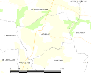
La Bazoge
- former commune in Manche, France
- Country:
- Postal Code: 50520
- Coordinates: 48° 38' 45" N, 1° 1' 44" E
- GPS tracks (wikiloc): [Link]
- Area: 5.8 sq km
- Population: 151

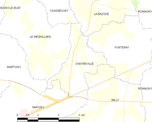
Chèvreville
- former commune in Manche, France
- Country:
- Postal Code: 50600
- Coordinates: 48° 36' 51" N, 1° 2' 50" E
- GPS tracks (wikiloc): [Link]
- Area: 4.45 sq km
- Population: 214


Le Mesnil-Rainfray
- former commune in Manche, France
- Country:
- Postal Code: 50520
- Coordinates: 48° 40' 1" N, 1° 3' 23" E
- GPS tracks (wikiloc): [Link]
- Area: 11.47 sq km
- Population: 212

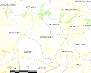
Le Mesnillard
- commune in Manche, France
- Country:
- Postal Code: 50600
- Coordinates: 48° 37' 38" N, 1° 4' 22" E
- GPS tracks (wikiloc): [Link]
- Area: 9.75 sq km
- Population: 282