Chermignac (Chermignac)

- commune in Charente-Maritime, France
- Country:

- Postal Code: 17460
- Coordinates: 45° 41' 0" N, 0° 40' 18" E


- GPS tracks (wikiloc): [Link]
- Area: 13.43 sq km
- Population: 1254
- Web site: http://www.chermignac.fr
- Wikipedia en: wiki(en)
- Wikipedia: wiki(fr)
- Wikidata storage: Wikidata: Q665849
- Wikipedia Commons Category: [Link]
- Freebase ID: [/m/03mcgls]
- GeoNames ID: Alt: [3025439]
- SIREN number: [211701024]
- BnF ID: [15248964p]
- Trismegistos Geo ID: [22948]
- INSEE municipality code: 17102
Shares border with regions:


Pessines
- commune in Charente-Maritime, France
- Country:
- Postal Code: 17810
- Coordinates: 45° 43' 44" N, 0° 43' 5" E
- GPS tracks (wikiloc): [Link]
- Area: 9.05 sq km
- Population: 748

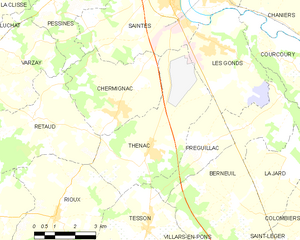
Thénac
- commune in Charente-Maritime, France
- Country:
- Postal Code: 17460
- Coordinates: 45° 40' 4" N, 0° 39' 15" E
- GPS tracks (wikiloc): [Link]
- Area: 19.17 sq km
- Population: 1667
- Web site: [Link]
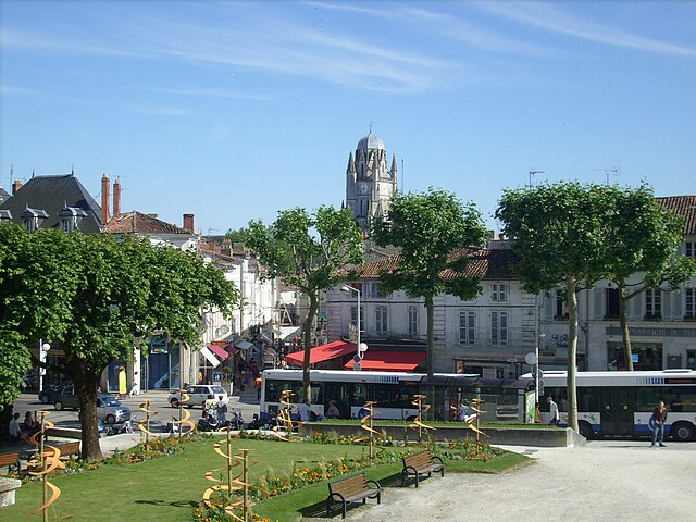

Saintes
- commune in Charente-Maritime, France
- Country:
- Postal Code: 17100
- Coordinates: 45° 44' 43" N, 0° 38' 4" E
- GPS tracks (wikiloc): [Link]
- Area: 45.55 sq km
- Population: 25288
- Web site: [Link]


Rétaud
- commune in Charente-Maritime, France
- Country:
- Postal Code: 17460
- Coordinates: 45° 40' 40" N, 0° 43' 38" E
- GPS tracks (wikiloc): [Link]
- Area: 19.92 sq km
- Population: 1078