Chevroux (Chevroux)
- commune in Ain, France
- Country:

- Postal Code: 01190
- Coordinates: 46° 22' 50" N, 4° 56' 55" E


- GPS tracks (wikiloc): [Link]
- Area: 17.2 sq km
- Population: 964
- Web site: http://www.chevroux.fr
- Wikipedia en: wiki(en)
- Wikipedia: wiki(fr)
- Wikidata storage: Wikidata: Q579448
- Wikipedia Commons Category: [Link]
- Wikipedia Commons Maps Category: [Link]
- Freebase ID: [/m/03cz0m1]
- GeoNames ID: Alt: [6424464]
- SIREN number: [210101028]
- INSEE municipality code: 01102
Shares border with regions:

Ozan
- commune in Ain, France
- Country:
- Postal Code: 01190
- Coordinates: 46° 23' 30" N, 4° 54' 56" E
- GPS tracks (wikiloc): [Link]
- Area: 6.6 sq km
- Population: 668


Bâgé-la-Ville
- former commune in Ain, France
- Country:
- Postal Code: 01380
- Coordinates: 46° 18' 56" N, 4° 56' 43" E
- GPS tracks (wikiloc): [Link]
- Area: 39.68 sq km
- Population: 3177
- Web site: [Link]

Manziat
- commune in Ain, France
- Country:
- Postal Code: 01570
- Coordinates: 46° 21' 34" N, 4° 54' 28" E
- GPS tracks (wikiloc): [Link]
- Area: 12.63 sq km
- Population: 1988
- Web site: [Link]


Dommartin
- former commune in Ain, France
- Country:
- Postal Code: 01380
- Coordinates: 46° 20' 15" N, 4° 59' 24" E
- GPS tracks (wikiloc): [Link]
- Area: 17.19 sq km
- Population: 886
- Web site: [Link]

Boz
- commune in Ain, France
- Country:
- Postal Code: 01190
- Coordinates: 46° 24' 25" N, 4° 54' 34" E
- GPS tracks (wikiloc): [Link]
- Area: 7.31 sq km
- Population: 516
- Web site: [Link]

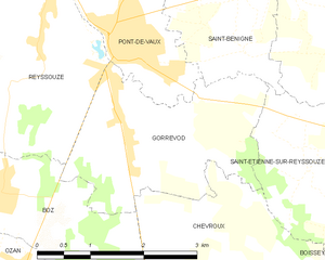
Gorrevod
- commune in Ain, France
- Country:
- Postal Code: 01190
- Coordinates: 46° 24' 57" N, 4° 56' 28" E
- GPS tracks (wikiloc): [Link]
- Area: 6.88 sq km
- Population: 854

Boissey
- commune in Ain, France
- Country:
- Postal Code: 01190
- Coordinates: 46° 22' 54" N, 4° 59' 46" E
- GPS tracks (wikiloc): [Link]
- Area: 9.05 sq km
- Population: 331

Saint-Étienne-sur-Reyssouze
- commune in Ain, France
- Country:
- Postal Code: 01190
- Coordinates: 46° 24' 47" N, 5° 0' 3" E
- GPS tracks (wikiloc): [Link]
- Area: 13.82 sq km
- Population: 566