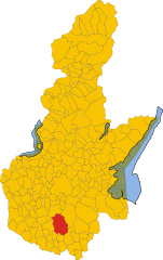
Cigole (Cigole)
- Italian comune
Cigole, a small town in the Lombardy region of Italy, offers a wonderful opportunity for hiking enthusiasts. Nestled in the Oglio Valley, this area is surrounded by beautiful landscapes, including rolling hills, lush forests, and scenic views of the countryside.
Hiking Trails
-
Monte Guglielmo: One of the most popular hiking destinations near Cigole is Monte Guglielmo. Trails vary in difficulty, with some routes suitable for beginners and others challenging experienced hikers. The summit provides panoramic views of Lake Iseo and the surrounding region.
-
Valle dell'Oglio: Walking along the Oglio River offers a gentler hike with beautiful natural scenery. The trails along the river are ideal for families and those looking for a more leisurely experience.
-
Local Trails: In and around Cigole, there are many local paths that connect to the network of trails in the countryside. These can lead you through charming villages, vineyards, and historic sites.
What to Expect
- Scenic Beauty: Expect stunning views of the surrounding valleys, forests, and perhaps even local wildlife. The area is characterized by its rich biodiversity and beautiful natural landscapes.
- Cultural Stops: Many hikes can lead you to nearby small towns and historical sites, allowing for a cultural experience alongside your outdoor adventure.
- Weather Considerations: The weather can vary greatly depending on the season. It's important to check the forecast and dress accordingly. Spring and autumn are usually the best times for hiking in this region.
Essential Tips
- Gear: Wear appropriate footwear and bring enough water, snacks, and a map or GPS device.
- Local Guidance: Consider hiring a local guide if you're unfamiliar with the area or wish to explore off the beaten track.
- Respect Nature: Follow Leave No Trace principles to preserve the natural beauty of the trails for future hikers.
Overall, hiking in and around Cigole can be a rewarding experience for outdoor enthusiasts, providing a blend of adventure, natural beauty, and cultural exploration.
- Country:

- Postal Code: 25020
- Local Dialing Code: 030
- Licence Plate Code: BS
- Coordinates: 45° 18' 0" N, 10° 11' 0" E


- GPS tracks (wikiloc): [Link]
- AboveSeaLevel: 57 м m
- Area: 9.93 sq km
- Population: 1544
- Web site: http://www.comune.cigole.brescia.it/
- Wikipedia en: wiki(en)
- Wikipedia: wiki(it)
- Wikidata storage: Wikidata: Q104007
- Wikipedia Commons Category: [Link]
- Freebase ID: [/m/041w4v]
- GeoNames ID: Alt: [6540184]
- VIAF ID: Alt: [148933065]
- OSM relation ID: [44659]
- TGN ID: [7048046]
- ISTAT ID: 017053
- Italian cadastre code: C685
Shares border with regions:

Leno
- comune of Italy
Leno, a small town in Lombardy, Italy, is situated in a picturesque region known for its beautiful countryside and proximity to larger nature areas. While Leno itself may not offer extensive hiking trails directly within the town, it serves as a gateway to several scenic hiking opportunities in the surrounding areas....
- Country:

- Postal Code: 25024
- Local Dialing Code: 030
- Licence Plate Code: BS
- Coordinates: 45° 22' 13" N, 10° 13' 0" E


- GPS tracks (wikiloc): [Link]
- AboveSeaLevel: 66 м m
- Area: 58.45 sq km
- Population: 14322
- Web site: [Link]
Manerbio
- Italian comune
Manerbio is a charming town in the Lombardy region of Italy, but it's not particularly known for hiking in the same way that more mountainous areas are. However, if you're looking to enjoy the natural scenery and some outdoor activities in and around Manerbio, there are still options available....
- Country:

- Postal Code: 25025
- Local Dialing Code: 030
- Licence Plate Code: BS
- Coordinates: 45° 22' 0" N, 10° 8' 0" E


- GPS tracks (wikiloc): [Link]
- AboveSeaLevel: 64 м m
- Area: 27.88 sq km
- Population: 13109
- Web site: [Link]
Milzano
- Italian comune
Milzano is a small town located in the Lombardy region of Italy, known for its beautiful landscapes and proximity to the surrounding countryside. While it may not be as widely recognized as a hiking destination compared to larger national parks or mountain ranges, it offers several opportunities for outdoor enthusiasts. Here’s a guide on hiking in and around Milzano:...
- Country:

- Postal Code: 25020
- Local Dialing Code: 030
- Licence Plate Code: BS
- Coordinates: 45° 16' 29" N, 10° 11' 59" E


- GPS tracks (wikiloc): [Link]
- AboveSeaLevel: 49 м m
- Area: 8.49 sq km
- Population: 1764
- Web site: [Link]
Pavone del Mella
- Italian comune
Pavone del Mella is a charming municipality located in the Lombardy region of Italy, in the province of Brescia. While it may not be as well-known for hiking as some of the more prominent areas in Italy, there are still opportunities for hiking and enjoying the beautiful natural surroundings....
- Country:

- Postal Code: 25020
- Local Dialing Code: 030
- Licence Plate Code: BS
- Coordinates: 45° 18' 3" N, 10° 12' 31" E


- GPS tracks (wikiloc): [Link]
- AboveSeaLevel: 54 м m
- Area: 11.61 sq km
- Population: 2801
- Web site: [Link]
San Gervasio Bresciano
- Italian comune
 Hiking in San Gervasio Bresciano
San Gervasio Bresciano is a charming town located in the province of Brescia in northern Italy, surrounded by beautiful natural landscapes that are ideal for hiking enthusiasts. Here are some details about hiking in and around San Gervasio Bresciano:...
- Country:

- Postal Code: 25020
- Local Dialing Code: 030
- Licence Plate Code: BS
- Coordinates: 45° 18' 26" N, 10° 8' 58" E


- GPS tracks (wikiloc): [Link]
- AboveSeaLevel: 57 м m
- Area: 10.5 sq km
- Population: 2571
- Web site: [Link]
