Cocumont (Cocumont)

- commune in Lot-et-Garonne, France
- Country:

- Postal Code: 47250
- Coordinates: 44° 26' 55" N, 0° 1' 34" E


- GPS tracks (wikiloc): [Link]
- Area: 25.44 sq km
- Population: 1110
- Web site: http://www.cocumont-aquitaine.fr
- Wikipedia en: wiki(en)
- Wikipedia: wiki(fr)
- Wikidata storage: Wikidata: Q626943
- Wikipedia Commons Category: [Link]
- Freebase ID: [/m/03qm142]
- GeoNames ID: Alt: [3024468]
- SIREN number: [214700684]
- BnF ID: [152611499]
- archINFORM location ID: [6876]
- INSEE municipality code: 47068
Shares border with regions:

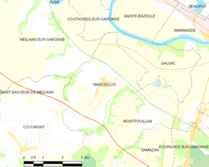
Marcellus
- commune in Lot-et-Garonne, France
- Country:
- Postal Code: 47200
- Coordinates: 44° 28' 51" N, 0° 4' 41" E
- GPS tracks (wikiloc): [Link]
- Area: 11.77 sq km
- Population: 852
- Web site: [Link]


Montpouillan
- commune in Lot-et-Garonne, France
- Country:
- Postal Code: 47200
- Coordinates: 44° 28' 4" N, 0° 6' 18" E
- GPS tracks (wikiloc): [Link]
- Area: 12.07 sq km
- Population: 761
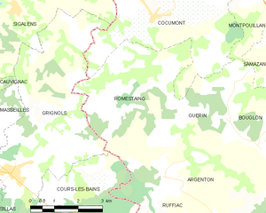
Romestaing
- commune in Lot-et-Garonne, France
- Country:
- Postal Code: 47250
- Coordinates: 44° 25' 1" N, 0° 0' 11" E
- GPS tracks (wikiloc): [Link]
- AboveSeaLevel: 187 м m
- Area: 15.46 sq km
- Population: 168
- Web site: [Link]


Guérin
- commune in Lot-et-Garonne, France
- Country:
- Postal Code: 47250
- Coordinates: 44° 24' 36" N, 0° 4' 8" E
- GPS tracks (wikiloc): [Link]
- Area: 10.43 sq km
- Population: 252


Sigalens
- commune in Gironde, France
- Country:
- Postal Code: 33690
- Coordinates: 44° 26' 57" N, 0° 2' 43" E
- GPS tracks (wikiloc): [Link]
- Area: 18.33 sq km
- Population: 379
- Web site: [Link]


Saint-Sauveur-de-Meilhan
- commune in Lot-et-Garonne, France
- Country:
- Postal Code: 47180
- Coordinates: 44° 28' 54" N, 0° 0' 8" E
- GPS tracks (wikiloc): [Link]
- Area: 7.03 sq km
- Population: 333
- Web site: [Link]


Meilhan-sur-Garonne
- commune in Lot-et-Garonne, France
- Country:
- Postal Code: 47180
- Coordinates: 44° 31' 17" N, 0° 2' 1" E
- GPS tracks (wikiloc): [Link]
- Area: 28.62 sq km
- Population: 1340
- Web site: [Link]


Grignols
- commune in Gironde, France
- Country:
- Postal Code: 33690
- Coordinates: 44° 23' 16" N, 0° 2' 38" E
- GPS tracks (wikiloc): [Link]
- Area: 22.7 sq km
- Population: 1173
- Web site: [Link]