Codigoro (Codigoro)
.svg)
- Italian comune
 Hiking in Codigoro
Codigoro is a small town located in the province of Ferrara in the Emilia-Romagna region of northern Italy. While it may not be as well-known as some other Italian hiking destinations, it offers some unique landscapes and opportunities for exploration, particularly for those interested in nature and rural environments.
Hiking Opportunities in Codigoro:
-
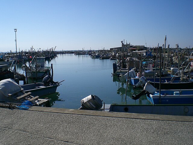
Po Delta Park: Codigoro is close to the Po Delta Regional Park (Parco del Delta del Po), which is a UNESCO World Heritage site. The park features a unique mix of wetlands, lagoons, and river deltas, offering excellent hiking trails. You can explore diverse ecosystems, birdwatching sites, and picturesque countryside.
-
Nature Trails: Within the Po Delta, there are many marked hiking trails that vary in difficulty. These trails often take you through scenic areas where you can observe local flora and fauna, including migratory birds, which makes this a great spot for birdwatchers.
-
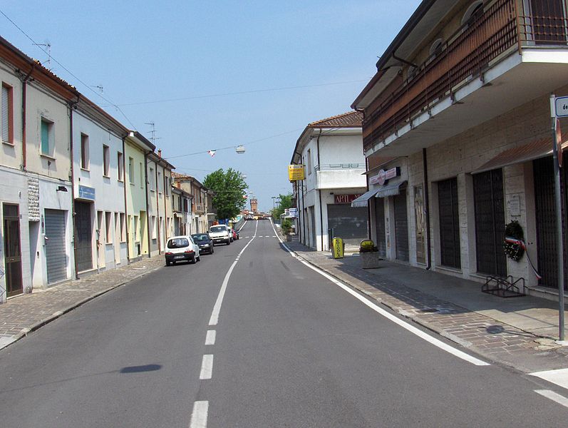
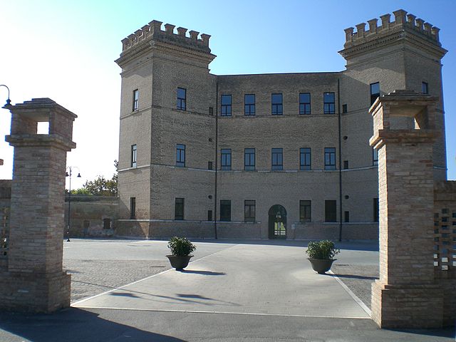
Local Villages: Hiking around Codigoro can also lead you to exploring quaint nearby villages and historical sites. You can find charming local architecture, churches, and even traditional farms, which makes for an enriching cultural experience.
-
Seasonal Hiking: The ideal time for hiking in Codigoro and the surrounding delta region is spring and early autumn, when the weather is mild and the landscapes are vibrant. Summer can be hot, while winter may present challenges due to mud and cold.
Tips for Hiking in Codigoro:
- Stay Hydrated: Carry enough water, especially on warmer days.
- Footwear: Wear sturdy hiking boots or shoes, suitable for varied terrain.
- Map and Navigation: Although many trails are marked, bringing a map or a GPS device can be helpful.
- Respect the Environment: Follow Leave No Trace principles to preserve the natural beauty of the area.
- Insect Protection: In the wetlands, be mindful of mosquitoes, especially in warmer months. Use insect repellent as needed.
In summary, while Codigoro may not be a major hiking hub, its proximity to the Po Delta and the surrounding natural beauty make it a lovely destination for those seeking outdoor adventure and tranquility in nature.
- Country:

- Postal Code: 44021
- Local Dialing Code: 0533
- Licence Plate Code: FE
- Coordinates: 44° 50' 0" N, 12° 7' 0" E


- GPS tracks (wikiloc): [Link]
- AboveSeaLevel: 4 м m
- Area: 170.01 sq km
- Population: 11740
- Web site: http://www.comune.codigoro.fe.it/
- Wikipedia en: wiki(en)
- Wikipedia: wiki(it)
- Wikidata storage: Wikidata: Q95095
- Wikipedia Commons Gallery: [Link]
- Wikipedia Commons Category: [Link]
- Freebase ID: [/m/0gkj12]
- GeoNames ID: Alt: [6538479]
- VIAF ID: Alt: [249403924]
- OSM relation ID: [43655]
- GND ID: Alt: [4638107-7]
- Quora topic ID: [Codigoro]
- UN/LOCODE: [ITIFC]
- ISTAT ID: 038005
- Italian cadastre code: C814
Shares border with regions:


Comacchio
- Italian comune
Hiking in Comacchio
Comacchio, located in the Emilia-Romagna region of Italy, is renowned for its picturesque canals and charming bridges, giving it the nickname "Little Venice". While it's not a traditional hiking destination, there are several ways to enjoy the natural beauty and unique landscapes of the surrounding area....
- Country:
- Postal Code: 44022
- Local Dialing Code: 0533
- Licence Plate Code: FE
- Coordinates: 44° 42' 0" N, 12° 11' 0" E
- GPS tracks (wikiloc): [Link]
- AboveSeaLevel: 1 м m
- Area: 284.13 sq km
- Population: 22188
- Web site: [Link]

Goro
- Italian comune
Hiking in Goro
Goro, located in the Emilia-Romagna region of Italy, offers a unique hiking experience primarily due to its proximity to the Po Delta, a UNESCO Biosphere Reserve. This area is characterized by a mix of wetlands, lagoons, and rich biodiversity, making it an ideal spot for nature lovers and outdoor enthusiasts....
- Country:
- Postal Code: 44020
- Local Dialing Code: 0533
- Licence Plate Code: FE
- Coordinates: 44° 51' 6" N, 12° 17' 45" E
- GPS tracks (wikiloc): [Link]
- AboveSeaLevel: 1 м m
- Area: 33.18 sq km
- Population: 3742
- Web site: [Link]


Jolanda di Savoia
- Italian comune
Hiking in Jolanda di Savoia
Jolanda di Savoia is a small municipality located in the Emilia-Romagna region of Italy, known for its picturesque landscapes and agricultural surroundings. While it may not be as widely recognized for hiking as some of the more mountainous regions of Italy, there are still opportunities for outdoor enthusiasts in and around the area....
- Country:
- Postal Code: 44037
- Local Dialing Code: 0532
- Licence Plate Code: FE
- Coordinates: 44° 53' 0" N, 11° 59' 0" E
- GPS tracks (wikiloc): [Link]
- AboveSeaLevel: 1 м m
- Area: 108.03 sq km
- Population: 2838
- Web site: [Link]

Lagosanto
- Italian comune
Hiking in Lagosanto
Lagosanto is a charming destination in the Emilia-Romagna region of Italy, situated near the Po River Delta. While it may not be as famous as some other hiking destinations in Italy, it offers unique opportunities for outdoor enthusiasts who appreciate nature, wildlife, and serene landscapes. Here are some key points to consider when hiking in and around Lagosanto:...
- Country:
- Postal Code: 44023
- Local Dialing Code: 0533
- Licence Plate Code: FE
- Coordinates: 44° 46' 0" N, 12° 8' 0" E
- GPS tracks (wikiloc): [Link]
- AboveSeaLevel: 2 м m
- Area: 34.44 sq km
- Population: 4844
- Web site: [Link]

Mesola
- Italian comune
Hiking in Mesola
Mesola, located in the Emilia-Romagna region of Italy, is known for its stunning natural landscapes, rich history, and proximity to the Po Delta. Here are some key aspects to consider when planning a hiking trip in the Mesola area:...
- Country:
- Postal Code: 44026
- Local Dialing Code: 0533
- Licence Plate Code: FE
- Coordinates: 44° 55' 14" N, 12° 13' 48" E
- GPS tracks (wikiloc): [Link]
- AboveSeaLevel: 1 м m
- Area: 84.31 sq km
- Population: 6778
- Web site: [Link]