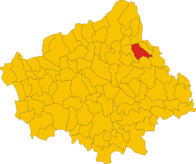
Codogné (Codogné)
.svg)
- Italian comune
 Hiking in Codogné
Codogné, a charming town located in the Veneto region of Italy, is surrounded by picturesque landscapes, making it an enjoyable destination for hiking enthusiasts. While it may not be as widely recognized for hiking as some of the more mountainous areas of Italy, Codogné offers various trails that lead through the scenic countryside, vineyards, and woodlands.
Here are some highlights and tips for hiking in and around Codogné:
Scenic Trails
-
Countryside Paths: The rolling hills and farmland surrounding Codogné provide a network of trails that are perfect for leisurely hikes. You can enjoy views of vineyards, orchards, and traditional Veneto architecture.
-
Villages Connection: Some trails connect to nearby villages, allowing hikers to explore local culture and perhaps stop for a meal at a quaint trattoria.
-
Natural Parks: While Codogné itself is small, it is located within reasonable distance from natural parks and protected areas that offer more extensive hiking opportunities. Consider taking day trips to nearby parks in the Treviso area.
Tips for Hiking in Codogné
-
Trail Maps: Always grab a local hiking map or use a reliable hiking app. The trails can vary in difficulty, so understanding the terrain is essential.
-
Weather Considerations: The weather in this region can change rapidly. Dress in layers and check the forecast before setting out.
-
Local Guide: If you're unfamiliar with the area or want to learn more about the local flora and fauna, consider hiring a local guide.
-
Respect Nature: As with any outdoor activity, ensure you follow Leave No Trace principles. Stay on marked trails, avoid disturbing wildlife, and clean up after yourself.
-
Local Amenities: Codogné has basic amenities for hikers, such as cafes for refreshments, but it's always good to carry water and snacks.
Conclusion
Hiking in Codogné offers a unique blend of nature and culture. Whether you're looking for a casual walk through vineyards or a more challenging trek in nearby parks, Codogné and its surroundings can provide a satisfying hiking experience. Enjoy your adventure, and don’t forget to take in the beautiful Veneto landscape!
- Country:

- Postal Code: 31013
- Local Dialing Code: 0438
- Licence Plate Code: TV
- Coordinates: 45° 52' 0" N, 12° 26' 0" E


- GPS tracks (wikiloc): [Link]
- AboveSeaLevel: 23 м m
- Area: 21.75 sq km
- Population: 5339
- Web site: http://www.comune.codogne.tv.it/
- Wikipedia en: wiki(en)
- Wikipedia: wiki(it)
- Wikidata storage: Wikidata: Q46307
- Wikipedia Commons Category: [Link]
- Freebase ID: [/m/0gk2mj]
- GeoNames ID: Alt: [6536641]
- VIAF ID: Alt: [248751379]
- OSM relation ID: [46351]
- UN/LOCODE: [ITRVB]
- ISTAT ID: 026019
- Italian cadastre code: C815
Shares border with regions:


San Fior
- Italian comune
Hiking in San Fior
San Fior, located in the Veneto region of Italy, is not as widely recognized as some other hiking destinations, but it offers picturesque landscapes and a taste of the beautiful Italian countryside. Here are some key points about hiking in the area:...
- Country:
- Postal Code: 31020
- Local Dialing Code: 0438
- Licence Plate Code: TV
- Coordinates: 45° 55' 20" N, 12° 21' 41" E
- GPS tracks (wikiloc): [Link]
- AboveSeaLevel: 57 м m
- Area: 17.82 sq km
- Population: 6958
- Web site: [Link]

Godega di Sant'Urbano
- Italian comune
Hiking in Godega di Sant'Urbano
Godega di Sant'Urbano, located in the Veneto region of Italy, is a charming area that offers a range of outdoor activities, including hiking. While it's primarily known for its agricultural landscapes and proximity to the scenic foothills of the Alps, it also provides opportunities for those looking to explore nature on foot....
- Country:
- Postal Code: 31010
- Local Dialing Code: 0438
- Licence Plate Code: TV
- Coordinates: 45° 55' 43" N, 12° 23' 49" E
- GPS tracks (wikiloc): [Link]
- AboveSeaLevel: 52 м m
- Area: 24.34 sq km
- Population: 6034
- Web site: [Link]


Vazzola
- Italian comune
Hiking in Vazzola
Vazzola, located in the region of Veneto, Italy, is surrounded by beautiful landscapes that are great for hiking. While it may not be as well-known as other Italian hiking destinations, it offers opportunities to explore the natural beauty of the area, including vineyards, hills, and rural scenery....
- Country:
- Postal Code: 31028
- Local Dialing Code: 0438
- Licence Plate Code: TV
- Coordinates: 45° 50' 0" N, 12° 23' 0" E
- GPS tracks (wikiloc): [Link]
- AboveSeaLevel: 22 м m
- Area: 26.16 sq km
- Population: 6972
- Web site: [Link]
Fontanelle
- Italian comune
Hiking in Fontanelle
Fontanelle, a charming area in the Veneto region of Italy, offers a variety of hiking opportunities that showcase the region's natural beauty, diverse landscapes, and rich cultural heritage. Here are some key points to consider for hiking in Fontanelle:...
- Country:
- Postal Code: 31043
- Local Dialing Code: 0422
- Licence Plate Code: TV
- Coordinates: 45° 50' 0" N, 12° 28' 0" E
- GPS tracks (wikiloc): [Link]
- AboveSeaLevel: 18 м m
- Area: 35.35 sq km
- Population: 5744
- Web site: [Link]


San Vendemiano
- Italian comune
Hiking in San Vendemiano
San Vendemiano is a charming town located in the Treviso province of the Veneto region in Italy. It offers a variety of hiking opportunities, thanks to its picturesque landscapes, rolling hills, and proximity to the Prosecco wine region. Here are some highlights for hiking in and around San Vendemiano:...
- Country:
- Postal Code: 31020
- Local Dialing Code: 0438
- Licence Plate Code: TV
- Coordinates: 45° 53' 29" N, 12° 20' 20" E
- GPS tracks (wikiloc): [Link]
- AboveSeaLevel: 46 м m
- Area: 18 sq km
- Population: 8776
- Web site: [Link]


Mareno di Piave
- Italian comune
Hiking in Mareno di Piave
Mareno di Piave is a small town located in the Veneto region of northern Italy. While it's not as well-known as larger cities for hiking, it is surrounded by beautiful landscapes and offers opportunities for outdoor activities. Here’s some information on hiking in and around Mareno di Piave:...
- Country:
- Postal Code: 31010
- Local Dialing Code: 0438
- Licence Plate Code: TV
- Coordinates: 45° 50' 27" N, 12° 21' 7" E
- GPS tracks (wikiloc): [Link]
- AboveSeaLevel: 36 м m
- Area: 27.77 sq km
- Population: 9613
- Web site: [Link]


Gaiarine
- Italian comune
Hiking in Gaiarine
Gaiarine, located in the province of Treviso in the Veneto region of Italy, is not as widely recognized for hiking as some of the more famous destinations in the Alps or Dolomites, but it can still offer some pleasant outdoor experiences....
- Country:
- Postal Code: 31018
- Local Dialing Code: 0434
- Licence Plate Code: TV
- Coordinates: 45° 53' 0" N, 12° 29' 0" E
- GPS tracks (wikiloc): [Link]
- AboveSeaLevel: 20 м m
- Area: 28.78 sq km
- Population: 6070
- Web site: [Link]