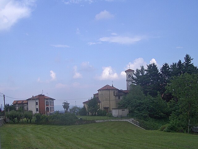
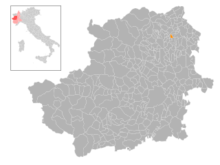
Colleretto Giacosa (Colleretto Giacosa)
- Municipality in Italy.
Colleretto Giacosa is a charming village in the Piedmont region of Italy, nestled in the Susa Valley and surrounded by the beautiful foothills of the Alps. The area offers fantastic hiking opportunities for both beginners and experienced trekkers.
Hiking Trails
-
Val Grande Nature Reserve: This nearby reserve features a variety of trails that allow you to explore rich flora and fauna, dramatic landscapes, and panoramic views of the Alps. Trails range from easy to moderate, making it suitable for all hikers.
-
Monte Biano: A popular hike in the area that offers stunning views from the summit. The trail is moderately challenging and rewards climbers with sweeping vistas of the surrounding valleys and mountains.
-
Colle del Lys: This area provides an array of hiking paths suitable for different skill levels. The trails can lead you through lush forests and meadows, and you may encounter wildlife along the way.
Tips for Hiking in Colleretto Giacosa
- Weather: Check the weather conditions before setting out, as mountain weather can change rapidly.
- Proper Gear: Wear sturdy hiking boots and consider dressing in layers, as temperatures can vary with elevation.
- Navigation: Bring a map or GPS device; some trails may not be well marked.
- Water & Snacks: Carry enough water and high-energy snacks to keep you energized during your hike.
- Local Regulations: Be aware of any local regulations regarding outdoor activities, especially in protected areas.
Seasonality
The best time for hiking in Colleretto Giacosa is typically late spring to early autumn (May to September) when the weather is milder, and trails are more accessible. However, winter hiking is also popular, but it requires appropriate gear and skills for navigating snow-covered trails.
Whether you're looking to enjoy a leisurely stroll or a more challenging trek, Colleretto Giacosa offers a beautiful backdrop for your outdoor adventures.
- Country:

- Postal Code: 10010
- Local Dialing Code: 0125
- Licence Plate Code: TO
- Coordinates: 45° 26' 0" N, 7° 47' 0" E


- GPS tracks (wikiloc): [Link]
- AboveSeaLevel: 280 м m
- Area: 4.59 sq km
- Population: 579
- Web site: http://www.comune.collerettogiacosa.to.it
- Wikipedia en: wiki(en)
- Wikipedia: wiki(it)
- Wikidata storage: Wikidata: Q9315
- Wikipedia Commons Category: [Link]
- Freebase ID: [/m/0g6vrb]
- GeoNames ID: Alt: [6543256]
- OSM relation ID: [44960]
- MusicBrainz area ID: [c03c6518-83f2-4111-b871-a04374ff9ef8]
- ISTAT ID: 001092
- Italian cadastre code: C868
Shares border with regions:
Samone
- comune in the Province of Turin in the Italian region Piedmont
Hiking in Samone, a quaint village in the Piedmont region of northern Italy, offers an enchanting experience for outdoor enthusiasts. Known for its stunning landscapes, Samone provides access to a variety of hiking trails that cater to different skill levels....
- Country:

- Postal Code: 10010
- Local Dialing Code: 0125
- Licence Plate Code: TO
- Coordinates: 45° 26' 0" N, 7° 50' 0" E


- GPS tracks (wikiloc): [Link]
- AboveSeaLevel: 250 м m
- Area: 2.43 sq km
- Population: 1585
- Web site: [Link]


San Martino Canavese
- Italian comune
 Hiking in San Martino Canavese
San Martino Canavese is a charming village located in the Canavese region of Piedmont, Italy. It offers a variety of hiking opportunities that cater to different skill levels and provide stunning views of the surrounding landscape, including the Alps and lush valleys....
- Country:

- Postal Code: 10010
- Local Dialing Code: 0125
- Licence Plate Code: TO
- Coordinates: 45° 24' 0" N, 7° 49' 0" E


- GPS tracks (wikiloc): [Link]
- AboveSeaLevel: 385 м m
- Area: 9.79 sq km
- Population: 826
- Web site: [Link]


Loranzè
- Italian comune
Loranzè is a beautiful destination for hikers, located in the Piedmont region of Italy. It offers a range of hiking opportunities through stunning landscapes featuring mountains, forests, and scenic views. Here are some highlights and tips for hiking in Loranzè:...
- Country:

- Postal Code: 10010
- Local Dialing Code: 0125
- Licence Plate Code: TO
- Coordinates: 45° 26' 0" N, 7° 49' 0" E


- GPS tracks (wikiloc): [Link]
- AboveSeaLevel: 243 м m
- Area: 4.19 sq km
- Population: 1170
- Web site: [Link]


Parella
- Italian comune
Parella, located in the region of Piedmont in Italy, offers a beautiful backdrop for hiking enthusiasts. The area is part of the larger Canavese region, known for its stunning landscapes, rolling hills, and picturesque views of the surrounding mountains, including the Alps....
- Country:

- Postal Code: 10010
- Local Dialing Code: 0125
- Licence Plate Code: TO
- Coordinates: 45° 26' 0" N, 7° 47' 0" E


- GPS tracks (wikiloc): [Link]
- AboveSeaLevel: 330 м m
- Area: 200 sq km
- Population: 438
- Web site: [Link]


Pavone Canavese
- Italian comune
Pavone Canavese is a charming village located in the Piedmont region of northern Italy, surrounded by beautiful landscapes and rich natural diversity, making it a great destination for hiking enthusiasts. Here are some highlights when considering hiking in and around Pavone Canavese:...
- Country:

- Postal Code: 10018
- Local Dialing Code: 0125
- Licence Plate Code: TO
- Coordinates: 45° 27' 0" N, 7° 51' 0" E


- GPS tracks (wikiloc): [Link]
- AboveSeaLevel: 262 м m
- Area: 11.54 sq km
- Population: 3861
- Web site: [Link]
