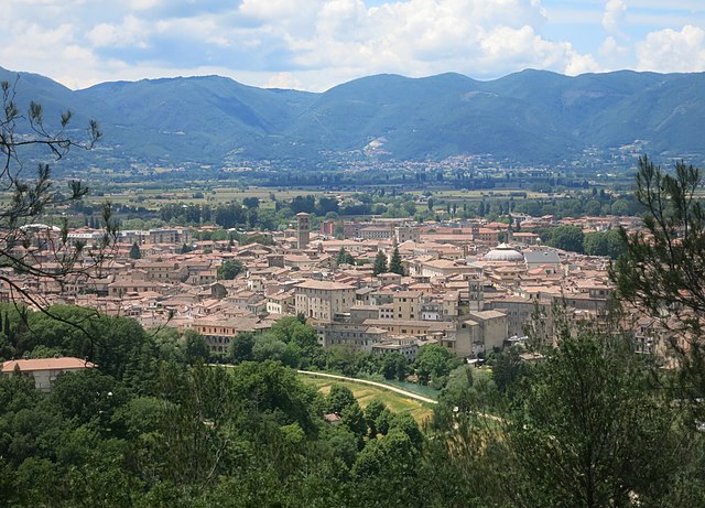
Colli sul Velino (Colli sul Velino)
.svg)
- Italian comune
 Hiking in Colli sul Velino
Colli sul Velino is a picturesque town located in the province of Rieti in the Italian region of Lazio. Nestled in the foothills of the Apennines, it offers stunning landscapes and a variety of hiking opportunities. Here are some key points to consider if you're planning a hike in this area:
Trails and Hiking Routes
-
Nature Trails: The region features several well-marked nature trails suitable for different skill levels. Many trails are surrounded by rich flora and fauna, providing an immersive experience in nature.
-
Monti della Laga: Nearby, the Monti della Laga mountain range offers more challenging hikes with breathtaking views. Look for trails that lead to scenic overlooks or along ridges.
-
Cascata del Rio Verde: This trail will lead you to beautiful waterfalls, ideal for a relaxing break and taking photos.
Difficulty Levels
- There are hikes suitable for beginners, as well as more challenging routes for experienced hikers. Always check trail difficulty and conditions before heading out.
Best Time to Hike
- The best times to hike in Colli sul Velino are during the spring (April to June) and fall (September to October). The weather is generally pleasant, and the natural beauty during these seasons is particularly striking.
What to Bring
- Gear: Comfortable hiking shoes, weather-appropriate clothing, a backpack, and plenty of water.
- Navigation: A map or GPS device is recommended, especially for longer or less-marked trails.
- Snacks: Pack energy-boosting snacks for your journey.
Safety Tips
- Always inform someone about your hiking plans.
- Check weather conditions before you go.
- Hike within your experience level and physical limits.
Local Amenities
- Colli sul Velino has local accommodations and eateries, making it a good base for multi-day hiking trips. Consider trying local cuisine for an authentic experience after a long hike.
Cultural Sites
- While hiking, you can often encounter historical sites, churches, and ruins, adding cultural value to your outdoor adventure.
Whether you are looking for a leisurely walk in nature or an adventurous trek in the mountains, Colli sul Velino offers a charming experience for all hiking enthusiasts. Enjoy your hike!
- Country:

- Postal Code: 02010
- Local Dialing Code: 0746
- Licence Plate Code: RI
- Coordinates: 42° 30' 0" N, 12° 47' 0" E


- GPS tracks (wikiloc): [Link]
- AboveSeaLevel: 465 м m
- Area: 12.76 sq km
- Population: 510
- Web site: http://www.collisulvelino.org
- Wikipedia en: wiki(en)
- Wikipedia: wiki(it)
- Wikidata storage: Wikidata: Q118085
- Wikipedia Commons Category: [Link]
- Freebase ID: [/m/0gm593]
- GeoNames ID: Alt: [6540508]
- OSM relation ID: [42043]
- ISTAT ID: 057022
- Italian cadastre code: C880
Shares border with regions:

Rieti
- Italian comune
Hiking in Rieti
Rieti, located in the Lazio region of Italy, is a wonderful destination for hiking enthusiasts. This area is characterized by its stunning natural landscapes, rich history, and diverse wildlife. Here are some key points about hiking in Rieti:...
- Country:
- Postal Code: 02100
- Local Dialing Code: 0746
- Licence Plate Code: RI
- Coordinates: 42° 24' 16" N, 12° 51' 24" E
- GPS tracks (wikiloc): [Link]
- AboveSeaLevel: 405 м m
- Area: 206.46 sq km
- Population: 47436
- Web site: [Link]


Contigliano
- Italian comune
Hiking in Contigliano
Contigliano is a beautiful village located in the province of Rieti, in the Italian region of Lazio. Surrounded by stunning landscapes, it offers various hiking opportunities for both beginners and experienced hikers. Here are some key points to consider about hiking in Contigliano:...
- Country:
- Postal Code: 02043
- Local Dialing Code: 0746
- Licence Plate Code: RI
- Coordinates: 42° 25' 0" N, 12° 46' 0" E
- GPS tracks (wikiloc): [Link]
- AboveSeaLevel: 488 м m
- Area: 53.55 sq km
- Population: 3884
- Web site: [Link]
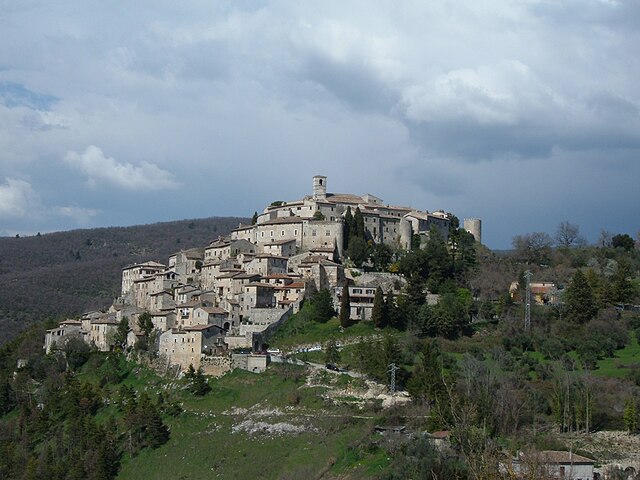

Labro
- Italian comune
Hiking in Labro
Labro, a quaint village located in the province of Rieti in Italy, offers a charming backdrop for hiking enthusiasts. Here are some key points to consider when planning a hike in and around Labro:...
- Country:
- Postal Code: 02010
- Local Dialing Code: 0746
- Licence Plate Code: RI
- Coordinates: 42° 31' 34" N, 12° 48' 1" E
- GPS tracks (wikiloc): [Link]
- AboveSeaLevel: 628 м m
- Area: 11.75 sq km
- Population: 351
- Web site: [Link]


Morro Reatino
- Italian comune
Hiking in Morro Reatino
Morro Reatino is a charming village located in the province of Rieti, in the Italian region of Lazio, surrounded by stunning natural landscapes ideal for hiking enthusiasts. Here’s an overview of what you can expect while hiking in this area:...
- Country:
- Postal Code: 02010
- Local Dialing Code: 0746
- Licence Plate Code: RI
- Coordinates: 42° 32' 0" N, 12° 50' 0" E
- GPS tracks (wikiloc): [Link]
- AboveSeaLevel: 745 м m
- Area: 15.74 sq km
- Population: 365
- Web site: [Link]
Rivodutri
- Italian comune
Hiking in Rivodutri
Rivodutri is a charming village located in the Lazio region of Italy, surrounded by the scenic landscapes of the Sabina area. It's an excellent destination for hiking enthusiasts due to its diverse terrain, rich history, and stunning natural beauty....
- Country:
- Postal Code: 02010
- Local Dialing Code: 0746
- Licence Plate Code: RI
- Coordinates: 42° 31' 0" N, 12° 51' 0" E
- GPS tracks (wikiloc): [Link]
- AboveSeaLevel: 560 м m
- Area: 26.79 sq km
- Population: 1214
- Web site: [Link]


Terni
- city in the region Umbria, in Italy
Hiking in Terni
Terni, located in the Umbria region of Italy, offers a variety of hiking opportunities that are perfect for outdoor enthusiasts. The area is known for its stunning natural landscapes, including waterfalls, rivers, and rolling hills. Here are some key highlights about hiking in and around Terni:...
- Country:
- Postal Code: 05100
- Local Dialing Code: 0744
- Licence Plate Code: TR
- Coordinates: 42° 34' 0" N, 12° 39' 0" E
- GPS tracks (wikiloc): [Link]
- AboveSeaLevel: 130 м m
- Area: 211.90 sq km
- Population: 111189
- Web site: [Link]