Combret (Combret)
- commune in Aveyron, France
- Country:

- Postal Code: 12370
- Coordinates: 43° 50' 30" N, 2° 40' 21" E


- GPS tracks (wikiloc): [Link]
- Area: 49.85 sq km
- Population: 271
- Wikipedia en: wiki(en)
- Wikipedia: wiki(fr)
- Wikidata storage: Wikidata: Q1153340
- Wikipedia Commons Gallery: [Link]
- Wikipedia Commons Category: [Link]
- Freebase ID: [/m/03m93fn]
- GeoNames ID: Alt: [6614327]
- SIREN number: [211200696]
- BnF ID: [15247045p]
- INSEE municipality code: 12069
Shares border with regions:


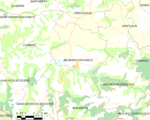
Belmont-sur-Rance
- commune in Aveyron, France
- Country:

- Postal Code: 12370
- Coordinates: 43° 49' 1" N, 2° 45' 18" E


- GPS tracks (wikiloc): [Link]
- Area: 44.19 sq km
- Population: 1005
- Web site: [Link]
La Serre
- commune in Aveyron, France
- Country:

- Postal Code: 12380
- Coordinates: 43° 53' 6" N, 2° 40' 55" E


- GPS tracks (wikiloc): [Link]
- AboveSeaLevel: 650 м m
- Area: 18.52 sq km
- Population: 117


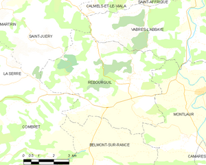
Rebourguil
- commune in Aveyron, France
- Country:

- Postal Code: 12400
- Coordinates: 43° 53' 15" N, 2° 46' 28" E


- GPS tracks (wikiloc): [Link]
- Area: 35.31 sq km
- Population: 285


Saint-Sernin-sur-Rance
- commune in Aveyron, France
- Country:

- Postal Code: 12380
- Coordinates: 43° 53' 3" N, 2° 36' 13" E


- GPS tracks (wikiloc): [Link]
- Area: 11.14 sq km
- Population: 636


Laval-Roquecezière
- commune in Aveyron, France
- Country:

- Postal Code: 12380
- Coordinates: 43° 48' 25" N, 2° 38' 52" E


- GPS tracks (wikiloc): [Link]
- Area: 30.66 sq km
- Population: 265
Saint-Juéry
- commune in Aveyron, France
- Country:

- Postal Code: 12550
- Coordinates: 43° 54' 36" N, 2° 41' 44" E


- GPS tracks (wikiloc): [Link]
- AboveSeaLevel: 500 м m
- Area: 29.01 sq km
- Population: 282
- Web site: [Link]


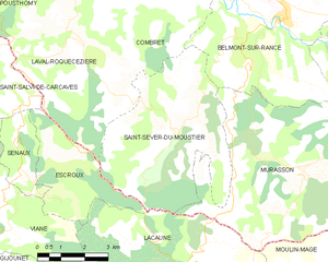
Saint-Sever-du-Moustier
- commune in Aveyron, France
- Country:

- Postal Code: 12370
- Coordinates: 43° 46' 33" N, 2° 41' 59" E


- GPS tracks (wikiloc): [Link]
- Area: 26.03 sq km
- Population: 213
