Condat-lès-Montboissier (Condat-lès-Montboissier)

- commune in Puy-de-Dôme, France
- Country:

- Postal Code: 63490
- Coordinates: 45° 33' 2" N, 3° 29' 59" E


- GPS tracks (wikiloc): [Link]
- AboveSeaLevel: 591 м m
- Area: 20.52 sq km
- Population: 224
- Wikipedia en: wiki(en)
- Wikipedia: wiki(fr)
- Wikidata storage: Wikidata: Q524292
- Wikipedia Commons Category: [Link]
- Freebase ID: [/m/03qh9dl]
- GeoNames ID: Alt: [6617317]
- SIREN number: [216301192]
- BnF ID: [15269469p]
- INSEE municipality code: 63119
Shares border with regions:


Égliseneuve-des-Liards
- commune in Puy-de-Dôme, France
- Country:
- Postal Code: 63490
- Coordinates: 45° 34' 5" N, 3° 25' 26" E
- GPS tracks (wikiloc): [Link]
- Area: 8.35 sq km
- Population: 137

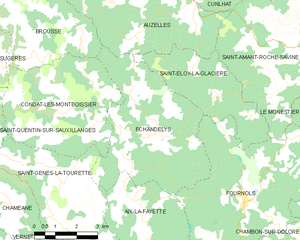
Échandelys
- commune in Puy-de-Dôme, France
- Country:
- Postal Code: 63980
- Coordinates: 45° 32' 37" N, 3° 31' 48" E
- GPS tracks (wikiloc): [Link]
- Area: 23.59 sq km
- Population: 255


Saint-Genès-la-Tourette
- commune in Puy-de-Dôme, France
- Country:
- Postal Code: 63580
- Coordinates: 45° 30' 40" N, 3° 28' 18" E
- GPS tracks (wikiloc): [Link]
- Area: 18.49 sq km
- Population: 175
Sugères
- commune in Puy-de-Dôme, France
- Country:
- Postal Code: 63490
- Coordinates: 45° 36' 7" N, 3° 24' 30" E
- GPS tracks (wikiloc): [Link]
- Area: 20.64 sq km
- Population: 609
- Web site: [Link]


Brousse
- commune in Puy-de-Dôme, France
- Country:
- Postal Code: 63490
- Coordinates: 45° 36' 6" N, 3° 27' 32" E
- GPS tracks (wikiloc): [Link]
- Area: 22.45 sq km
- Population: 346
Saint-Quentin-sur-Sauxillanges
- commune in Puy-de-Dôme, France
- Country:
- Postal Code: 63490
- Coordinates: 45° 33' 0" N, 3° 23' 38" E
- GPS tracks (wikiloc): [Link]
- Area: 8.25 sq km
- Population: 111