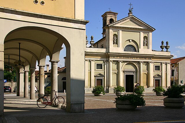
Confienza (Confienza)
.svg)
- Italian comune
 Hiking in Confienza
Confienza, while not widely known in hiking circles, is located in Italy and offers the charm of rural landscapes and natural beauty typical of the region. The area surrounding Confienza presents opportunities for light hiking and enjoying nature, particularly if you venture into nearby parks or natural reserves.
Hiking Options Near Confienza:
-
Local Trails: While specific trails in Confienza might not be well-documented, local rural paths can often be found. These paths may take you through fields, along rivers, and beside wooded areas, offering a peaceful experience.
-
Nearby Nature Reserves: Consider exploring nearby nature reserves or regional parks, such as the Ticino Park, which is accessible not too far from Confienza. It offers well-marked trails suitable for hiking, cycling, and birdwatching.
-
Scenic Routes: Look for roads or paths that lead to nearby villages or scenic viewpoints. These can be great for leisurely walks and provide insight into the local culture and heritage.
Hiking Tips for Confienza:
- Check Local Conditions: Since trails may not be as maintained as those in popular hiking destinations, check local conditions before you go.
- Weather Preparedness: Be aware of the weather, as it can change quickly. Dress in layers and bring rain gear if necessary.
- Hydration and Snacks: Always carry enough water and some snacks to keep your energy levels up, especially if you're going on longer walks.
- Guidebooks and Maps: Consider carrying a detailed map of the area or a hiking guide specific to the Lombardy region for the best experience.
Local Attractions:
- While in Confienza, be sure to explore local cuisine. The area is known for its agricultural production, and you might find local eateries offering delicious Italian fare.
- Engage with the community—locals can be a great resource for discovering hidden gems in terms of walking paths or less-known sites.
Safety:
- Always inform someone about your hiking plan, especially if you are venturing out alone.
- Make sure to wear suitable footwear and dress appropriately for the terrain and weather conditions.
While you might not find extensive hiking trails in Confienza itself, the surrounding areas offer plenty of opportunities for enjoying the outdoors. Happy hiking!
- Country:

- Postal Code: 27030
- Local Dialing Code: 0384
- Licence Plate Code: PV
- Coordinates: 45° 18' 0" N, 8° 32' 0" E


- GPS tracks (wikiloc): [Link]
- AboveSeaLevel: 126 м m
- Area: 26.81 sq km
- Population: 1616
- Web site: http://www.comune.confienza.pv.it/
- Wikipedia en: wiki(en)
- Wikipedia: wiki(it)
- Wikidata storage: Wikidata: Q40369
- Wikipedia Commons Category: [Link]
- Freebase ID: [/m/0gjhsq]
- GeoNames ID: Alt: [6539496]
- OSM relation ID: [44702]
- MusicBrainz area ID: [ce97b137-88be-4fb2-8f5a-9908135d4035]
- UN/LOCODE: [ITZFK]
- ISTAT ID: 018052
- Italian cadastre code: C958
Shares border with regions:

Casalino
- Italian comune
Hiking in Casalino
Casalino is a charming area located in Italy's Piedmont region, known for its picturesque landscapes and hiking opportunities. The surrounding countryside features rolling hills, vineyards, and is rich in natural beauty, making it a great destination for outdoor enthusiasts....
- Country:
- Postal Code: 28060
- Local Dialing Code: 0321
- Licence Plate Code: NO
- Coordinates: 45° 21' 30" N, 8° 31' 26" E
- GPS tracks (wikiloc): [Link]
- AboveSeaLevel: 131 м m
- Area: 39.49 sq km
- Population: 1537
- Web site: [Link]

Granozzo con Monticello
- Italian comune
Hiking in Granozzo con Monticello
Granozzo con Monticello, located in the Province of Novara in the Piedmont region of Italy, offers a quaint setting for outdoor enthusiasts. While this area may not be as famous for hiking as some of the more mountainous parts of Italy, it does provide pleasant opportunities for walking and exploring the natural beauty of the surrounding countryside....
- Country:
- Postal Code: 28060
- Local Dialing Code: 0321
- Licence Plate Code: NO
- Coordinates: 45° 22' 0" N, 8° 34' 0" E
- GPS tracks (wikiloc): [Link]
- AboveSeaLevel: 129 м m
- Area: 19.52 sq km
- Population: 1410
- Web site: [Link]
Vespolate
- Italian comune
Hiking in Vespolate
Vespolate is a small town located in the Piedmont region of Italy, surrounded by beautiful landscapes that offer various hiking opportunities. While it may not be as well-known as larger mountain regions, its scenic views and tranquil environment make it a great destination for outdoor enthusiasts looking for hiking experiences....
- Country:
- Postal Code: 28079
- Local Dialing Code: 0321
- Licence Plate Code: NO
- Coordinates: 45° 21' 0" N, 8° 40' 0" E
- GPS tracks (wikiloc): [Link]
- AboveSeaLevel: 123 м m
- Area: 17.78 sq km
- Population: 2048
- Web site: [Link]

Vinzaglio
- Italian comune
Hiking in Vinzaglio
Vinzaglio is a small municipality located in the Piedmont region of Italy, nestled in the foothills of the Alps. While it may not be as widely recognized as some other hiking destinations in the region, it offers a peaceful environment and beautiful landscapes for those looking to hike in a more tranquil setting....
- Country:
- Postal Code: 28060
- Local Dialing Code: 0161
- Licence Plate Code: NO
- Coordinates: 45° 19' 0" N, 8° 31' 0" E
- GPS tracks (wikiloc): [Link]
- AboveSeaLevel: 124 м m
- Area: 15.46 sq km
- Population: 575
- Web site: [Link]


Robbio
- Italian comune
Hiking in Robbio
Robbio is a small town located in the Lombardy region of Italy, primarily known for its agricultural landscape and historical sites. While it may not be a major hiking destination compared to nearby areas like the Apennines or the Alps, there are still opportunities for enjoyable outdoor activities and nature walks....
- Country:
- Postal Code: 27038
- Local Dialing Code: 0384
- Licence Plate Code: PV
- Coordinates: 45° 17' 29" N, 8° 35' 32" E
- GPS tracks (wikiloc): [Link]
- AboveSeaLevel: 122 м m
- Area: 40.54 sq km
- Population: 5828
- Web site: [Link]


Palestro
- Italian comune
Hiking in Palestro
Palestro, located in the province of Pavia, Lombardy, Italy, is a charming area surrounded by stunning landscapes and offers various hiking opportunities. Here are some key points to consider when planning a hike in the Palestro area:...
- Country:
- Postal Code: 27030
- Local Dialing Code: 0384
- Licence Plate Code: PV
- Coordinates: 45° 18' 0" N, 8° 32' 0" E
- GPS tracks (wikiloc): [Link]
- AboveSeaLevel: 121 м m
- Area: 18.81 sq km
- Population: 1924
- Web site: [Link]